 |
|
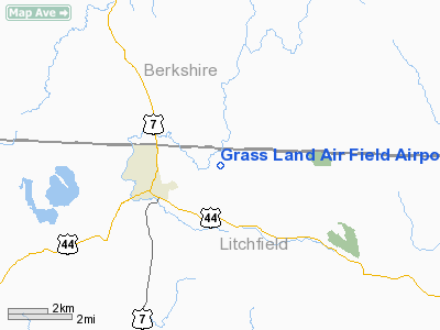
Grass Land Air Field Airport |
Location
& QuickFacts
|
FAA
Information Effective: |
2006-09-28 |
|
Airport
Identifier: |
CT04 |
|
Longitude/Latitude: |
073-17-13.4140W/42-02-20.3300N
-73.287059/42.038981 (Estimated) |
|
Elevation: |
705 ft / 214.88 m (Estimated) |
|
Land: |
0 acres |
|
From
nearest city: |
2 nautical miles E of North Canaan, CT |
|
Location: |
Litchfield County, CT |
|
Magnetic Variation: |
14W (1995) |
Owner
& Manager
|
Ownership: |
Privately owned |
|
Owner: |
Stephen Segalla |
|
Address: |
18 Margaret Lane
North Canaan, CT 06018 |
|
Phone
number: |
860-824-1439 |
|
Manager: |
Stephen Segalla |
|
Address: |
18 Margaret Lane
North Canaan, CT 06018 |
|
Phone number: |
860-824-1439 |
Airport
Operations and Facilities
|
Airport
Use: |
Private |
|
Segmented
Circle: |
No |
|
Control
Tower: |
No |
|
Attendance
Schedule: |
UNATNDD |
|
Sectional
chart: |
New York |
|
Region: |
ANE - New England |
|
Boundary
ARTCC: |
ZBW - Boston |
|
Tie-in
FSS: |
BDR - Bridgeport |
|
FSS
Phone: |
866-293-5149 |
|
FSS
Toll Free: |
1-800-WX-BRIEF |
|
Runway Information
Runway 17/35
|
Dimension: |
1800 x 100 ft / 548.6 x 30.5 m |
|
Surface: |
TURF, |
|
|
Runway 17 |
Runway 35 |
|
Traffic
Pattern: |
Left |
Left |
|
Radio Navigation
Aids
|
ID |
Type |
Name |
Ch |
Freq |
Var |
Dist |
|
GBR |
FAN MARKER |
Sheffield |
|
|
13W |
6.3 nm |
|
PSF |
FAN MARKER |
Abyss |
|
|
13W |
25.3 nm |
|
SKU |
FAN MARKER |
Stanwyck |
|
|
12W |
45.8 nm |
|
GBR |
NDB |
Great Barrington |
|
395.00 |
14W |
10.1 nm |
|
PFH |
NDB |
Philmont |
|
272.00 |
13W |
23.3 nm |
|
DXT |
NDB |
Dalton |
|
370.00 |
15W |
26.5 nm |
|
TBY |
NDB |
Waterbury |
|
257.00 |
14W |
31.3 nm |
|
MMK |
NDB |
Meriden |
|
238.00 |
14W |
37.8 nm |
|
HF |
NDB |
Lomis |
|
244.00 |
15W |
38.3 nm |
|
PO |
NDB |
Meier |
|
403.00 |
12W |
41.2 nm |
|
SKU |
NDB |
Stanwyck |
|
261.00 |
12W |
45.8 nm |
|
CTR |
VOR/DME |
Chester |
098X |
115.10 |
13W |
21.4 nm |
|
PWL |
VOR/DME |
Pawling |
090X |
114.30 |
12W |
21.4 nm |
|
IGN |
VOR/DME |
Kingston |
123X |
117.60 |
12W |
32.8 nm |
|
HFD |
VOR/DME |
Hartford |
096X |
114.90 |
13W |
40.9 nm |
|
CMK |
VOR/DME |
Carmel |
113X |
116.60 |
12W |
47.5 nm |
|
BAF |
VORTAC |
Barnes |
077X |
113.00 |
14W |
26.5 nm |
|
BDL |
VORTAC |
Bradley |
027X |
109.00 |
14W |
27.4 nm |
|
CEF |
VORTAC |
Westover |
87X |
114.00 |
14W |
35.2 nm |
|
ALB |
VORTAC |
Albany |
100X |
115.30 |
13W |
48.3 nm |
|
BDL |
VOT |
Bradley Intl |
|
111.40 |
|
27.6 nm |
|
HFD |
VOT |
Hartford |
|
108.20 |
|
33.8 nm |
|
ALB |
VOT |
Albany County |
|
108.20 |
|
48.5 nm |
Remarks
- DAYLIGHT
VFR OPNS ONLY.
- (ARPT
STATUS) ARPT CLSD INDEFLY.
- PRVDD
VFR, PR USE, PROPONENT PRVD DOCUMENTATION TO FAA AIR TRAFFIC INDICATING
THAT THE TRAFFIC PATTERN DOES NOT INTERFERE WITH HILLSIDE ARPT; ALL
USERS ARE NOTIFIED OF THE THREE CONDITIONS; AVOID RISING TERRAIN EAST
OF THE ARPT.
Grass Land Air Field Airport
Address:
Litchfield County, CT
Tel:
860-824-1439
Images
and information placed above are from
http://www.airport-data.com/airport/CT04/
We
thank them for the data!
| General
Info |
| Country |
United
States |
| State |
CONNECTICUT
|
| FAA ID |
CT04
|
| Latitude |
42-02-20.330N
|
| Longitude |
073-17-13.414W
|
| Elevation |
705 feet
|
| Near City |
NORTH
CANAAN |
We don't guarantee the information is fresh and accurate. The data may
be wrong or outdated.
For more up-to-date information please refer to other sources.
|
|


