 |
|
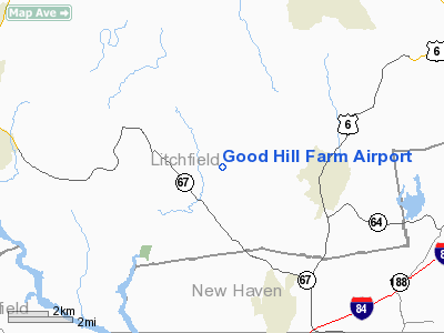
Location
& QuickFacts
|
FAA
Information Effective: |
2006-09-28 |
|
Airport
Identifier: |
CT59 |
|
Longitude/Latitude: |
073-15-58.4170W/41-33-00.3440N
-73.266227/41.550096 (Estimated) |
|
Elevation: |
949 ft / 289.26 m (Estimated) |
|
Land: |
60 acres |
|
From
nearest city: |
3 nautical miles E of Roxbury, CT |
|
Location: |
Litchfield County, CT |
|
Magnetic Variation: |
14W (1985) |
Owner
& Manager
|
Ownership: |
Privately owned |
|
Owner: |
J. L. Pond |
|
Address: |
463 Good Hill Rd
Woodbury, CT 06798 |
|
Phone
number: |
203-263-3943 |
|
Manager: |
J. L. Pond |
|
Address: |
463 Good Hill Rd
Woodbury, CT 06798 |
|
Phone number: |
203-263-3943 |
Airport
Operations and Facilities
|
Airport Use: |
Private |
|
Wind indicator: |
Yes |
|
Segmented Circle: |
No |
|
Control Tower: |
No |
|
Attendance Schedule: |
UNATNDD |
|
Landing fee charge: |
No |
|
Sectional chart: |
New York |
|
Region: |
ANE - New England |
|
Boundary ARTCC: |
ZBW - Boston |
|
Tie-in FSS: |
BDR - Bridgeport |
|
FSS on Airport: |
No |
|
FSS Phone: |
866-293-5149 |
|
FSS Toll Free: |
1-800-WX-BRIEF |
Airport
Services
|
Airframe
Repair: |
NONE |
|
Power
Plant Repair: |
NONE |
|
Runway Information
Runway N/S
|
Dimension: |
2700 x 200 ft / 823.0 x 61.0 m |
|
Surface: |
TURF, |
|
|
Runway N |
Runway S |
|
Traffic
Pattern: |
Left |
Left |
|
Radio Navigation
Aids
|
ID |
Type |
Name |
Ch |
Freq |
Var |
Dist |
|
GBR |
FAN MARKER |
Sheffield |
|
|
13W |
35.0 nm |
|
SKU |
FAN MARKER |
Stanwyck |
|
|
12W |
35.1 nm |
|
TBY |
NDB |
Waterbury |
|
257.00 |
14W |
5.6 nm |
|
MMK |
NDB |
Meriden |
|
238.00 |
14W |
19.8 nm |
|
HF |
NDB |
Lomis |
|
244.00 |
15W |
29.3 nm |
|
PO |
NDB |
Meier |
|
403.00 |
12W |
31.5 nm |
|
SKU |
NDB |
Stanwyck |
|
261.00 |
12W |
35.1 nm |
|
OP |
NDB |
Old Field Point Light |
|
316.00 |
13W |
35.1 nm |
|
GBR |
NDB |
Great Barrington |
|
395.00 |
14W |
38.5 nm |
|
SW |
NDB |
Neely |
|
335.00 |
14W |
43.5 nm |
|
PFH |
NDB |
Philmont |
|
272.00 |
13W |
46.9 nm |
|
PWL |
VOR/DME |
Pawling |
090X |
114.30 |
12W |
20.0 nm |
|
CMK |
VOR/DME |
Carmel |
113X |
116.60 |
12W |
21.6 nm |
|
BDR |
VOR/DME |
Bridgeport |
25X |
108.80 |
12W |
24.3 nm |
|
HVN |
VOR/DME |
New Haven |
035X |
109.80 |
13W |
24.4 nm |
|
IGN |
VOR/DME |
Kingston |
123X |
117.60 |
12W |
25.9 nm |
|
MAD |
VOR/DME |
Madison |
041X |
110.40 |
13W |
29.5 nm |
|
HFD |
VOR/DME |
Hartford |
096X |
114.90 |
13W |
32.8 nm |
|
CCC |
VOR/DME |
Calverton |
119X |
117.20 |
13W |
42.9 nm |
|
DPK |
VOR/DME |
Deer Park |
124X |
117.70 |
12W |
45.6 nm |
|
CTR |
VOR/DME |
Chester |
098X |
115.10 |
13W |
46.8 nm |
|
BDL |
VORTAC |
Bradley |
027X |
109.00 |
14W |
35.0 nm |
|
BAF |
VORTAC |
Barnes |
077X |
113.00 |
14W |
44.3 nm |
|
BDR |
VOT |
Bridgeport |
|
109.25 |
|
24.2 nm |
|
HFD |
VOT |
Hartford |
|
108.20 |
|
29.8 nm |
|
BDL |
VOT |
Bradley Intl |
|
111.40 |
|
35.1 nm |
|
ISP |
VOT |
Long Island Mac Arthur |
|
109.40 |
|
46.4 nm |
Remarks
- OWNER
DOES NOT DESIRE ARPT TO BE CHARTED.
- EXISTED
PRIOR TO 1959.
Based Aircraft
|
Aircraft
based on field: |
4 |
|
Single
Engine Airplanes: |
4 |
Good Hill Farm Airport
Address:
Litchfield County, CT
Tel:
203-263-3943
Images
and information placed above are from
http://www.airport-data.com/airport/CT59/
We
thank them for the data!
| General
Info |
| Country |
United
States |
| State |
CONNECTICUT
|
| FAA ID |
CT59
|
| Latitude |
41-33-00.344N
|
| Longitude |
073-15-58.417W
|
| Elevation |
949 feet
|
| Near City |
ROXBURY
|
We don't guarantee the information is fresh and accurate. The data may
be wrong or outdated.
For more up-to-date information please refer to other sources.
|
|


