 |
|
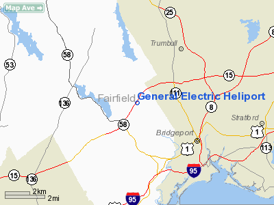
General Electric Heliport |
|
|
Location
& QuickFacts
|
FAA
Information Effective: |
2006-09-28 |
|
Airport
Identifier: |
CT41 |
|
Longitude/Latitude: |
073-15-19.4150W/41-13-02.3460N
-73.255393/41.217318 (Estimated) |
|
Elevation: |
122 ft / 37.19 m (Estimated) |
|
Land: |
0 acres |
|
From
nearest city: |
4 nautical miles N of Fairfield, CT |
|
Location: |
Fairfield County, CT |
|
Magnetic Variation: |
14W (1985) |
Owner
& Manager
|
Ownership: |
Privately owned |
|
Owner: |
General Electric Co |
|
Address: |
3135 Easton Tnpk
Fairfield, CT 06431 |
|
Phone
number: |
203-373-2580 |
|
Manager: |
P. A. Deysenroth |
|
Address: |
G E Co 3135 Easton Turnpike
Fairfield, CT 06431 |
|
Phone number: |
203-373-2580
EXT 5-2629. |
Airport
Operations and Facilities
|
Airport Use: |
Private |
|
Wind indicator: |
Yes |
|
Segmented Circle: |
Yes |
|
Control Tower: |
No |
|
Attendance Schedule: |
UNATNDD |
|
Lighting Schedule: |
SS-SR |
|
Landing fee charge: |
No |
|
Sectional chart: |
New York |
|
Region: |
ANE - New England |
|
Boundary ARTCC: |
ZBW - Boston |
|
Responsible ARTCC: |
ZNY - New York |
|
Tie-in FSS: |
BDR - Bridgeport |
|
FSS on Airport: |
No |
|
FSS Phone: |
866-293-5149 |
|
FSS Toll Free: |
1-800-WX-BRIEF |
Airport
Services
|
Runway Information
Helipad H1
|
Dimension: |
150 x 90 ft / 45.7 x 27.4 m |
|
Surface: |
ASPH, |
|
Edge
Lights: |
Medium |
|
|
Runway H1 |
Runway |
|
Traffic
Pattern: |
Left |
Left |
|
Radio Navigation
Aids
|
ID |
Type |
Name |
Ch |
Freq |
Var |
Dist |
|
SKU |
FAN MARKER |
Stanwyck |
|
|
12W |
40.2 nm |
|
OP |
NDB |
Old Field Point Light |
|
316.00 |
13W |
15.7 nm |
|
TBY |
NDB |
Waterbury |
|
257.00 |
14W |
19.4 nm |
|
MMK |
NDB |
Meriden |
|
238.00 |
14W |
26.1 nm |
|
BBN |
NDB |
Babylon |
|
275.00 |
14W |
33.3 nm |
|
HF |
NDB |
Lomis |
|
244.00 |
15W |
37.9 nm |
|
PO |
NDB |
Meier |
|
403.00 |
12W |
38.5 nm |
|
SKU |
NDB |
Stanwyck |
|
261.00 |
12W |
40.2 nm |
|
PNJ |
NDB |
Paterson |
|
347.00 |
12W |
43.7 nm |
|
SW |
NDB |
Neely |
|
335.00 |
14W |
46.8 nm |
|
OGY |
NDB |
Bridge |
|
414.00 |
12W |
48.3 nm |
|
FOK |
TACAN |
Suffolk Co |
047X |
|
13W |
36.3 nm |
|
BDR |
VOR/DME |
Bridgeport |
25X |
108.80 |
12W |
6.8 nm |
|
CMK |
VOR/DME |
Carmel |
113X |
116.60 |
12W |
15.2 nm |
|
HVN |
VOR/DME |
New Haven |
035X |
109.80 |
13W |
16.9 nm |
|
DPK |
VOR/DME |
Deer Park |
124X |
117.70 |
12W |
25.7 nm |
|
MAD |
VOR/DME |
Madison |
041X |
110.40 |
13W |
26.1 nm |
|
CCC |
VOR/DME |
Calverton |
119X |
117.20 |
13W |
27.0 nm |
|
PWL |
VOR/DME |
Pawling |
090X |
114.30 |
12W |
36.7 nm |
|
IGN |
VOR/DME |
Kingston |
123X |
117.60 |
12W |
37.1 nm |
|
LGA |
VOR/DME |
La Guardia |
078X |
113.10 |
12W |
38.1 nm |
|
HFD |
VOR/DME |
Hartford |
096X |
114.90 |
13W |
40.8 nm |
|
JFK |
VOR/DME |
Kennedy |
106X |
115.90 |
12W |
42.2 nm |
|
TEB |
VOR/DME |
Teterboro |
021X |
108.40 |
11W |
42.8 nm |
|
CRI |
VOR/DME |
Canarsie |
070X |
112.30 |
11W |
46.5 nm |
|
HTO |
VORTAC |
Hampton |
083X |
113.60 |
13W |
46.2 nm |
|
BDR |
VOT |
Bridgeport |
|
109.25 |
|
6.8 nm |
|
ISP |
VOT |
Long Island Mac Arthur |
|
109.40 |
|
26.8 nm |
|
HFD |
VOT |
Hartford |
|
108.20 |
|
41.3 nm |
|
JFK |
VOT |
Kennedy |
|
115.10 |
|
42.3 nm |
Remarks
General Electric Heliport
Address:
Fairfield County, CT
Tel:
203-373-2580
Images
and information placed above are from
http://www.airport-data.com/airport/CT41/
We
thank them for the data!
| General
Info |
| Country |
United
States |
| State |
CONNECTICUT
|
| FAA ID |
CT41
|
| Latitude |
41-13-02.346N
|
| Longitude |
073-15-19.415W
|
| Elevation |
122 feet
|
| Near City |
FAIRFIELD
|
We don't guarantee the information is fresh and accurate. The data may
be wrong or outdated.
For more up-to-date information please refer to other sources.
|
|


