 |
|
|
|
Location
& QuickFacts
|
FAA
Information Effective: |
2006-09-28 |
|
Airport
Identifier: |
6Y2 |
|
Longitude/Latitude: |
073-27-38.4410W/41-34-04.3390N
-73.460678/41.567872 (Estimated) |
|
Elevation: |
675 ft / 205.74 m (Estimated) |
|
Land: |
3 acres |
|
From
nearest city: |
2 nautical miles W of New Milford, CT |
|
Location: |
Litchfield County, CT |
|
Magnetic Variation: |
14W (1990) |
Owner
& Manager
|
Ownership: |
Privately owned |
|
Owner: |
Carl Dunham Jr |
|
Address: |
Candlewood Mountain Rd
New Milford, CT 06776 |
|
Phone
number: |
860-354-4681 |
|
Manager: |
Carl Dunham Jr |
|
Address: |
Candlewood Mountain Rd
New Milford, CT 06776 |
|
Phone number: |
860-354-4681 |
Airport
Operations and Facilities
|
Airport
Use: |
Open to public |
|
Wind
indicator: |
Yes |
|
Segmented
Circle: |
No |
|
Control
Tower: |
No |
|
Attendance
Schedule: |
UNATNDD |
|
Sectional
chart: |
New York |
|
Region: |
ANE - New England |
|
Boundary
ARTCC: |
ZBW - Boston |
|
Tie-in
FSS: |
BDR - Bridgeport |
|
FSS
on Airport: |
No |
|
FSS
Phone: |
866-293-5149 |
|
FSS
Toll Free: |
1-800-WX-BRIEF |
|
NOTAMs
Facility: |
BDR (NOTAM-d service avaliable) |
Airport
Communications
|
Runway Information
Helipad H1
|
Dimension: |
50 x 50 ft / 15.2 x 15.2 m |
|
Surface: |
TURF, |
|
|
Runway H1 |
Runway |
|
Traffic
Pattern: |
Left |
Left |
|
Radio Navigation
Aids
|
ID |
Type |
Name |
Ch |
Freq |
Var |
Dist |
|
SKU |
FAN MARKER |
Stanwyck |
|
|
12W |
26.4 nm |
|
GBR |
FAN MARKER |
Sheffield |
|
|
13W |
33.9 nm |
|
TBY |
NDB |
Waterbury |
|
257.00 |
14W |
14.4 nm |
|
PO |
NDB |
Meier |
|
403.00 |
12W |
22.7 nm |
|
SKU |
NDB |
Stanwyck |
|
261.00 |
12W |
26.4 nm |
|
MMK |
NDB |
Meriden |
|
238.00 |
14W |
28.7 nm |
|
SW |
NDB |
Neely |
|
335.00 |
14W |
34.9 nm |
|
GBR |
NDB |
Great Barrington |
|
395.00 |
14W |
37.1 nm |
|
HF |
NDB |
Lomis |
|
244.00 |
15W |
37.8 nm |
|
OP |
NDB |
Old Field Point Light |
|
316.00 |
13W |
38.7 nm |
|
PFH |
NDB |
Philmont |
|
272.00 |
13W |
42.8 nm |
|
PNJ |
NDB |
Paterson |
|
347.00 |
12W |
48.7 nm |
|
PWL |
VOR/DME |
Pawling |
090X |
114.30 |
12W |
13.7 nm |
|
IGN |
VOR/DME |
Kingston |
123X |
117.60 |
12W |
17.3 nm |
|
CMK |
VOR/DME |
Carmel |
113X |
116.60 |
12W |
18.1 nm |
|
BDR |
VOR/DME |
Bridgeport |
25X |
108.80 |
12W |
28.8 nm |
|
HVN |
VOR/DME |
New Haven |
035X |
109.80 |
13W |
31.8 nm |
|
MAD |
VOR/DME |
Madison |
041X |
110.40 |
13W |
37.8 nm |
|
HFD |
VOR/DME |
Hartford |
096X |
114.90 |
13W |
41.3 nm |
|
DPK |
VOR/DME |
Deer Park |
124X |
117.70 |
12W |
47.2 nm |
|
CCC |
VOR/DME |
Calverton |
119X |
117.20 |
13W |
48.6 nm |
|
CTR |
VOR/DME |
Chester |
098X |
115.10 |
13W |
49.1 nm |
|
BDL |
VORTAC |
Bradley |
027X |
109.00 |
14W |
41.3 nm |
|
BAF |
VORTAC |
Barnes |
077X |
113.00 |
14W |
48.8 nm |
|
BDR |
VOT |
Bridgeport |
|
109.25 |
|
28.7 nm |
|
HFD |
VOT |
Hartford |
|
108.20 |
|
37.7 nm |
|
BDL |
VOT |
Bradley Intl |
|
111.40 |
|
41.4 nm |
|
ISP |
VOT |
Long Island Mac Arthur |
|
109.40 |
|
49.7 nm |
Remarks
- HELIPORT
CLSD EXCP PPR CALL 860-354-4681.
- PRVDD
DAYTIME VFR OPNS ONLY; INGRESS/EGRESS LIMITED TO CANDLELIGHT FARMS ARPT
APCHS; REMOVE TRAILER EAST OF PAD; HELIPAD PERIMETER OUTLINED BY IN-GROUND
MARKERS TO PROVIDE COLOR AND TEXTURAL DIFFERENCES FROM TURF.
Operational Statistics
|
Aircraft
Operations: |
7/Month |
|
General
Aviation Local: |
62.5% |
|
General
Aviation Itinerant: |
37.5% |
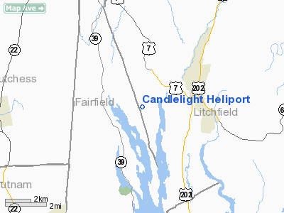
Candlelight Heliport
Address:
Litchfield County, CT
Tel:
860-354-4681
Images
and information placed above are from
http://www.airport-data.com/airport/6Y2/
We
thank them for the data!
| General
Info |
| Country |
United
States |
| State |
CONNECTICUT
|
| FAA ID |
6Y2
|
| Latitude |
41-34-04.339N
|
| Longitude |
073-27-38.441W
|
| Elevation |
675 feet
|
| Near City |
NEW MILFORD
|
We don't guarantee the information is fresh and accurate. The data may
be wrong or outdated.
For more up-to-date information please refer to other sources.
|
|


