 |
|
Location
& QuickFacts
|
FAA
Information Effective: |
2006-09-28 |
|
Airport
Identifier: |
CT67 |
|
Longitude/Latitude: |
073-03-33.3880W/41-36-51.3490N
-73.059274/41.614264 (Estimated) |
|
Elevation: |
300 ft / 91.44 m (Estimated) |
|
Land: |
0 acres |
|
From
nearest city: |
2 nautical miles E of Watertown, CT |
|
Location: |
Litchfield County, CT |
|
Magnetic Variation: |
14W (1985) |
Owner
& Manager
|
Ownership: |
Privately owned |
|
Owner: |
A.j.oster Co. |
|
Address: |
One Frost Bridge Rd
Watertown, CT 06795 |
|
Phone
number: |
203-274-5441 |
|
Manager: |
Pete Aylward |
|
Address: |
One Frost Bridge Rd
Watertown, CT 06795 |
|
Phone number: |
203-274-5441 |
Airport
Operations and Facilities
|
Airport
Use: |
Private |
|
Wind
indicator: |
Yes |
|
Segmented
Circle: |
Yes |
|
Control
Tower: |
No |
|
Attendance
Schedule: |
ALL/MON-FRI/0800-1700 |
|
Landing
fee charge: |
No |
|
Sectional
chart: |
New York |
|
Region: |
ANE - New England |
|
Boundary
ARTCC: |
ZBW - Boston |
|
Tie-in
FSS: |
BDR - Bridgeport |
|
FSS
on Airport: |
No |
|
FSS
Phone: |
866-293-5149 |
|
FSS
Toll Free: |
1-800-WX-BRIEF |
|
Runway Information
Helipad H1
|
Dimension: |
50 x 50 ft / 15.2 x 15.2 m |
|
Surface: |
ASPH, |
|
|
Runway H1 |
Runway |
|
Traffic
Pattern: |
Left |
Left |
|
Radio Navigation
Aids
|
ID |
Type |
Name |
Ch |
Freq |
Var |
Dist |
|
GBR |
FAN MARKER |
Sheffield |
|
|
13W |
33.7 nm |
|
SKU |
FAN MARKER |
Stanwyck |
|
|
12W |
44.6 nm |
|
TBY |
NDB |
Waterbury |
|
257.00 |
14W |
6.4 nm |
|
MMK |
NDB |
Meriden |
|
238.00 |
14W |
12.1 nm |
|
HF |
NDB |
Lomis |
|
244.00 |
15W |
19.5 nm |
|
GBR |
NDB |
Great Barrington |
|
395.00 |
14W |
37.5 nm |
|
OP |
NDB |
Old Field Point Light |
|
316.00 |
13W |
38.4 nm |
|
PO |
NDB |
Meier |
|
403.00 |
12W |
40.8 nm |
|
SKU |
NDB |
Stanwyck |
|
261.00 |
12W |
44.6 nm |
|
PFH |
NDB |
Philmont |
|
272.00 |
13W |
48.5 nm |
|
HVN |
VOR/DME |
New Haven |
035X |
109.80 |
13W |
22.6 nm |
|
HFD |
VOR/DME |
Hartford |
096X |
114.90 |
13W |
23.1 nm |
|
MAD |
VOR/DME |
Madison |
041X |
110.40 |
13W |
24.5 nm |
|
PWL |
VOR/DME |
Pawling |
090X |
114.30 |
12W |
26.0 nm |
|
BDR |
VOR/DME |
Bridgeport |
25X |
108.80 |
12W |
27.4 nm |
|
CMK |
VOR/DME |
Carmel |
113X |
116.60 |
12W |
30.9 nm |
|
IGN |
VOR/DME |
Kingston |
123X |
117.60 |
12W |
34.4 nm |
|
CTR |
VOR/DME |
Chester |
098X |
115.10 |
13W |
41.0 nm |
|
CCC |
VOR/DME |
Calverton |
119X |
117.20 |
13W |
42.8 nm |
|
ORW |
VOR/DME |
Norwich |
037X |
110.00 |
14W |
47.8 nm |
|
GON |
VOR/DME |
Groton |
45Y |
110.85 |
14W |
48.5 nm |
|
BDL |
VORTAC |
Bradley |
027X |
109.00 |
14W |
25.7 nm |
|
BAF |
VORTAC |
Barnes |
077X |
113.00 |
14W |
36.3 nm |
|
CEF |
VORTAC |
Westover |
87X |
114.00 |
14W |
42.4 nm |
|
HFD |
VOT |
Hartford |
|
108.20 |
|
19.7 nm |
|
BDL |
VOT |
Bradley Intl |
|
111.40 |
|
25.8 nm |
|
BDR |
VOT |
Bridgeport |
|
109.25 |
|
27.4 nm |
|
GON |
VOT |
Groton |
|
110.25 |
|
48.6 nm |
|
ISP |
VOT |
Long Island Mac Arthur |
|
109.40 |
|
49.7 nm |
Remarks
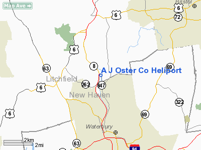
A J Oster Co Heliport
Address:
Litchfield County, CT
Tel:
203-274-5441
Images
and information placed above are from
http://www.airport-data.com/airport/CT67/
We
thank them for the data!
| General
Info |
| Country |
United
States |
| State |
CONNECTICUT
|
| FAA ID |
CT67
|
| Latitude |
41-36-51.349N
|
| Longitude |
073-03-33.388W
|
| Elevation |
300 feet
|
| Near City |
WATERTOWN
|
We don't guarantee the information is fresh and accurate. The data may
be wrong or outdated.
For more up-to-date information please refer to other sources.
|
|


