|
|
MYV directs here, for the Japanese rock artist, see Miyavi.
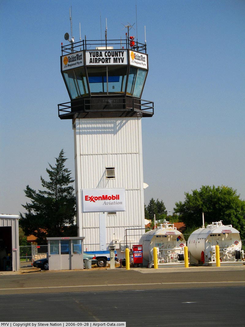
| Yuba County Airport |
 |
| IATA: KMYV – ICAO: KMYV |
| Summary |
| Airport type |
Public |
| Operator |
Yuba County |
| Location |
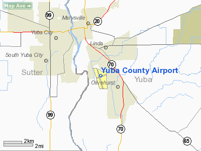
Yuba County, near Marysville, California |
| Elevation AMSL |
62 ft / 19 m |
| Coordinates |
39°05′51.982″N 121°34′11.370″W / 39.09777278°N 121.569825°W / 39.09777278; -121.569825Coordinates: 39°05′51.982″N 121°34′11.370″W / 39.09777278°N 121.569825°W / 39.09777278; -121.569825 |
| Runways |
| Direction |
Length |
Surface |
| ft |
m |
| 14/32 |
6006 |
1831 |
Asphalt |
| 5/23 |
3281 |
1000 |
Asphalt |
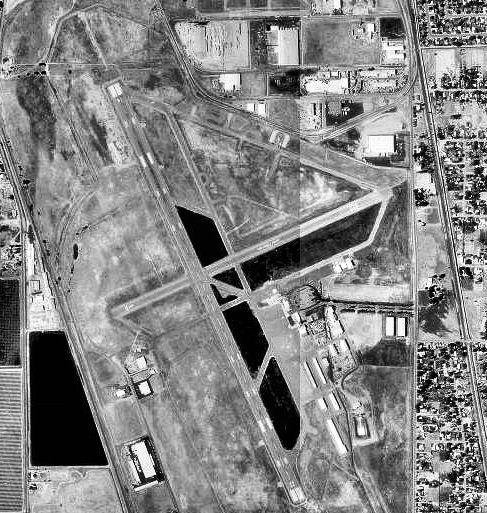
Yuba County Airport (IATA: MYV, ICAO: KMYV) is a public airport located three miles (4.8 km) southeast of Marysville, serving Yuba County, California, USA. The airport has two runways and is mostly used for general aviation. Facilities
Yuba County Airport has two runways:
- Runway 12/30: 6,006 x 150 ft (1,831 x 46 m). Surface: Asphalt
- Runway 5/23: 3,281 x 60 ft (1,000 x 18 m). Surface: Asphalt
History
The airfield was opened in December 1943. During World War II the airfield was known as Marysville Army Air Field and was used by the United States Army Air Forces Air Technical Service. With the end of the war, the base was declared excess to requirements and returned to civil control.
The above content comes from Wikipedia and is published under free licenses – click here to read more.
|
 |
(Click on the photo to enlarge) |
Location
& QuickFacts
|
FAA
Information Effective: |
2006-09-28 |
|
Airport
Identifier: |
MYV |
|
Longitude/Latitude: |
121-34-11.3700W/39-05-51.9820N
-121.569825/39.097773 (Estimated) |
|
Elevation: |
62 ft / 18.90 m (Surveyed) |
|
Land: |
933 acres |
|
From
nearest city: |
3 nautical miles SE of Marysville, CA |
|
Location: |
Yuba County, CA |
|
Magnetic Variation: |
16E (1985) |
Owner
& Manager
|
Ownership: |
Publicly owned |
|
Owner: |
Yuba County |
|
Address: |
1364 Sky Harbor Drive
Marysville, CA 95901 |
|
Phone
number: |
530-741-7575 |
|
Manager: |
Mary Hansen |
|
Address: |
1364 Sky Harbor Drive
Marysville, CA 95901 |
|
Phone number: |
530-741-6463 |
Airport
Operations and Facilities
|
Airport
Use: |
Open to public |
|
Wind
indicator: |
Yes |
|
Segmented
Circle: |
Yes |
|
Control
Tower: |
No |
|
Attendance
Schedule: |
ALL/ALL/0600-1800 |
|
Lighting
Schedule: |
DUSK-DAWN
ACTVT HIRL RY 14/32; VASI RY 14 & 32; MALSR RY 14 -
CTAF. |
|
Beacon
Color: |
Clear-Green (lighted land airport) |
|
Landing
fee charge: |
No |
|
Sectional
chart: |
San Francisco |
|
Region: |
AWP - Western-Pacific |
|
Traffic
Pattern Alt: |
1000 ft |
|
Boundary
ARTCC: |
ZOA - Oakland |
|
Tie-in
FSS: |
RIU - Rancho Murieta |
|
FSS
on Airport: |
No |
|
FSS
Phone: |
916-354-0161 |
|
FSS
Toll Free: |
1-800-WX-BRIEF |
|
NOTAMs
Facility: |
MYV (NOTAM-d service avaliable) |
|
Federal Agreements: |
NGPRVY |
Airport
Communications
|
CTAF: |
123.050 |
|
Unicom: |
123.050 |
Airport
Services
|
Fuel
available: |
100LLA |
|
Airframe
Repair: |
MAJOR |
|
Power
Plant Repair: |
MAJOR |
|
Bottled
Oxygen: |
NONE |
|
Bulk
Oxygen: |
NONE |
|
Runway Information
Runway 05/23
|
Dimension: |
3281 x 60 ft / 1000.0 x 18.3 m |
|
Surface: |
ASPH, Good Condition |
|
Weight
Limit: |
Single wheel: 42000 lbs.
Dual wheel: 60000 lbs.
Dual
tandem wheel: 95000 lbs. |
|
|
Runway 05 |
Runway 23 |
|
Longitude: |
121-34-26.6110W |
121-33-48.3660W |
|
Latitude: |
39-05-48.5100N |
39-06-01.2950N |
|
Elevation: |
60.00 ft |
62.00 ft |
|
Alignment: |
67 |
127 |
|
Traffic
Pattern: |
Left |
Left |
|
Markings: |
Numbers only, Good Condition |
Numbers only, Good Condition |
|
Runway
End Identifier: |
No |
No |
|
Centerline
Lights: |
No |
No |
|
Touchdown
Lights: |
No |
No |
|
Obstruction: |
25 ft rr, 800.0 ft from runway, 200 ft left
of centerline, 24:1 slope to clear |
45 ft tree, 900.0 ft from runway, 50 ft right
of centerline, 15:1 slope to clear |
|
Runway 14/32
|
Dimension: |
6006 x 150 ft / 1830.6 x 45.7 m |
|
Surface: |
ASPH, Good Condition |
|
Weight
Limit: |
Single wheel: 75000 lbs.
Dual wheel: 100000 lbs.
Dual
tandem wheel: 150000 lbs. |
|
Edge
Lights: |
High |
|
|
Runway 14 |
Runway 32 |
|
Longitude: |
121-34-28.5160W |
121-33-58.4670W |
|
Latitude: |
39-06-17.6630N |
39-05-23.1110N |
|
Elevation: |
61.00 ft |
58.00 ft |
|
Alignment: |
127 |
127 |
|
ILS
Type: |
ILS |
|
|
Traffic
Pattern: |
Left |
Left |
|
Markings: |
Precision instrument, Fair Condition
RY 14/32 MARKINGS FADED. |
Precision instrument, Fair Condition |
|
Crossing
Height: |
50.00 ft |
32.00 ft |
|
VASI: |
4-box on left side |
4-box on left side |
|
Visual
Glide Angle: |
3.00� |
3.00� |
|
Approach
lights: |
MALSR |
|
|
Runway
End Identifier: |
Yes |
No |
|
Centerline
Lights: |
No |
No |
|
Touchdown
Lights: |
No |
No |
|
Obstruction: |
75 ft tree, 3200.0 ft from runway, 300 ft left
of centerline, 40:1 slope to clear |
39 ft pole, 1750.0 ft from runway, 175 ft right
of centerline, 39:1 slope to clear |
|
Radio Navigation
Aids
|
ID |
Type |
Name |
Ch |
Freq |
Var |
Dist |
|
MY |
NDB |
Halow |
|
222.00 |
16E |
4.7 nm |
|
OVE |
NDB |
Oroville |
|
212.00 |
16E |
24.0 nm |
|
BAB |
TACAN |
Beale |
023X |
|
16E |
6.4 nm |
|
TZZ |
VOR |
Travis |
|
116.40 |
17E |
46.7 nm |
|
MYV |
VOR/DME |
Marysville |
045X |
110.80 |
16E |
0.2 nm |
|
MCC |
VOR/DME |
Mc Clellan |
029X |
109.20 |
17E |
27.0 nm |
|
CIC |
VOR/DME |
Chico |
035X |
109.80 |
16E |
43.5 nm |
|
HNW |
VOR/DME |
Hangtown |
102X |
115.50 |
17E |
44.4 nm |
|
ILA |
VORTAC |
Williams |
091X |
114.40 |
18E |
21.4 nm |
|
MXW |
VORTAC |
Maxwell |
037X |
110.00 |
18E |
33.1 nm |
|
SAC |
VORTAC |
Sacramento |
099X |
115.20 |
17E |
39.3 nm |
|
SMF |
VOT |
Sacramento Metropolitan |
|
111.40 |
|
24.5 nm |
|
SAC |
VOT |
Sacramento Executive |
|
111.40 |
|
35.3 nm |
Remarks
-
RY 23 +35
FT PLINES 900-1050 FT FM RY END; RUNNING 145 FT LEFT TO 210 FT RIGHT.
-
RWY 5/23
HAS A 210' STOPWAY ON SW END A 509' STOPWAY ON NE END.
-
MIGRATORY
FLOCKS OF WATERFOWL IN VICINITY OF AIRPORT DURING THE SPRING AND FALL
OF THE YEAR.
Based Aircraft
|
Aircraft
based on field: |
115 |
|
Single
Engine Airplanes: |
92 |
|
Multi
Engine Airplanes: |
18 |
|
Jet Engine
Airplanes: |
2 |
|
Helicopters: |
1 |
|
Ultralights: |
2 |
Yuba County Airport
Address:
Yuba County, CA
Tel:
530-741-7575,
530-741-6463
Images
and information placed above are from
http://www.airport-data.com/airport/MYV/
We
thank them for the data!
| General
Info |
| Country |
United
States |
| State |
CALIFORNIA
|
| FAA ID |
MYV
|
| Latitude |
39-05-51.982N
|
| Longitude |
121-34-11.370W
|
| Elevation |
62 feet
|
| Near City |
MARYSVILLE
|
We don't guarantee the information is fresh and accurate. The data may
be wrong or outdated.
For more up-to-date information please refer to other sources.
|
|