 |
|
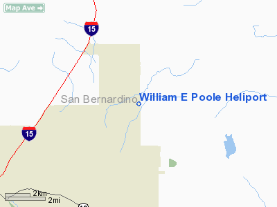
Location
& QuickFacts
|
FAA
Information Effective: |
2006-09-28 |
|
Airport
Identifier: |
10CA |
|
Longitude/Latitude: |
117-10-21.1540W/34-36-07.9760N
-117.172543/34.602216 (Estimated) |
|
Elevation: |
3120 ft / 950.98 m (Estimated) |
|
Land: |
0 acres |
|
From
nearest city: |
6 nautical miles NW of Apple Valley, CA |
|
Location: |
San Bernardino County, CA |
|
Magnetic Variation: |
14E (1985) |
Owner
& Manager
|
Ownership: |
Privately owned |
|
Owner: |
Chet Rasberry Inc |
|
Address: |
19378 Central Rd
Apple Valley, CA 92307 |
|
Phone
number: |
619-247-5845 |
|
Manager: |
Chet Rasberry |
|
Address: |
19378 Central Rd
Apple Valley, CA 92307 |
|
Phone number: |
619-247-5845 |
Airport
Operations and Facilities
|
Airport
Use: |
Private |
|
Wind
indicator: |
Yes |
|
Segmented
Circle: |
No |
|
Control
Tower: |
No |
|
Attendance
Schedule: |
UNATNDD |
|
Sectional
chart: |
Los Angeles |
|
Region: |
AWP - Western-Pacific |
|
Boundary
ARTCC: |
ZLA - Los Angeles |
|
Tie-in
FSS: |
RAL - Riverside |
|
FSS
Phone: |
951-351-3020 |
|
FSS
Toll Free: |
1-800-WX-BRIEF |
|
Runway Information
Helipad H1
|
Dimension: |
30
x 30 ft / 9.1 x 9.1 m |
|
Surface: |
CONC, |
|
|
Runway H1 |
Runway |
|
Traffic
Pattern: |
Left |
Left |
|
Radio Navigation
Aids
|
ID |
Type |
Name |
Ch |
Freq |
Var |
Dist |
|
SB |
NDB |
Petis |
|
397.00 |
14E |
34.2 nm |
|
SJY |
NDB |
San Jacinto |
|
227.00 |
14E |
49.3 nm |
|
RIV |
TACAN |
March |
077X |
|
14E |
42.1 nm |
|
RAL |
VOR |
Riverside |
|
112.40 |
15E |
41.4 nm |
|
HDF |
VOR |
Homeland |
|
113.40 |
14E |
49.6 nm |
|
VCV |
VOR/DME |
Victorville |
031X |
109.40 |
14E |
10.8 nm |
|
EDW |
VORTAC |
Edwards |
111X |
116.40 |
15E |
35.9 nm |
|
DAG |
VORTAC |
Daggett |
079X |
113.20 |
15E |
36.5 nm |
|
HEC |
VORTAC |
Hector |
074X |
112.70 |
15E |
37.0 nm |
|
POM |
VORTAC |
Pomona |
041X |
110.40 |
15E |
43.8 nm |
|
PMD |
VORTAC |
Palmdale |
092X |
114.50 |
15E |
44.1 nm |
|
PDZ |
VORTAC |
Paradise |
059X |
112.20 |
15E |
44.8 nm |
Remarks
-
PVT USE
ONLY; VFR OPS ONLY.
Based Aircraft
|
Aircraft
based on field: |
7 |
|
Helicopters: |
7 |
William E Poole Heliport
Address:
San Bernardino County, CA
Tel:
619-247-5845
Images
and information placed above are from
http://www.airport-data.com/airport/10CA/
We
thank them for the data!
| General
Info |
| Country |
United
States |
| State |
CALIFORNIA
|
| FAA ID |
10CA
|
| Latitude |
34-36-07.976N
|
| Longitude |
117-10-21.154W
|
| Elevation |
3120 feet
|
| Near City |
APPLE
VALLEY |
We don't guarantee the information is fresh and accurate. The data may
be wrong or outdated.
For more up-to-date information please refer to other sources.
|
|

