 |
|
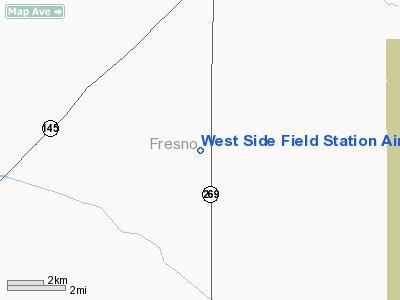
West Side Field Station Airport |
Location
& QuickFacts
|
FAA
Information Effective: |
2006-09-28 |
|
Airport
Identifier: |
7CA6 |
|
Longitude/Latitude: |
120-06-36.5180W/36-20-19.8250N
-120.110144/36.338840 (Estimated) |
|
Elevation: |
280 ft / 85.34 m (Estimated) |
|
Land: |
0 acres |
|
From
nearest city: |
5 nautical miles S of Five Points, CA |
|
Location: |
Fresno County, CA |
|
Magnetic Variation: |
15E (1985) |
Owner
& Manager
|
Ownership: |
Publicly owned |
|
Owner: |
Regents Of Univ Of California |
|
Address: |
300 Lakeside Dr Fl 12
Oakland, CA 94612-3550 |
|
Manager: |
Jimmie Ross |
|
Address: |
P0 Box 158
Five Points, CA 93624 |
|
Phone number: |
209-884-2411 |
Airport
Operations and Facilities
|
Airport Use: |
Private |
|
Wind indicator: |
Yes |
|
Segmented Circle: |
No |
|
Control Tower: |
No |
|
Attendance Schedule: |
ALL/MON-FRI/0700-1600 |
|
Landing fee charge: |
No |
|
Sectional chart: |
San Francisco |
|
Region: |
AWP - Western-Pacific |
|
Boundary ARTCC: |
ZOA - Oakland |
|
Tie-in FSS: |
RIU - Rancho Murieta |
|
FSS on Airport: |
No |
|
FSS Phone: |
916-354-0161 |
|
FSS Toll Free: |
1-800-WX-BRIEF |
Airport
Communications
|
Runway Information
Runway 16/34
|
Dimension: |
1960 x 70 ft / 597.4 x 21.3 m |
|
Surface: |
DIRT, |
|
|
Runway 16 |
Runway 34 |
|
Traffic
Pattern: |
Left |
Left |
|
Radio Navigation
Aids
|
ID |
Type |
Name |
Ch |
Freq |
Var |
Dist |
|
FCH |
NDB |
Chandler |
|
344.00 |
15E |
26.7 nm |
|
COR |
NDB |
Salyer Farms |
|
205.00 |
16E |
32.3 nm |
|
CUK |
NDB |
Academy |
|
266.00 |
14E |
32.8 nm |
|
NLC |
TACAN |
Lemoore |
080X |
|
16E |
7.0 nm |
|
ROM |
VOR |
Priest |
|
110.00 |
16E |
29.4 nm |
|
VIS |
VOR/DME |
Visalia |
031X |
109.40 |
16E |
30.4 nm |
|
CZQ |
VORTAC |
Clovis |
076X |
112.90 |
15E |
35.7 nm |
|
PXN |
VORTAC |
Panoche |
073X |
112.60 |
16E |
39.4 nm |
|
AVE |
VORTAC |
Avenal |
118X |
117.10 |
16E |
42.1 nm |
|
PRB |
VORTAC |
Paso Robles |
090X |
114.30 |
16E |
47.3 nm |
Remarks
West Side Field Station Airport
Address:
Fresno County, CA
Tel:
209-884-2411
Images
and information placed above are from
http://www.airport-data.com/airport/7CA6/
We
thank them for the data!
| General
Info |
| Country |
United
States |
| State |
CALIFORNIA
|
| FAA ID |
7CA6
|
| Latitude |
36-20-19.825N
|
| Longitude |
120-06-36.518W
|
| Elevation |
280 feet
|
| Near City |
FIVE POINTS
|
We don't guarantee the information is fresh and accurate. The data may
be wrong or outdated.
For more up-to-date information please refer to other sources.
|
|


