|
|
Watsonville Municipal Airport |
| Watsonville Municipal Airport |
 |
| IATA: WVI – ICAO: KWVI – FAA LID: WVI |
| Summary |
| Airport type |
Public |
| Operator |
City of Watsonville |
| Location |
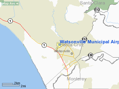
Watsonville, California |
| Elevation AMSL |
163 ft / 49.7 m |
| Coordinates |
36°56′09″N 121°47′23″W / 36.93583°N 121.78972°W / 36.93583; -121.78972Coordinates: 36°56′09″N 121°47′23″W / 36.93583°N 121.78972°W / 36.93583; -121.78972 |
| Runways |
| Direction |
Length |
Surface |
| ft |
m |
| 2/20 |
4,501 |
1,372 |
Asphalt |
| 8/26 |
3,999 |
1,219 |
Asphalt |
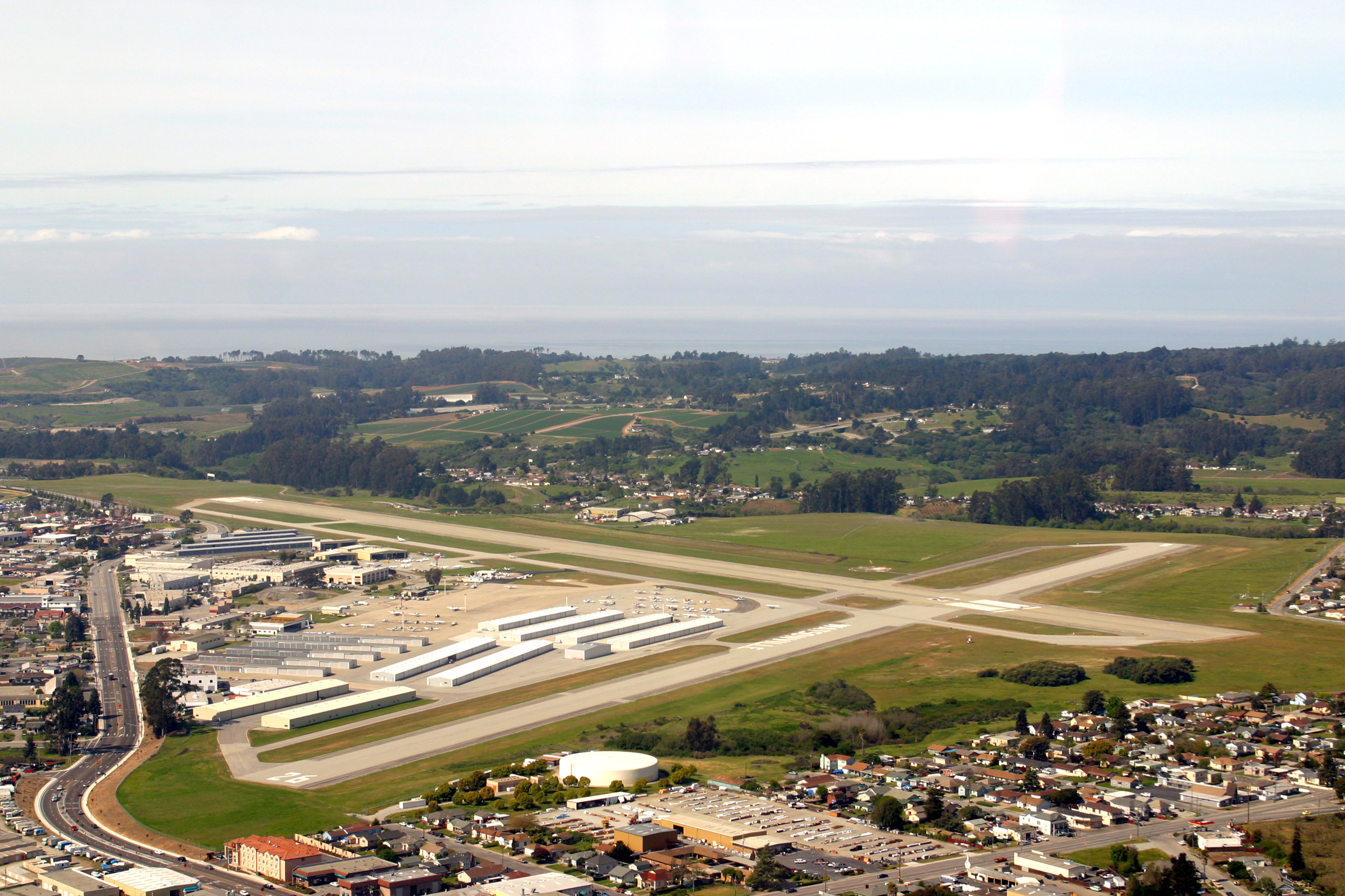
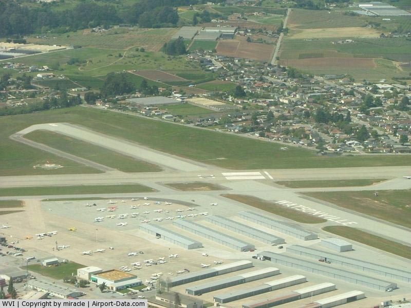
Watsonville Municipal Airport (IATA: WVI, ICAO: KWVI, FAA LID: WVI) is a public airport located three miles (5 km) northwest of the central business district (CBD) of Watsonville, a city in Santa Cruz County, California, USA. The airport covers 330 acres (134 ha) and has two runways. The largest aircraft to ever land at Watsonville were 05-5141 and 05-5143, C-17 Globemaster IIIs from March ARB, CA. Facilities
The Watsonville airport's longest runway is 02-20 and its dimensions are 4501' x 150'. The crosswind runway, 08-26, 3999' x 100', is used when winds favor it and when the fog is moving across the field from the Monterey Bay.
The airport is uncontrolled, and the CTAF is 122.8 MHz, and the ASOS can be received on 132.275 MHz or by calling 831-724-8794.
Instrument Approaches
The airport has three approaches, making it a popular instrument training area.
- Localizer Runway 02 (needs overwater flight)
- VOR/GPS-A (from Salinas VOR)
- NDB/GPS-B (from PAJAR NDB located 1.1 nm SW of the field)
Instrument pilots be advised Watsonville is occasionally surrounded by non-IFR traffic that (illegally) climbs/descends to low stratus layer. ATC usually calls them out, but they can not always see them. So frequent traffic calls to CTAF even when IMC prevails become important.
The above content comes from Wikipedia and is published under free licenses – click here to read more.
|
 |
(Click on the photo to enlarge) |
|
 |
(Click on the photo to enlarge) |
|
 |
(Click on the photo to enlarge) |
|
 |
(Click on the photo to enlarge) |
|
 |
(Click on the photo to enlarge) |
|
 |
(Click on the photo to enlarge) |
Location
& QuickFacts
|
FAA
Information Effective: |
2006-09-28 |
|
Airport
Identifier: |
WVI |
|
Longitude/Latitude: |
121-47-22.7000W/36-56-08.6000N
-121.789639/36.935722 (Estimated) |
|
Elevation: |
163 ft / 49.68 m (Surveyed) |
|
Land: |
330 acres |
|
From
nearest city: |
3 nautical miles NW of Watsonville, CA |
|
Location: |
Santa Cruz County, CA |
|
Magnetic Variation: |
16E (1985) |
Owner
& Manager
|
Ownership: |
Publicly owned |
|
Owner: |
City Of Watsonville |
|
Address: |
250 Main St
Watsonville, CA 95076 |
|
Phone number: |
831-728-6048 |
|
Manager: |
Don French |
|
Address: |
100 Aviation Way
Watsonville, CA 95076 |
|
Phone number: |
831-728-6075 |
Airport
Operations and Facilities
|
Airport
Use: |
Open to public |
|
Wind
indicator: |
Yes |
|
Segmented
Circle: |
Yes |
|
Control
Tower: |
No |
|
Attendance
Schedule: |
ALL/ALL/0700-1900 |
|
Lighting
Schedule: |
DUSK-DAWN
ACTVT MIRL RY 02/20; REIL RY 02; VASI RYS 02 & 20 -
CTAF. |
|
Beacon
Color: |
Clear-Green (lighted land airport) |
|
Landing
fee charge: |
No |
|
Sectional
chart: |
San Francisco |
|
Region: |
AWP - Western-Pacific |
|
Traffic
Pattern Alt: |
1000 ft |
|
Boundary
ARTCC: |
ZOA - Oakland |
|
Tie-in
FSS: |
OAK - Oakland |
|
FSS
on Airport: |
No |
|
FSS
Phone: |
510-273-6111 |
|
FSS
Toll Free: |
1-800-WX-BRIEF |
|
NOTAMs
Facility: |
WVI (NOTAM-d service avaliable) |
|
Federal Agreements: |
NGPRY |
Airport
Communications
|
CTAF: |
122.800 |
|
Unicom: |
122.800 |
Airport
Services
|
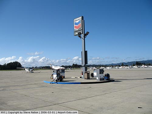
Fuel
available: |
100LL80 A |
|
Airframe
Repair: |
MINOR |
|
Power
Plant Repair: |
MAJOR |
|
Bottled
Oxygen: |
LOW |
|
Bulk
Oxygen: |
NONE |
|
Runway Information
Runway 02/20
|
Dimension: |
4501 x 150 ft / 1371.9 x 45.7 m |
|
Surface: |
ASPH, Good Condition |
|
Weight
Limit: |
Single wheel: 81000 lbs.
Dual wheel: 96000 lbs.
Dual
tandem wheel: 167000 lbs. |
|
Edge
Lights: |
Medium |
|
|
Runway 02 |
Runway 20 |
|
Longitude: |
121-47-44.8593W |
121-47-15.2222W |
|
Latitude: |
36-55-44.5276N |
36-56-22.1316N |
|
Elevation: |
140.00 ft |
158.00 ft |
|
Alignment: |
32 |
127 |
|
ILS
Type: |
LOCALIZER |
|
|
Traffic
Pattern: |
Left |
Left |
|
Markings: |
Non-precision instrument, Fair Condition |
Non-precision instrument, Fair Condition |
|
Crossing
Height: |
48.00 ft |
49.00 ft |
|
Displaced
threshold: |
0.00
ft |
590.00 ft |
|
VASI: |
2-box on left side |
2-box on left side |
|
Visual
Glide Angle: |
3.00� |
3.50� |
|
Runway
End Identifier: |
Yes |
No |
|
Centerline
Lights: |
No |
No |
|
Touchdown
Lights: |
No |
No |
|
Obstruction: |
46 ft tree, 1350.0 ft from runway, 25:1 slope
to clear |
80 ft tree, 1198.0 ft from runway, 125 ft left
of centerline, 12:1 slope to clear
RWY 20 APCH RATIO 22:1 TO DSPLCD THR. |
|
Runway 08/26
|
Dimension: |
3999 x 100 ft / 1218.9 x 30.5 m |
|
Surface: |
ASPH, Good Condition |
|
Weight
Limit: |
Single wheel: 45000 lbs.
Dual wheel: 65000 lbs. |
|
|
Runway 08 |
Runway 26 |
|
Longitude: |
121-47-38.7099W |
121-46-50.1713W |
|
Latitude: |
36-56-17.9800N |
36-56-11.2309N |
|
Elevation: |
163.00 ft |
136.00 ft |
|
Alignment: |
99 |
127 |
|
Traffic
Pattern: |
Left |
Left |
|
Markings: |
Basic, Good Condition |
Basic, Good Condition |
|
Crossing
Height: |
45.00 ft |
0.00
ft |
|
VASI: |
2-light PAPI on right side |
|
|
Visual
Glide Angle: |
4.00� |
0.00� |
|
Runway
End Identifier: |
No |
No |
|
Centerline
Lights: |
No |
No |
|
Touchdown
Lights: |
No |
No |
|
Obstruction: |
60 ft tree, 1050.0 ft from runway, 100 ft right
of centerline, 14:1 slope to clear |
40 ft tree, 945.0 ft from runway, 200 ft left
of centerline, 18:1 slope to clear |
|
Radio Navigation
Aids
|
ID |
Type |
Name |
Ch |
Freq |
Var |
Dist |
|
PDG |
NDB |
Pajar |
|
327.00 |
17E |
1.6 nm |
|
UAD |
NDB |
Chualar |
|
263.00 |
16E |
30.7 nm |
|
LV |
NDB |
Reiga |
|
374.00 |
16E |
45.8 nm |
|
TCY |
NDB |
Tracy |
|
203.00 |
15E |
48.4 nm |
|
NUQ |
TACAN |
Moffett |
123X |
|
17E |
32.5 nm |
|
SJC |
VOR/DME |
San Jose |
088X |
114.10 |
16E |
27.4 nm |
|
SFO |
VOR/DME |
San Francisco |
105X |
115.80 |
17E |
49.7 nm |
|
SNS |
VORTAC |
Salinas |
120X |
117.30 |
17E |
18.6 nm |
|
OSI |
VORTAC |
Woodside |
086X |
113.90 |
17E |
36.2 nm |
|
BSR |
VORTAC |
Big Sur |
087X |
114.00 |
16E |
45.9 nm |
|
SFO |
VOT |
San Francisco Intl |
|
111.00 |
|
49.7 nm |
Remarks
-
SEAGULLS ON & INVOF
ARPT.
-
ARPT HAS
NOISE ABATEMENT PROCEDURES CTC AMGR (831) 728-6075.
-
+110 FT
TREES 435 FT LEFT OF RWY 26 THRESHOLD
-
UNLIGHTED
+ 69 FT TREE, 390 FT RIGHT OF RWY 20 THRESHOLD
Based Aircraft
|
Aircraft
based on field: |
331 |
|
Single
Engine Airplanes: |
298 |
|
Multi
Engine Airplanes: |
26 |
|
Jet Engine
Airplanes: |
6 |
|
Helicopters: |
1 |
Operational Statistics
|
Aircraft
Operations: |
348/Day |
|
Air Taxi: |
2.0% |
|
General
Aviation Local: |
39.1% |
|
General
Aviation Itinerant: |
58.6% |
|
Military: |
0.4% |
Watsonville Municipal Airport
Address:
Santa Cruz County, CA
Tel:
831-728-6048, 831-728-6075
Images
and information placed above are from
http://www.airport-data.com/airport/WVI/
We
thank them for the data!
| General
Info |
| Country |
United
States |
| State |
CALIFORNIA
|
| FAA ID |
WVI
|
| Latitude |
36-56-08.628N
|
| Longitude |
121-47-22.624W
|
| Elevation |
160 feet
|
| Near City |
WATSONVILLE
|
We don't guarantee the information is fresh and accurate. The data may
be wrong or outdated.
For more up-to-date information please refer to other sources.
|
|