 |
|
Watsonville Community Hospital Heliport |
|
|
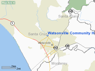
Location
& QuickFacts
|
FAA
Information Effective: |
2006-09-28 |
|
Airport
Identifier: |
CL99 |
|
Longitude/Latitude: |
121-46-33.8240W/36-56-23.8280N
-121.776062/36.939952 (Estimated) |
|
Elevation: |
111 ft / 33.83 m (Estimated) |
|
Land: |
0 acres |
|
From
nearest city: |
0 nautical miles E of Watsonville, CA |
|
Location: |
Santa Cruz County, CA |
|
Magnetic Variation: |
16E (1985) |
Owner
& Manager
|
Ownership: |
Publicly owned |
|
Owner: |
Watsonville Community Hosp |
|
Address: |
298 Green Valley Rd
Watsonville, CA 95076 |
|
Phone
number: |
408-724-4741 |
|
Manager: |
Lawrence L. Shannon |
|
Address: |
298 Green Valley Rd
Watsonville, CA 95076 |
|
Phone number: |
408-724-4741 |
Airport
Operations and Facilities
|
Airport
Use: |
Private
MEDICAL. |
|
Wind
indicator: |
Yes |
|
Segmented
Circle: |
No |
|
Control
Tower: |
No |
|
Attendance
Schedule: |
UNATNDD |
|
Lighting
Schedule: |
PHONE REQ
FOR PERIMETER LGTS CALL 408-724-4741. |
|
Sectional
chart: |
San Francisco |
|
Region: |
AWP - Western-Pacific |
|
Boundary
ARTCC: |
ZOA - Oakland |
|
Tie-in
FSS: |
OAK - Oakland |
|
FSS
Phone: |
510-273-6111 |
|
FSS
Toll Free: |
1-800-WX-BRIEF |
|
Runway Information
Helipad H1
|
Dimension: |
50 x 50 ft / 15.2 x 15.2 m |
|
Surface: |
CONC, |
|
|
Runway H1 |
Runway |
|
Traffic
Pattern: |
Left |
Left |
|
Radio Navigation
Aids
|
ID |
Type |
Name |
Ch |
Freq |
Var |
Dist |
|
PDG |
NDB |
Pajar |
|
327.00 |
17E |
2.2 nm |
|
UAD |
NDB |
Chualar |
|
263.00 |
16E |
30.6 nm |
|
LV |
NDB |
Reiga |
|
374.00 |
16E |
45.4 nm |
|
TCY |
NDB |
Tracy |
|
203.00 |
15E |
47.9 nm |
|
NUQ |
TACAN |
Moffett |
123X |
|
17E |
32.5 nm |
|
SJC |
VOR/DME |
San Jose |
088X |
114.10 |
16E |
27.4 nm |
|
SFO |
VOR/DME |
San Francisco |
105X |
115.80 |
17E |
49.9 nm |
|
SNS |
VORTAC |
Salinas |
120X |
117.30 |
17E |
18.6 nm |
|
OSI |
VORTAC |
Woodside |
086X |
113.90 |
17E |
36.4 nm |
|
BSR |
VORTAC |
Big Sur |
087X |
114.00 |
16E |
46.1 nm |
|
PXN |
VORTAC |
Panoche |
073X |
112.60 |
16E |
49.8 nm |
|
SFO |
VOT |
San Francisco Intl |
|
111.00 |
|
49.9 nm |
Remarks
-
PRVDD VFR/PVT
USE ONLY; IF NGT OPERS COND, LGTG RQRD; & COORD OPERS W/MGR OF WATSONVILLE
MUNI ARPT.
Based Aircraft
|
Aircraft
based on field: |
1 |
|
Helicopters: |
1 |
Watsonville Community Hospital Heliport
Address:
Santa Cruz County, CA
Tel:
408-724-4741
Images
and information placed above are from
http://www.airport-data.com/airport/CL99/
We
thank them for the data!
| General
Info |
| Country |
United
States |
| State |
CALIFORNIA
|
| FAA ID |
CL99
|
| Latitude |
36-56-23.828N
|
| Longitude |
121-46-33.824W
|
| Elevation |
111 feet
|
| Near City |
WATSONVILLE
|
We don't guarantee the information is fresh and accurate. The data may
be wrong or outdated.
For more up-to-date information please refer to other sources.
|
|


