 |
|
Wasco-kern County Airport |
Wasco Airport
Wasco-Kern County Airport |
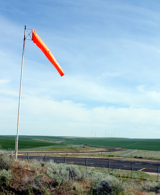 |
| Taxiway at Wasco State Airport |
| IATA: none – ICAO: none – FAA LID: L19 |
| Summary |
| Airport type |
Public |
| Operator |
Kern County |
| Location |
Wasco, California |
| Elevation AMSL |
313 ft / 95.4 m |
| Coordinates |
35°37′11″N 119°21′13″W / 35.61972°N 119.35361°W / 35.61972; -119.35361Coordinates: 35°37′11″N 119°21′13″W / 35.61972°N 119.35361°W / 35.61972; -119.35361 |
| Runways |
| Direction |
Length |
Surface |
| ft |
m |
| 12/30 |
3,380 |
1,030 |
Asphalt |
Wasco Airport (FAA LID: L19), also known as Wasco-Kern County Airport, is a public airport located two miles (3.2 km) northwest of Wasco, serving Kern County, California, USA. This general aviation airport covers 158 acres (64 ha) and has one runway.
The above content comes from Wikipedia and is published under free licenses – click here to read more.

Location
& QuickFacts
|
FAA
Information Effective: |
2006-09-28 |
|
Airport
Identifier: |
L19 |
|
Longitude/Latitude: |
119-21-13.4070W/35-37-10.8440N
-119.353724/35.619679 (Estimated) |
|
Elevation: |
313 ft / 95.40 m (Estimated) |
|
Land: |
158 acres |
|
From
nearest city: |
2 nautical miles NW of Wasco, CA |
|
Location: |
Kern County, CA |
|
Magnetic Variation: |
15E (1985) |
Owner
& Manager
|
Ownership: |
Publicly owned |
|
Owner: |
Kern County Dept Of Airports |
|
Address: |
3701 Wings Way, Suite 300
Bakersfield, CA 93308-7026 |
|
Phone
number: |
661-391-1800 |
|
Manager: |
Jack Gotcher |
|
Address: |
3701 Wings Way, Suite 300
Bakersfield, CA 93308-7026 |
|
Phone
number: |
661-391-1800
RESIDENT CUSTODIAN ON ARPT. CELL PHONE: (661) 747-4055 24
HRS: (661) 393-3868 FAX: (661) 391-1801 EMAIL: BFLSECURITY@CO.KERN.CA.US |
Airport
Operations and Facilities
|
Airport
Use: |
Open to public |
|
Wind
indicator: |
Yes |
|
Segmented
Circle: |
Yes |
|
Control
Tower: |
No |
|
Attendance
Schedule: |
IREG |
|
Lighting
Schedule: |
DUSK-DAWN
ACTVT MIRL RY 12/30 - CTAF. |
|
Beacon
Color: |
Clear-Green (lighted land airport) |
|
Landing
fee charge: |
No |
|
Sectional
chart: |
Los Angeles |
|
Region: |
AWP - Western-Pacific |
|
Traffic
Pattern Alt: |
800 ft |
|
Boundary
ARTCC: |
ZLA - Los Angeles |
|
Tie-in
FSS: |
RIU - Rancho Murieta |
|
FSS
on Airport: |
No |
|
FSS
Phone: |
916-354-0161 |
|
FSS
Toll Free: |
1-800-WX-BRIEF |
|
NOTAMs
Facility: |
RIU (NOTAM-d service avaliable) |
|
Federal Agreements: |
NGY |
Airport
Communications
|
CTAF: |
122.800 |
|
Unicom: |
122.800 |
Airport
Services
|
Fuel
available: |
100LL
FUEL AVBL BY PHONE CALL ONLY (805) 758-3009. |
|
Airframe
Repair: |
NONE |
|
Power
Plant Repair: |
NONE |
|
Bottled
Oxygen: |
NONE |
|
Bulk
Oxygen: |
NONE |
|
Runway Information
Runway 12/30
|
Dimension: |
3380 x 60 ft / 1030.2 x 18.3 m |
|
Surface: |
ASPH, Good Condition |
|
Weight
Limit: |
Single wheel: 6000 lbs. |
|
Edge
Lights: |
Medium
RY 12 LGTD THLD RELCTD 455 FT; RY 30 LGTD THLD RELCTD 240 FT FOR
NIGHT OPNS; 2685 FT OF RY 12/30 USBL AT NIGHT. |
|
|
Runway 12 |
Runway 30 |
|
Traffic
Pattern: |
Left |
Left |
|
Markings: |
Basic, Good Condition |
Basic, Good Condition |
|
Displaced
threshold: |
455.00 ft |
240.00 ft |
|
Runway
End Identifier: |
No |
No |
|
Centerline
Lights: |
No |
No |
|
Touchdown
Lights: |
No |
No |
|
Obstruction: |
20 ft trees, 200.0 ft from runway
+30 FT TREES RIGHT TO LEFT 600 FT FM DSPLCD THR. RY 12 APCH
RATIO 20:1 TO DSPLCD THLD.
+6' FENCE & +15' RD 0' TO 70' FM RY END 80' L TO 70' R. |
15 ft road, 200.0 ft from runway
RY 30 APCH RATIO 26:1 TO DSPLCD THLD.
+4' FENCE 85' TO 180' FM RY END 125' L TO 125' R; +15' RD
105' TO 200' FM RY END 125' L TO 125' R; +8' SIGN 200' FM
RY END 0' L. |
|
Radio Navigation
Aids
|
ID |
Type |
Name |
Ch |
Freq |
Var |
Dist |
|
COR |
NDB |
Salyer Farms |
|
205.00 |
16E |
28.3 nm |
|
TTE |
VOR/DME |
Tule |
029X |
109.20 |
16E |
24.0 nm |
|
VIS |
VOR/DME |
Visalia |
031X |
109.40 |
16E |
45.4 nm |
|
EHF |
VORTAC |
Shafter |
101X |
115.40 |
14E |
14.9 nm |
|
AVE |
VORTAC |
Avenal |
118X |
117.10 |
16E |
30.6 nm |
|
FLW |
VORTAC |
Fellows |
122X |
117.50 |
16E |
40.4 nm |
|
BFL |
VOT |
Bakersfield |
|
111.20 |
|
19.0 nm |
Remarks
-
CROP DUSTING
OPNS PROHIBITED EXCP BY AMGR 661-393-7990.
-
ESTABD PRIOR TO 5/1/59.
Based Aircraft
|
Aircraft
based on field: |
14 |
|
Single
Engine Airplanes: |
13 |
|
Multi
Engine Airplanes: |
1 |
Operational Statistics
|
Aircraft
Operations: |
193/Week |
|
Air Taxi: |
10.0% |
|
General
Aviation Local: |
80.0% |
|
General
Aviation Itinerant: |
10.0% |
Wasco-kern County Airport
Address:
Kern County, CA
Tel:
661-391-1800
Images
and information placed above are from
http://www.airport-data.com/airport/L19/
We
thank them for the data!
| General
Info |
| Country |
United
States |
| State |
CALIFORNIA
|
| FAA ID |
L19
|
| Latitude |
35-37-10.844N
|
| Longitude |
119-21-13.407W
|
| Elevation |
313 feet
|
| Near City |
WASCO
|
We don't guarantee the information is fresh and accurate. The data may
be wrong or outdated.
For more up-to-date information please refer to other sources.
|
|


