 |
|
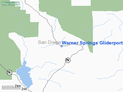
Warner Springs Gliderport |
|
|
Location
& QuickFacts
|
FAA
Information Effective: |
2006-09-28 |
|
Airport
Identifier: |
CL35 |
|
Longitude/Latitude: |
116-40-29.0720W/33-17-04.1340N
-116.674742/33.284482 (Estimated) |
|
Elevation: |
2885 ft / 879.35 m (Estimated) |
|
Land: |
0 acres |
|
From
nearest city: |
2 nautical miles E of Warner Springs, CA |
|
Location: |
San Diego County, CA |
|
Magnetic Variation: |
13E (1985) |
Owner
& Manager
|
Ownership: |
Privately owned |
|
Owner: |
Warner Springs Ranch |
|
Address: |
31930 Hwy 79
Warner Springs, CA 92086
SKY SAILING 31930 HWY 79. |
|
Phone
number: |
760-782-3555 |
|
Manager: |
Bret Willat
LEASEE. |
|
Address: |
Sky Sailing 31930 Hwy 79
Warner Springs, CA 92086 |
|
Phone number: |
760-782-0404 |
Airport
Operations and Facilities
|
Airport
Use: |
Private |
|
Wind
indicator: |
Yes |
|
Segmented
Circle: |
Yes |
|
Control
Tower: |
No |
|
Attendance
Schedule: |
ALL/ALL/0900-1700 |
|
Lighting
Schedule: |
RDO-CTL
ACTVT LIRL RY 08/26 - 122.800. |
|
Landing fee charge: |
Yes |
|
Sectional chart: |
Los Angeles |
|
Region: |
AWP - Western-Pacific |
|
Boundary ARTCC: |
ZLA - Los Angeles |
|
Tie-in FSS: |
SAN - San Diego |
|
FSS Phone: |
858-277-7043 |
|
FSS Toll Free: |
1-800-WX-BRIEF |
Airport
Communications
|
Runway Information
Runway 08/26
|
Dimension: |
4700 x 70 ft / 1432.6 x 21.3 m |
|
Surface: |
ASPH-GRVL,
LAST 1200' TO THE WEST IS GRVL SFC. |
|
Edge
Lights: |
Low |
|
|
Runway 08 |
Runway 26 |
|
Traffic
Pattern: |
Left |
Left |
|
Obstruction: |
|
200 ft hill, 5200.0 ft from runway |
|
Radio Navigation
Aids
|
ID |
Type |
Name |
Ch |
Freq |
Var |
Dist |
|
SAN |
FAN MARKER |
Encat |
|
|
15E |
40.4 nm |
|
SJY |
NDB |
San Jacinto |
|
227.00 |
14E |
34.7 nm |
|
UN |
NDB |
Tijuana |
|
381.00 |
14E |
48.6 nm |
|
NKX |
TACAN |
Miramar |
033X |
|
15E |
34.7 nm |
|
NFG |
TACAN |
Camp Pendleton |
055X |
|
13E |
35.8 nm |
|
NZY |
TACAN |
North Island |
117X |
|
14E |
44.4 nm |
|
RIV |
TACAN |
March |
077X |
|
14E |
48.0 nm |
|
NRS |
TACAN |
Imperial Beach |
029X |
|
14E |
48.5 nm |
|
NKX |
UHF/NDB |
Miramar |
|
352.00 |
15E |
34.0 nm |
|
HDF |
VOR |
Homeland |
|
113.40 |
14E |
39.1 nm |
|
TIJ |
VOR/DME |
Tijuana |
112X |
116.50 |
14E |
46.9 nm |
|
JLI |
VORTAC |
Julian |
087X |
114.00 |
15E |
9.7 nm |
|
TRM |
VORTAC |
Thermal |
109X |
116.20 |
13E |
33.1 nm |
|
PSP |
VORTAC |
Palm Springs |
102X |
115.50 |
13E |
37.3 nm |
|
OCN |
VORTAC |
Oceanside |
100X |
115.30 |
15E |
37.4 nm |
|
MZB |
VORTAC |
Mission Bay |
125X |
117.80 |
15E |
41.0 nm |
|
PGY |
VORTAC |
Poggi |
035X |
109.80 |
14E |
43.3 nm |
|
SEE |
VOT |
Gillespie Field |
|
110.00 |
|
31.5 nm |
|
SAN |
VOT |
Mount Soledad |
|
109.00 |
|
39.5 nm |
Remarks
Based Aircraft
|
Aircraft
based on field: |
80 |
|
Single
Engine Airplanes: |
10 |
|
Gliders: |
70 |
Warner Springs Gliderport
Address:
San Diego County, CA
Tel:
760-782-3555,
760-782-0404
Images
and information placed above are from
http://www.airport-data.com/airport/CL35/
We
thank them for the data!
| General
Info |
| Country |
United
States |
| State |
CALIFORNIA
|
| FAA ID |
CL35
|
| Latitude |
33-17-04.134N
|
| Longitude |
116-40-29.072W
|
| Elevation |
2885 feet
|
| Near City |
WARNER
SPRINGS |
We don't guarantee the information is fresh and accurate. The data may
be wrong or outdated.
For more up-to-date information please refer to other sources.
|
|


