 |
|
|
|
|
|
Location
& QuickFacts
|
FAA
Information Effective: |
2006-09-28 |
|
Airport
Identifier: |
0O9 |
|
Longitude/Latitude: |
123-59-04.2700W/41-50-44.4060N
-123.984519/41.845668 (Estimated) |
|
Elevation: |
356 ft / 108.51 m (Surveyed) |
|
Land: |
15 acres |
|
From
nearest city: |
1 nautical miles W of Gasquet, CA |
|
Location: |
Del Norte County, CA |
|
Magnetic Variation: |
18E (1985) |
Owner
& Manager
|
Ownership: |
Publicly owned |
|
Owner: |
Del Norte County |
|
Address: |
700 5th St
Crescent City, CA 95531 |
|
Phone
number: |
707-464-7229 |
|
Manager: |
Dan Harrison
DIR OF PUBLIC WORKS; COUNTY ENGINEER. |
|
Address: |
981 H Street, Suite 110
Crescent City, CA 95531 |
|
Phone number: |
707-464-7229 |
Airport
Operations and Facilities
|
Airport
Use: |
Open to public |
|
Wind
indicator: |
Yes |
|
Segmented
Circle: |
Yes |
|
Control
Tower: |
No |
|
Attendance
Schedule: |
UNATNDD |
|
Lighting
Schedule: |
DUSK-DAWN |
|
Landing
fee charge: |
No |
|
Sectional
chart: |
Klamath Falls |
|
Region: |
AWP - Western-Pacific |
|
Traffic
Pattern Alt: |
800 ft |
|
Boundary
ARTCC: |
ZSE - Seattle |
|
Tie-in
FSS: |
OAK - Oakland |
|
FSS
on Airport: |
No |
|
FSS
Phone: |
510-273-6111 |
|
FSS
Toll Free: |
1-800-WX-BRIEF |
|
NOTAMs
Facility: |
OAK (NOTAM-d service avaliable) |
Airport
Communications
|
Runway Information
Runway 06/24
|
Dimension: |
2990 x 50 ft / 911.4 x 15.2 m |
|
Surface: |
ASPH, Fair Condition |
|
Weight
Limit: |
Single wheel: 12000 lbs. |
|
Edge
Lights: |
Non-standard lighting system
NSTD LIRL ON CENTER 2000 FT ONLY BTN DSPLCD THRS. |
|
|
Runway 06 |
Runway 24 |
|
Traffic
Pattern: |
Left |
Left |
|
Markings: |
Basic, Fair Condition |
Basic, Fair Condition |
|
Displaced
threshold: |
500.00 ft |
490.00 ft |
|
Runway
End Identifier: |
No |
No |
|
Centerline
Lights: |
No |
No |
|
Touchdown
Lights: |
No |
No |
|
Obstruction: |
45 ft trees, 200.0 ft from runway, 85 ft left
of centerline
APCH RATIO TO DSPLCD THLD 15:1; APCH RATIO 14:1 TO DSPLCD
THLD OVER +30 FT TREE AT 650 FT FM DSPLCD THLD 85 FT LEFT.
3 FT FENCE AT 60 FT; 20 FT TREES AT 150 FT, 85 FT LEFT. |
65 ft trees, 650.0 ft from runway, 130 ft right
of centerline, 6:1 slope to clear
APCH RATIO 17:1 TO DSPLCD THLD.
+4'
FENCE 0-200' LEFT & RIGHT. |
|
Radio Navigation
Aids
|
ID |
Type |
Name |
Ch |
Freq |
Var |
Dist |
|
CEC |
VORTAC |
Crescent City |
027X |
109.00 |
19E |
12.2 nm |
Remarks
-
+5' BRUSH
AND 30-100' TREES RIGHT AND LEFT IN PRIM SFC.
-
ARPT IN
CANYON; HIGH MOUNTAINS AND TREES SURROUND ARPT MOUNTAIN FLYING EXPERIENCE
STRONGLY RECOMMENDED.
-
PVT DRIVEWAY
TO SOUTH OF RY PENETRATES CLEAR SPACE, DRIVEWAY EDGE 88 FT FM RY CNTRLN,
-
NO NIGHT OPERATION AUTHORIZED.
-
ESTABD PRIOR TO 5/15/59.
Based Aircraft
|
Aircraft
based on field: |
3 |
|
Single
Engine Airplanes: |
3 |
Operational Statistics
|
Aircraft
Operations: |
43/Week |
|
General
Aviation Local: |
45.5% |
|
General
Aviation Itinerant: |
45.5% |
|
Military: |
9.1% |
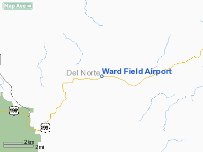
Ward Field Airport
Address:
Del Norte County, CA
Tel:
707-464-7229
Images
and information placed above are from
http://www.airport-data.com/airport/0O9/
We
thank them for the data!
| General
Info |
| Country |
United
States |
| State |
CALIFORNIA
|
| FAA ID |
0O9
|
| Latitude |
41-50-44.406N
|
| Longitude |
123-59-04.270W
|
| Elevation |
356 feet
|
| Near City |
GASQUET
|
We don't guarantee the information is fresh and accurate. The data may
be wrong or outdated.
For more up-to-date information please refer to other sources.
|
|


