 |
|
Victor Valley Community Hospital Heliport |
|
|
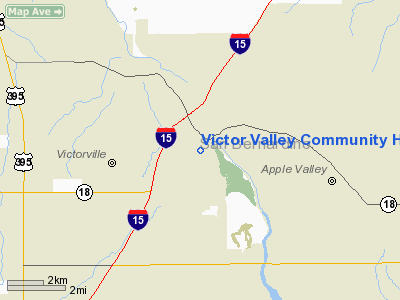
Location
& QuickFacts
|
FAA
Information Effective: |
2006-09-28 |
|
Airport
Identifier: |
69CA |
|
Longitude/Latitude: |
117-17-34.0000W/34-31-40.0000N
-117.292778/34.527778 (Estimated) |
|
Elevation: |
2896 ft / 882.70 m (Estimated) |
|
Land: |
0 acres |
|
From
nearest city: |
0 nautical miles N of Victorville, CA |
|
Location: |
San Bernardino County, CA |
|
Magnetic Variation: |
14E (1990) |
Owner
& Manager
|
Ownership: |
Privately owned |
|
Owner: |
Victor Valley Community Hosp |
|
Address: |
15248 Eleventh St
Victorville, CA 92392 |
|
Phone
number: |
619-245-8691 |
|
Manager: |
Bob Steele
DIRECTOR OF ENGINEERING. |
|
Address: |
15248 Eleventh St
Victorville, CA 92392 |
|
Phone number: |
619-245-8691 |
Airport
Operations and Facilities
|
Airport
Use: |
Private |
|
Wind
indicator: |
Yes |
|
Segmented
Circle: |
No |
|
Control
Tower: |
No |
|
Attendance
Schedule: |
ALL/ALL/ALL |
|
Beacon
Color: |
Clear-Green-Yellow (heliport) |
|
Sectional
chart: |
Los Angeles |
|
Region: |
AWP - Western-Pacific |
|
Boundary
ARTCC: |
ZLA - Los Angeles |
|
Tie-in
FSS: |
RAL - Riverside |
|
FSS
on Airport: |
No |
|
FSS
Phone: |
951-351-3020 |
|
FSS
Toll Free: |
1-800-WX-BRIEF |
|
Runway Information
Helipad H1
|
Dimension: |
60 x 60 ft / 18.3 x 18.3 m |
|
Surface: |
CONC,
HELISTOP ON FREE-STANDING STRUCTURE ABOVE PARKING LOT. |
|
|
Runway H1 |
Runway |
|
Traffic
Pattern: |
Left |
Left |
|
Radio Navigation
Aids
|
ID |
Type |
Name |
Ch |
Freq |
Var |
Dist |
|
SB |
NDB |
Petis |
|
397.00 |
14E |
28.6 nm |
|
EMT |
NDB |
El Monte |
|
359.00 |
15E |
45.2 nm |
|
SJY |
NDB |
San Jacinto |
|
227.00 |
14E |
46.4 nm |
|
GWF |
NDB |
Gen William J Fox |
|
282.00 |
15E |
47.4 nm |
|
RIV |
TACAN |
March |
077X |
|
14E |
37.3 nm |
|
RAL |
VOR |
Riverside |
|
112.40 |
15E |
35.5 nm |
|
HDF |
VOR |
Homeland |
|
113.40 |
14E |
45.5 nm |
|
VCV |
VOR/DME |
Victorville |
031X |
109.40 |
14E |
6.3 nm |
|
EDW |
VORTAC |
Edwards |
111X |
116.40 |
15E |
34.9 nm |
|
POM |
VORTAC |
Pomona |
041X |
110.40 |
15E |
36.5 nm |
|
PDZ |
VORTAC |
Paradise |
059X |
112.20 |
15E |
38.5 nm |
|
PMD |
VORTAC |
Palmdale |
092X |
114.50 |
15E |
38.7 nm |
|
DAG |
VORTAC |
Daggett |
079X |
113.20 |
15E |
43.9 nm |
|
HEC |
VORTAC |
Hector |
074X |
112.70 |
15E |
44.1 nm |
Remarks
Victor Valley Community Hospital Heliport
Address:
San Bernardino County, CA
Tel:
619-245-8691
Images
and information placed above are from
http://www.airport-data.com/airport/69CA/
We
thank them for the data!
| General
Info |
| Country |
United
States |
| State |
CALIFORNIA
|
| FAA ID |
69CA
|
| Latitude |
34-31-40.000N
|
| Longitude |
117-17-34.000W
|
| Elevation |
2896 feet
|
| Near City |
VICTORVILLE
|
We don't guarantee the information is fresh and accurate. The data may
be wrong or outdated.
For more up-to-date information please refer to other sources.
|
|


