 |
|
Vanderford Ranch Company Airport |
|
|
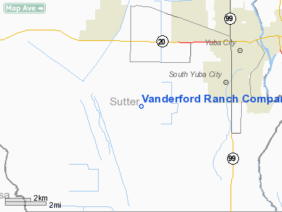
Location
& QuickFacts
|
FAA
Information Effective: |
2006-09-28 |
|
Airport
Identifier: |
CA73 |
|
Longitude/Latitude: |
121-42-58.8860W/39-05-44.6130N
-121.716357/39.095726 (Estimated) |
|
Elevation: |
42 ft / 12.80 m (Estimated) |
|
Land: |
0 acres |
|
From
nearest city: |
6 nautical miles SW of Yuba City, CA |
|
Location: |
Sutter County, CA |
|
Magnetic Variation: |
16E (1985) |
Owner
& Manager
|
Ownership: |
Privately owned |
|
Owner: |
V. G. Vanderford |
|
Address: |
5852 Bogue Rd
Yuba City, CA 95991 |
|
Phone
number: |
916-673-2724 |
|
Manager: |
V. G. Vanderford |
|
Address: |
5852 Bogue Rd
Yuba City, CA 95991 |
|
Phone number: |
916-673-2724 |
Airport
Operations and Facilities
|
Airport
Use: |
Private |
|
Wind
indicator: |
Yes |
|
Segmented
Circle: |
No |
|
Control
Tower: |
No |
|
Attendance
Schedule: |
ALL/MON-FRI/IRREG |
|
Lighting
Schedule: |
PHONE REQ
FOR RTG BCN & RWY LGTS, PHONE 916-673-2724. |
|
Beacon Color: |
Clear (unlighted land airport) |
|
Landing fee charge: |
No |
|
Sectional chart: |
San Francisco |
|
Region: |
AWP - Western-Pacific |
|
Boundary ARTCC: |
ZOA - Oakland |
|
Tie-in FSS: |
RIU - Rancho Murieta |
|
FSS on Airport: |
No |
|
FSS Phone: |
916-354-0161 |
|
FSS Toll Free: |
1-800-WX-BRIEF |
Airport
Services
|
Fuel
available: |
100 |
|
Airframe
Repair: |
NONE |
|
Power
Plant Repair: |
NONE |
|
Runway Information
Runway 16/34
|
Dimension: |
3220 x 48 ft / 981.5 x 14.6 m |
|
Surface: |
ASPH, |
|
Edge
Lights: |
Low
LGTS TEMP OUT OF SERVICE. |
|
|
Runway 16 |
Runway 34 |
|
Traffic
Pattern: |
Left |
Left |
|
Radio Navigation
Aids
|
ID |
Type |
Name |
Ch |
Freq |
Var |
Dist |
|
MY |
NDB |
Halow |
|
222.00 |
16E |
6.7 nm |
|
OVE |
NDB |
Oroville |
|
212.00 |
16E |
24.4 nm |
|
BAB |
TACAN |
Beale |
023X |
|
16E |
13.1 nm |
|
TZZ |
VOR |
Travis |
|
116.40 |
17E |
45.4 nm |
|
MYV |
VOR/DME |
Marysville |
045X |
110.80 |
16E |
6.7 nm |
|
MCC |
VOR/DME |
Mc Clellan |
029X |
109.20 |
17E |
29.6 nm |
|
CIC |
VOR/DME |
Chico |
035X |
109.80 |
16E |
42.2 nm |
|
ILA |
VORTAC |
Williams |
091X |
114.40 |
18E |
14.6 nm |
|
MXW |
VORTAC |
Maxwell |
037X |
110.00 |
18E |
27.0 nm |
|
SAC |
VORTAC |
Sacramento |
099X |
115.20 |
17E |
39.9 nm |
|
SMF |
VOT |
Sacramento Metropolitan |
|
111.40 |
|
25.0 nm |
|
SAC |
VOT |
Sacramento Executive |
|
111.40 |
|
36.4 nm |
Remarks
-
FAA FORM
7480-1 SUBMITTED FOR RECORDS.
Based Aircraft
|
Aircraft
based on field: |
11 |
|
Single
Engine Airplanes: |
2 |
|
Helicopters: |
9 |
Vanderford Ranch Company Airport
Address:
Sutter County, CA
Tel:
916-673-2724
Images
and information placed above are from
http://www.airport-data.com/airport/CA73/
We
thank them for the data!
| General
Info |
| Country |
United
States |
| State |
CALIFORNIA
|
| FAA ID |
CA73
|
| Latitude |
39-05-44.613N
|
| Longitude |
121-42-58.886W
|
| Elevation |
42 feet
|
| Near City |
YUBA CITY
|
We don't guarantee the information is fresh and accurate. The data may
be wrong or outdated.
For more up-to-date information please refer to other sources.
|
|


