 |
|
|
|
|
|
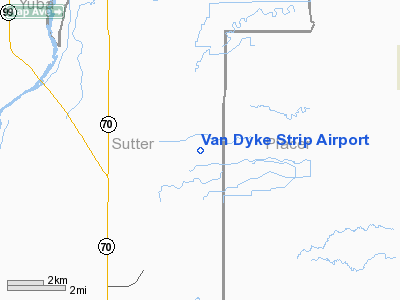
Location
& QuickFacts
|
FAA
Information Effective: |
2006-09-28 |
|
Airport
Identifier: |
25CL |
|
Longitude/Latitude: |
121-29-03.8440W/38-51-59.6320N
-121.484401/38.866564 (Estimated) |
|
Elevation: |
48 ft / 14.63 m (Estimated) |
|
Land: |
0 acres |
|
From
nearest city: |
3 nautical miles N of Pleasant Grove, CA |
|
Location: |
Sutter County, CA |
|
Magnetic Variation: |
16E (1985) |
Owner
& Manager
|
Ownership: |
Privately owned |
|
Owner: |
James C Van Dyke |
|
Address: |
4036 Pleasant Grove Rd
Pleasant Grove, CA 95668 |
|
Phone
number: |
916-655-3171 |
|
Manager: |
James C Van Dyke |
|
Address: |
4036 Pleasant Grove Rd
Pleasant Grove, CA 95668 |
|
Phone number: |
916-655-3171 |
Airport
Operations and Facilities
|
Airport Use: |
Private |
|
Wind indicator: |
Yes |
|
Segmented Circle: |
No |
|
Control Tower: |
No |
|
Attendance Schedule: |
UNATNDD |
|
Landing fee charge: |
No |
|
Sectional chart: |
San Francisco |
|
Region: |
AWP - Western-Pacific |
|
Boundary ARTCC: |
ZOA - Oakland |
|
Tie-in FSS: |
RIU - Rancho Murieta |
|
FSS on Airport: |
No |
|
FSS Phone: |
916-354-0161 |
|
FSS Toll Free: |
1-800-WX-BRIEF |
Airport
Services
|
Airframe
Repair: |
NONE |
|
Power
Plant Repair: |
NONE |
|
Runway Information
Runway N/S
|
Dimension: |
2900 x 50 ft / 883.9 x 15.2 m |
|
Surface: |
ASPH-DIRT, |
|
|
Runway N |
Runway S |
|
Traffic
Pattern: |
Right |
Left |
|
Obstruction: |
30 ft pline |
30 ft pline |
|
Radio Navigation
Aids
|
ID |
Type |
Name |
Ch |
Freq |
Var |
Dist |
|
MY |
NDB |
Halow |
|
222.00 |
16E |
19.1 nm |
|
OVE |
NDB |
Oroville |
|
212.00 |
16E |
38.3 nm |
|
BAB |
TACAN |
Beale |
023X |
|
16E |
16.3 nm |
|
SUU |
TACAN |
Travis |
113X |
|
17E |
43.2 nm |
|
TZZ |
VOR |
Travis |
|
116.40 |
17E |
34.9 nm |
|
MCC |
VOR/DME |
Mc Clellan |
029X |
109.20 |
17E |
12.5 nm |
|
MYV |
VOR/DME |
Marysville |
045X |
110.80 |
16E |
14.6 nm |
|
HNW |
VOR/DME |
Hangtown |
102X |
115.50 |
17E |
35.5 nm |
|
SAC |
VORTAC |
Sacramento |
099X |
115.20 |
17E |
25.6 nm |
|
ILA |
VORTAC |
Williams |
091X |
114.40 |
18E |
28.2 nm |
|
MXW |
VORTAC |
Maxwell |
037X |
110.00 |
18E |
43.8 nm |
|
SMF |
VOT |
Sacramento Metropolitan |
|
111.40 |
|
11.7 nm |
|
SAC |
VOT |
Sacramento Executive |
|
111.40 |
|
21.2 nm |
Remarks
Based Aircraft
|
Aircraft
based on field: |
4 |
|
Single
Engine Airplanes: |
4 |
Van Dyke Strip Airport
Address:
Sutter County, CA
Tel:
916-655-3171
Images
and information placed above are from
http://www.airport-data.com/airport/25CL/
We
thank them for the data!
| General
Info |
| Country |
United
States |
| State |
CALIFORNIA
|
| FAA ID |
25CL
|
| Latitude |
38-51-59.632N
|
| Longitude |
121-29-03.844W
|
| Elevation |
48 feet
|
| Near City |
PLEASANT
GROVE |
We don't guarantee the information is fresh and accurate. The data may
be wrong or outdated.
For more up-to-date information please refer to other sources.
|
|


