 |
|
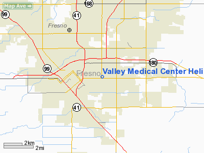
Valley Medical Center Heliport |
|
|
Location & QuickFacts
|
FAA Information Effective: |
2006-09-28 |
|
Airport Identifier: |
86CA |
|
Longitude/Latitude: |
119-45-13.5140W/36-44-13.8190N
-119.753754/36.737172 (Estimated) |
|
Elevation: |
307 ft / 93.57 m (Estimated) |
|
Land: |
0 acres |
|
From nearest city: |
1 nautical miles S of Fresno, CA |
|
Location: |
Fresno County, CA |
|
Magnetic Variation: |
15E (1985) |
Owner & Manager
|
Ownership: |
Publicly owned |
|
Owner: |
Valley Medical Center |
|
Address: |
445 S. Cedar
Fresno, CA 93702 |
|
Phone number: |
209-453-4000 |
|
Manager: |
Valley Medical Center |
|
Address: |
445 S. Cedar
Fresno, CA 93702 |
|
Phone number: |
209-453-4060 |
Airport
Operations and Facilities
|
Airport
Use: |
Private
MEDICAL. |
|
Wind
indicator: |
Yes |
|
Segmented Circle: |
No |
|
Control
Tower: |
No |
|
Attendance Schedule: |
UNATNDD |
|
Lighting
Schedule: |
PHONE REQ |
|
Beacon
Color: |
Clear-Green-Yellow (heliport) |
|
Landing
fee charge: |
No |
|
Sectional chart: |
San Francisco |
|
Region: |
AWP - Western-Pacific |
|
Boundary
ARTCC: |
ZOA - Oakland |
|
Tie-in
FSS: |
RIU - Rancho Murieta |
|
FSS
on Airport: |
No |
|
FSS
Phone: |
916-354-0161 |
|
FSS
Toll Free: |
1-800-WX-BRIEF |
|
Runway Information
Helipad H1
|
Dimension: |
30 x 30 ft / 9.1 x 9.1 m |
|
Surface: |
CONC, |
|
|
Runway H1 |
Runway |
|
Traffic
Pattern: |
Left |
Left |
|
Radio Navigation
Aids
|
ID |
Type |
Name |
Ch |
Freq |
Var |
Dist |
|
FCH |
NDB |
Chandler |
|
344.00 |
15E |
3.9 nm |
|
CUK |
NDB |
Academy |
|
266.00 |
14E |
5.7 nm |
|
COR |
NDB |
Salyer Farms |
|
205.00 |
16E |
41.7 nm |
|
NLC |
TACAN |
Lemoore |
080X |
|
16E |
25.8 nm |
|
VIS |
VOR/DME |
Visalia |
031X |
109.40 |
16E |
25.8 nm |
|
HYP |
VOR/DME |
El Nido |
089X |
114.20 |
15E |
42.5 nm |
|
CZQ |
VORTAC |
Clovis |
076X |
112.90 |
15E |
9.3 nm |
|
FRA |
VORTAC |
Friant |
103X |
115.60 |
17E |
23.3 nm |
|
PXN |
VORTAC |
Panoche |
073X |
112.60 |
16E |
49.4 nm |
Remarks
-
CONDL--VFR/PVT
USE; PROVIDED PILOTS ESTABLISH AND REMAIN IN TWO-WAY RADIO COMMUNICATION
WITH FRESNO TOWER WHILE OPERATING WITHIN FRESNO AIRPORT TRAFFIC AREA.
Valley Medical Center Heliport
Address:
Fresno County, CA
Tel:
209-453-4000, 209-453-4060
Images
and information placed above are from
http://www.airport-data.com/airport/86CA/
We
thank them for the data!
| General
Info |
| Country |
United
States |
| State |
CALIFORNIA
|
| FAA ID |
L35
|
| Latitude |
34-15-49.030N
|
| Longitude |
116-51-16.110W
|
| Elevation |
6748 feet
|
| Near City |
BIG BEAR
CITY |
We don't guarantee the information is fresh and accurate. The data may
be wrong or outdated.
For more up-to-date information please refer to other sources.
|
|


