 |
|
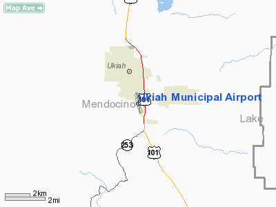
| Ukiah Municipal Airport |
| IATA: UKI – ICAO: KUKI – FAA LID: UKI |
| Summary |
| Airport type |
Public |
| Operator |
City of Ukiah |
| Location |
Ukiah, California |
| Elevation AMSL |
614 ft / 187.1 m |
| Coordinates |
39°07′33″N 123°12′03″W / 39.12583°N 123.20083°W / 39.12583; -123.20083Coordinates: 39°07′33″N 123°12′03″W / 39.12583°N 123.20083°W / 39.12583; -123.20083 |
| Runways |
| Direction |
Length |
Surface |
| ft |
m |
| 15/33 |
4,415 |
1,346 |
Asphalt |
Ukiah Municipal Airport (IATA: UKI, ICAO: KUKI, FAA LID: UKI) is a public airport located one mile (1.6 km) south of Ukiah, serving Mendocino County, California, USA. This general aviation airport covers 160 acres (65 ha) and has one runway.
The above content comes from Wikipedia and is published under free licenses – click here to read more.
Location
& QuickFacts
|
FAA
Information Effective: |
2006-09-28 |
|
Airport
Identifier: |
UKI |
|
Longitude/Latitude: |
123-12-03.0780W/39-07-33.4460N
-123.200855/39.125957 (Estimated) |
|
Elevation: |
614 ft / 187.15 m (Surveyed) |
|
Land: |
160 acres |
|
From
nearest city: |
1 nautical miles S of Ukiah, CA |
|
Location: |
Mendocino County, CA |
|
Magnetic Variation: |
17E (1985) |
Owner
& Manager
|
Ownership: |
Publicly owned |
|
Owner: |
City Of Ukiah |
|
Address: |
300 Seminary Av
Ukiah, CA 95482 |
|
Phone
number: |
707-467-2817 |
|
Manager: |
Paul L Richey |
|
Address: |
1403 S. State Street
Ukiah, CA 95482 |
|
Phone number: |
707-467-2855 |
Airport
Operations and Facilities
|
Airport
Use: |
Open to public |
|
Wind
indicator: |
Yes |
|
Segmented
Circle: |
Yes |
|
Control
Tower: |
No |
|
Attendance
Schedule: |
ALL/ALL/0800-DUSK |
|
Lighting
Schedule: |
DUSK-DAWN
ACTVT MIRL RY 15/33; REIL & VASI RY 15; REIL RY 33 -
CTAF. |
|
Beacon
Color: |
Clear-Green (lighted land airport)
SECOND ROTATING BCN ON MTN 250 DEGREES MAGNETIC & 2
MILES FM ARPT. |
|
Landing
fee charge: |
Yes
LNDG FEE FOR ALL ACFT OVR 12500 LBS. |
|
Sectional
chart: |
San Francisco |
|
Region: |
AWP - Western-Pacific |
|
Traffic
Pattern Alt: |
1000 ft |
|
Boundary
ARTCC: |
ZOA - Oakland |
|
Tie-in
FSS: |
OAK - Oakland |
|
FSS
on Airport: |
No |
|
FSS
Phone: |
510-273-6111 |
|
FSS
Toll Free: |
1-800-WX-BRIEF |
|
NOTAMs
Facility: |
UKI (NOTAM-d service avaliable) |
|
Federal Agreements: |
NGY |
Airport
Communications
|
CTAF: |
123.000 |
|
Unicom: |
123.000 |
Airport
Services
|
Fuel
available: |
100LLA |
|
Airframe
Repair: |
MAJOR |
|
Power
Plant Repair: |
MAJOR |
|
Bottled
Oxygen: |
NONE |
|
Bulk
Oxygen: |
HIGH |
|
Runway Information
Runway 15/33
|
Dimension: |
4415 x 150 ft / 1345.7 x 45.7 m |
|
Surface: |
ASPH, Good Condition |
|
Weight
Limit: |
Single wheel: 28000 lbs. |
|
Edge
Lights: |
Medium |
|
|
Runway 15 |
Runway 33 |
|
Longitude: |
123-12-08.7450W |
123-11-57.4130W |
|
Latitude: |
39-07-54.8110N |
39-07-12.0800N |
|
Elevation: |
614.00 ft |
602.00 ft |
|
Alignment: |
127 |
127 |
|
ILS
Type: |
LOC/DME |
|
|
Traffic
Pattern: |
Left |
Right |
|
Markings: |
Non-precision instrument, Fair Condition |
Non-precision instrument, Fair Condition |
|
Crossing
Height: |
27.00 ft |
0.00
ft |
|
VASI: |
4-box on left side |
|
|
Visual
Glide Angle: |
3.00� |
0.00� |
|
Runway
End Identifier: |
Yes
RY 15 REIL OTS INDEFLY. |
Yes
RY 33 REIL OTS INDEFLY. |
|
Centerline
Lights: |
No |
No |
|
Touchdown
Lights: |
No |
No |
|
Obstruction: |
27 ft trees, 950.0 ft from runway, 190 ft right
of centerline, 27:1 slope to clear |
27 ft trees, 700.0 ft from runway, 135 ft left
of centerline, 18:1 slope to clear |
|
Radio Navigation
Aids
|
ID |
Type |
Name |
Ch |
Freq |
Var |
Dist |
|
LOP |
NDB |
Lampson |
|
217.00 |
16E |
16.8 nm |
|
STS |
VOR/DME |
Santa Rosa |
077X |
113.00 |
16E |
41.4 nm |
|
ENI |
VORTAC |
Mendocino |
070X |
112.30 |
16E |
5.6 nm |
|
MXW |
VORTAC |
Maxwell |
037X |
110.00 |
18E |
47.0 nm |
Remarks
-
< 2200-0700 BETWEEN DEPARTURES ACFT JET>
-
<
ABATEMENT NOISE FOR 15 IS RWY WIND>
-
NOISE ABATEMENT
PROCEDURES: AMGR REQUESTS NO VFR STRAIGHT-IN APCHS TO RY 15/33, RIGHT
TURN AFTER DEP RY 33 TO AVOID OVERFLIGHT OF TOWN.
Based Aircraft
|
Aircraft
based on field: |
95 |
|
Single
Engine Airplanes: |
81 |
|
Multi
Engine Airplanes: |
8 |
|
Helicopters: |
2 |
|
Gliders: |
1 |
|
Ultralights: |
3 |
Operational Statistics
|
Aircraft
Operations: |
119/Day |
|
Air Taxi: |
6.9% |
|
General
Aviation Local: |
34.6% |
|
General
Aviation Itinerant: |
57.7% |
|
Military: |
0.7% |
Ukiah Municipal Airport
Address:
Mendocino County, CA
Tel:
707-467-2817,
707-467-2855
Images
and information placed above are from
http://www.airport-data.com/airport/UKI/
We
thank them for the data!
| General
Info |
| Country |
United
States |
| State |
CALIFORNIA
|
| FAA ID |
UKI
|
| Latitude |
39-07-33.446N
|
| Longitude |
123-12-03.078W
|
| Elevation |
614 feet
|
| Near City |
UKIAH
|
We don't guarantee the information is fresh and accurate. The data may
be wrong or outdated.
For more up-to-date information please refer to other sources.
|
|


