|
|
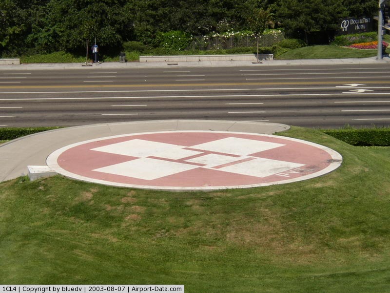
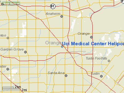
Uci Medical Center Heliport |
|
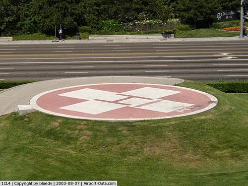 |
(Click on the photo to enlarge) |
Location
& QuickFacts
|
FAA
Information Effective: |
2006-09-28 |
|
Airport
Identifier: |
1CL4 |
|
Longitude/Latitude: |
117-53-25.7050W/33-47-19.5590N
-117.890474/33.788766 (Estimated) |
|
Elevation: |
140 ft / 42.67 m (Estimated) |
|
Land: |
0 acres |
|
From
nearest city: |
0 nautical miles N of Orange, CA |
|
Location: |
Orange County, CA |
|
Magnetic Variation: |
14E (1990) |
Owner
& Manager
|
Ownership: |
Privately owned |
|
Owner: |
Regents Of The Univ Of Cal |
|
Address: |
300 Lakeside Dr.
Oakland, CA 947612-3550 |
|
Phone
number: |
415-987-9220 |
|
Manager: |
Alexander Mcquilkin |
|
Address: |
101 The City Drive South
Orange, CA 92668 |
|
Phone number: |
714-634-6421 |
Airport
Operations and Facilities
|
Airport
Use: |
Private
MEDICAL USE |
|
Wind
indicator: |
Yes |
|
Segmented
Circle: |
No |
|
Control
Tower: |
No |
|
Attendance
Schedule: |
ALL/ALL/ALL |
|
Lighting
Schedule: |
DUSK-DAWN |
|
Sectional
chart: |
Los Angeles |
|
Region: |
AWP - Western-Pacific |
|
Boundary
ARTCC: |
ZLA - Los Angeles |
|
Tie-in
FSS: |
RAL - Riverside |
|
FSS
Phone: |
951-351-3020 |
|
FSS
Toll Free: |
1-800-WX-BRIEF |
|
Runway Information
Helipad H1
|
Dimension: |
40 x 40 ft / 12.2 x 12.2 m |
|
Surface: |
CONC, |
|
|
Runway H1 |
Runway |
|
Traffic
Pattern: |
Left |
Left |
|
Radio Navigation
Aids
|
ID |
Type |
Name |
Ch |
Freq |
Var |
Dist |
|
CPM |
NDB |
Compton |
|
378.00 |
15E |
18.8 nm |
|
EMT |
NDB |
El Monte |
|
359.00 |
15E |
19.3 nm |
|
SB |
NDB |
Petis |
|
397.00 |
14E |
30.7 nm |
|
PAI |
NDB |
Pacoima |
|
370.00 |
15E |
38.5 nm |
|
SJY |
NDB |
San Jacinto |
|
227.00 |
14E |
44.5 nm |
|
RIV |
TACAN |
March |
077X |
|
14E |
31.6 nm |
|
NFG |
TACAN |
Camp Pendleton |
055X |
|
13E |
39.9 nm |
|
RAL |
VOR |
Riverside |
|
112.40 |
15E |
24.1 nm |
|
HDF |
VOR |
Homeland |
|
113.40 |
14E |
35.2 nm |
|
ELB |
VOR/DME |
El Toro |
119X |
117.20 |
14E |
10.5 nm |
|
SMO |
VOR/DME |
Santa Monica |
045X |
110.80 |
15E |
31.2 nm |
|
VNY |
VOR/DME |
Van Nuys |
078X |
113.10 |
15E |
39.8 nm |
|
SLI |
VORTAC |
Seal Beach |
104X |
115.70 |
15E |
8.2 nm |
|
POM |
VORTAC |
Pomona |
041X |
110.40 |
15E |
18.2 nm |
|
PDZ |
VORTAC |
Paradise |
059X |
112.20 |
15E |
19.6 nm |
|
LAX |
VORTAC |
Los Angeles |
083X |
113.60 |
15E |
28.4 nm |
|
SXC |
VORTAC |
Santa Catalina |
051X |
111.40 |
15E |
36.3 nm |
|
OCN |
VORTAC |
Oceanside |
100X |
115.30 |
15E |
40.6 nm |
|
SNA |
VOT |
Santa Ana |
|
110.00 |
|
6.8 nm |
|
LAX |
VOT |
San Pedro Hill |
|
113.90 |
|
22.4 nm |
Remarks
-
RY H1 ELEVATED
6 FT ABOVE GRADE.
Uci Medical Center Heliport
Address:
Orange County, CA
Tel:
415-987-9220,
714-634-6421
Images
and information placed above are from
http://www.airport-data.com/airport/1CL4/
We
thank them for the data!
| General
Info |
| Country |
United
States |
| State |
CALIFORNIA
|
| FAA ID |
1CL4
|
| Latitude |
33-47-19.559N
|
| Longitude |
117-53-25.705W
|
| Elevation |
140 feet
|
| Near City |
ORANGE
|
We don't guarantee the information is fresh and accurate. The data may
be wrong or outdated.
For more up-to-date information please refer to other sources.
|
|