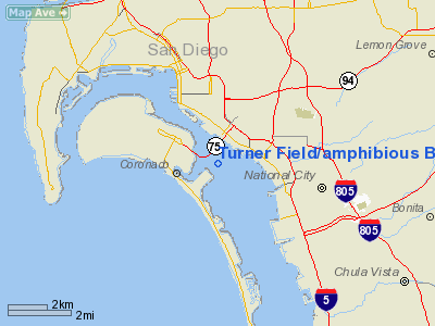
Turner Field - Amphibious Base Heliport |
Location
& QuickFacts
|
FAA
Information Effective: |
2006-09-28 |
|
Airport
Identifier: |
CL16 |
|
Longitude/Latitude: |
117-09-03.1160W/32-41-00.1880N
-117.150866/32.683386 (Estimated) |
|
Elevation: |
0 ft / 0.00 m (Estimated) |
|
Land: |
0 acres |
|
From
nearest city: |
3 nautical miles SE of Coronado, CA |
|
Location: |
San Diego County, CA |
|
Magnetic Variation: |
14E (1985) |
Owner
& Manager
|
Ownership: |
Army owned |
|
Owner: |
Naval Amphibious Bas Coronado |
|
Address: |
|
|
Phone number: |
619-437-2505 |
|
Address: |
|
Airport
Operations and Facilities
|
Airport
Use: |
Private |
|
Segmented
Circle: |
No |
|
Control
Tower: |
No |
|
Attendance
Schedule: |
ALL/ALL/DALGT |
|
Sectional
chart: |
Los Angeles |
|
Region: |
AWP - Western-Pacific |
|
Boundary
ARTCC: |
ZLA - Los Angeles |
|
Tie-in
FSS: |
SAN - San Diego |
|
FSS
Phone: |
858-277-7043 |
|
FSS
Toll Free: |
1-800-WX-BRIEF |
|
Runway Information
Helipad H1
|
Dimension: |
100 x 100 ft / 30.5 x 30.5 m |
|
Surface: |
ASPH, |
|
|
Runway H1 |
Runway |
|
Traffic
Pattern: |
Left |
Left |
|
Radio Navigation
Aids
|
ID |
Type |
Name |
Ch |
Freq |
Var |
Dist |
|
SAN |
FAN MARKER |
Encat |
|
|
15E |
3.4 nm |
|
UN |
NDB |
Tijuana |
|
381.00 |
14E |
10.8 nm |
|
NZY |
TACAN |
North Island |
117X |
|
14E |
3.5 nm |
|
NRS |
TACAN |
Imperial Beach |
029X |
|
14E |
7.5 nm |
|
NKX |
TACAN |
Miramar |
033X |
|
15E |
11.2 nm |
|
NFG |
TACAN |
Camp Pendleton |
055X |
|
13E |
37.5 nm |
|
NKX |
UHF/NDB |
Miramar |
|
352.00 |
15E |
11.5 nm |
|
TIJ |
VOR/DME |
Tijuana |
112X |
116.50 |
14E |
13.2 nm |
|
MZB |
VORTAC |
Mission Bay |
125X |
117.80 |
15E |
7.0 nm |
|
PGY |
VORTAC |
Poggi |
035X |
109.80 |
14E |
9.7 nm |
|
OCN |
VORTAC |
Oceanside |
100X |
115.30 |
15E |
36.1 nm |
|
JLI |
VORTAC |
Julian |
087X |
114.00 |
15E |
39.6 nm |
|
SAN |
VOT |
Mount Soledad |
|
109.00 |
|
10.7 nm |
|
SEE |
VOT |
Gillespie Field |
|
110.00 |
|
12.3 nm |
Remarks
-
ADVC NORTH
ISLAND ATCT PPR NUMBER AND IF ETA VARIES MORE THAN 15 MIN.
-
OPN DALGT HOURS.
-
LNDG/TKOF
CLNC BY STD LGT GUN SIGNALS.
Turner Field/amphibious Base Heliport
Address:
San Diego County, CA
Tel:
619-437-2505
Images
and information placed above are from
http://www.airport-data.com/airport/CL16/
We
thank them for the data!
| General
Info |
| Country |
United
States |
| State |
CALIFORNIA
|
| FAA ID |
CL16
|
| Latitude |
32-41-00.188N
|
| Longitude |
117-09-03.116W
|
| Elevation |
0 feet
|
| Near City |
CORONADO
|
We don't guarantee the information is fresh and accurate. The data may
be wrong or outdated.
For more up-to-date information please refer to other sources.
|


