 |
|
Turlock Municipal Airport |
| Turlock Municipal Airport |
| IATA: none – ICAO: none – FAA LID: O15 |
| Summary |
| Airport type |
Public |
| Operator |
City of Turlock |
| Location |
Turlock, California |
| Elevation AMSL |
159 ft / 48.5 m |
| Coordinates |
37°29′15″N 120°41′49″W / 37.4875°N 120.69694°W / 37.4875; -120.69694Coordinates: 37°29′15″N 120°41′49″W / 37.4875°N 120.69694°W / 37.4875; -120.69694 |
| Runways |
| Direction |
Length |
Surface |
| ft |
m |
| 12/30 |
2,985 |
910 |
Asphalt |
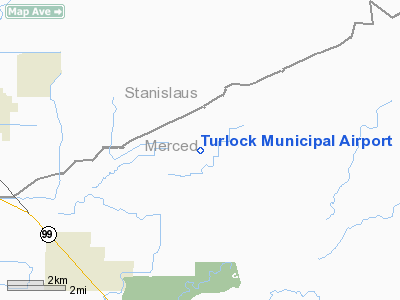
Turlock Municipal Airport (FAA LID: O15) is a public airport located eight miles (13 km) east of Turlock, serving Stanislaus County, California, USA. This general aviation airport covers 320 acres (129 ha) and has one runway.
The above content comes from Wikipedia and is published under free licenses – click here to read more.
Location
& QuickFacts
|
FAA
Information Effective: |
2006-09-28 |
|
Airport
Identifier: |
O15 |
|
Longitude/Latitude: |
120-41-48.7210W/37-29-14.7680N
-120.696867/37.487436 (Estimated) |
|
Elevation: |
159 ft / 48.46 m (Estimated) |
|
Land: |
320 acres |
|
From
nearest city: |
8 nautical miles E of Turlock, CA |
|
Location: |
Merced County, CA |
|
Magnetic Variation: |
16E (1985) |
Owner
& Manager
|
Ownership: |
Publicly owned |
|
Owner: |
City Of Turlock |
|
Address: |
156 S. Broadway
Turlock, CA 95380 |
|
Phone
number: |
209-668-5580 |
|
Manager: |
George Williams
ON SITE MGR: OTIS MERCER. |
|
Address: |
156 S. Broadway
Turlock, CA 95380 |
|
Phone number: |
209-632-3244
PUBLIC TELEPHONE AT ARPT (209) 632-3244. |
Airport
Operations and Facilities
|
Airport
Use: |
Open to public |
|
Wind
indicator: |
Yes |
|
Segmented
Circle: |
Yes |
|
Control
Tower: |
No |
|
Attendance
Schedule: |
ALL/ALL/ALL |
|
Lighting
Schedule: |
DUSK-DAWN
ACTVT LIRL RY 12/30 - CTAF. |
|
Beacon
Color: |
Clear-Green (lighted land airport) |
|
Landing
fee charge: |
No |
|
Sectional
chart: |
San Francisco |
|
Region: |
AWP - Western-Pacific |
|
Traffic
Pattern Alt: |
800 ft |
|
Boundary
ARTCC: |
ZOA - Oakland |
|
Tie-in
FSS: |
RIU - Rancho Murieta |
|
FSS
on Airport: |
No |
|
FSS
Phone: |
916-354-0161 |
|
FSS
Toll Free: |
1-800-WX-BRIEF |
|
NOTAMs
Facility: |
RIU (NOTAM-d service avaliable) |
|
Federal Agreements: |
NR |
Airport
Communications
|
CTAF: |
122.800 |
|
Unicom: |
122.800 |
Airport
Services
|
Fuel
available: |
100LL
FUEL AVBL 24 HRS CALL 209-632-3244 |
|
Airframe
Repair: |
MAJOR |
|
Power
Plant Repair: |
MAJOR |
|
Bottled
Oxygen: |
NONE |
|
Bulk
Oxygen: |
NONE |
|
Runway Information
Runway 12/30
|
Dimension: |
2985 x 50 ft / 909.8 x 15.2 m |
|
Surface: |
ASPH, Good Condition |
|
Weight
Limit: |
Single wheel: 12000 lbs. |
|
Edge
Lights: |
Non-standard
lighting system
NSTD LIRL; LGTS 20 FT FM EDGE OF RY. |
|
|
Runway 12 |
Runway 30 |
|
Elevation: |
159.00 ft |
159.00 ft |
|
Traffic
Pattern: |
Left |
Left |
|
Markings: |
Basic, Fair Condition |
Basic, Fair Condition |
|
Runway
End Identifier: |
|
No |
|
Centerline
Lights: |
No |
No |
|
Touchdown
Lights: |
No |
No |
|
Obstruction: |
30 ft pole, 800.0 ft from runway, 160 ft right
of centerline, 20:1 slope to clear |
3 ft berm, 200.0 ft from runway, 40 ft left
of centerline
+1 FT BERM 160-200 FT FM END OF RY & 40-125 FT L. |
|
Radio Navigation
Aids
|
ID |
Type |
Name |
Ch |
Freq |
Var |
Dist |
|
TCY |
NDB |
Tracy |
|
203.00 |
15E |
37.7 nm |
|
LV |
NDB |
Reiga |
|
374.00 |
16E |
48.6 nm |
|
MOD |
VOR/DME |
Modesto |
093X |
114.60 |
17E |
15.0 nm |
|
HYP |
VOR/DME |
El Nido |
089X |
114.20 |
15E |
21.5 nm |
|
ECA |
VORTAC |
Manteca |
107X |
116.00 |
17E |
30.7 nm |
|
LIN |
VORTAC |
Linden |
095X |
114.80 |
17E |
38.2 nm |
|
PXN |
VORTAC |
Panoche |
073X |
112.60 |
16E |
46.6 nm |
Remarks
-
ESTABD PRIOR TO 15 MAY
1959.
Based Aircraft
|
Aircraft
based on field: |
64 |
|
Single
Engine Airplanes: |
62 |
|
Multi
Engine Airplanes: |
2 |
Operational Statistics
|
Aircraft
Operations: |
200/Week |
|
General
Aviation Local: |
78.8% |
|
General
Aviation Itinerant: |
21.2% |
Turlock Municipal Airport
Address:
Merced County, CA
Tel:
209-668-5580,
209-632-3244
Images
and information placed above are from
http://www.airport-data.com/airport/O15/
We
thank them for the data!
| General
Info |
| Country |
United
States |
| State |
CALIFORNIA
|
| FAA ID |
O15
|
| Latitude |
37-29-14.768N
|
| Longitude |
120-41-48.721W
|
| Elevation |
159 feet
|
| Near City |
TURLOCK
|
We don't guarantee the information is fresh and accurate. The data may
be wrong or outdated.
For more up-to-date information please refer to other sources.
|
|


