 |
|
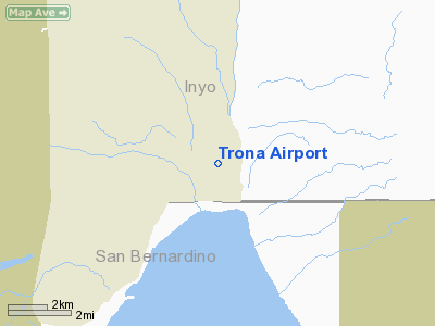
| Trona Airport |
| IATA: TRH – ICAO: none – FAA LID: L72 |
| Summary |
| Airport type |
Public |
| Owner |
US Dept of the Interior, Bureau of Land Management |
| Serves |
Trona, California |
| Elevation AMSL |
1,716 ft / 523 m |
| Coordinates |
35°48′44.832″N 117°19′38.2020″W / 35.81245333°N 117.32727833°W / 35.81245333; -117.32727833 |
| Runways |
| Direction |
Length |
Surface |
| ft |
m |
| 17/35 |
5,930 |
1,807 |
Asphalt |
| Helipads |
| Number |
Length |
Surface |
| ft |
m |
| H1 |
52 |
16 |
Asphalt |
| Statistics (2009) |
| Aircraft operations |
7,002 |
| Based aircraft |
18 |
| Source: Federal Aviation Administration |
Trona Airport is a public use airport in Inyo County, California, United States. It is owned by the United States Department of the Interior, Bureau of Land Management and is located four nautical miles (7.41 km) north of the central business district of Trona, California. Although most U.S. airports use the same three-letter location identifier for the FAA and IATA, this airport is assigned L72 by the FAA but has the designation TRH from the IATA
Facilities and aircraft
Trona Airport covers an area of 150 acres (61 ha) at an elevation of 1,716 feet (523 m) above mean sea level. It has one runway designated 17/35 with an asphalt surface measuring 5,930 by 60 feet (1,807 x 18 m) and one asphalt helipad measuring 52 by 52 feet (16 x 16 m), located 230 feet (70 m) west of runway 17/35 and 3,380 feet (1,030 m) south of runway 17 threshold.
For the 12-month period ending March 10, 2009, the airport had 7,002 aircraft operations, an average of 19 per day: 100% general aviation with a few ultralights. At that time there were 18 aircraft based at this airport: 82% single-engine, 6% multi-engine and 12% ultralight.
The above content comes from Wikipedia and is published under free licenses – click here to read more.
Location
& QuickFacts
|
FAA
Information Effective: |
2006-09-28 |
|
Airport
Identifier: |
L72 |
|
Longitude/Latitude: |
117-19-38.2020W/35-48-44.8320N
-117.327278/35.812453 (Estimated) |
|
Elevation: |
1716 ft / 523.04 m (Estimated) |
|
Land: |
150 acres |
|
From
nearest city: |
4 nautical miles N of Trona, CA |
|
Location: |
Inyo County, CA |
|
Magnetic Variation: |
14E (1985) |
Owner
& Manager
|
Ownership: |
Publicly owned |
|
Owner: |
Us Dept Of Interior, Blm
BUREAU OF LAND MGMT; SEARLES VALLEY COMMUNITY SERVICE COUNCIL
- P.O. BOX 443 - TRONA - CA - 93592. |
|
Address: |
300 N. Richmond
Ridgecrest, CA 93555 |
|
Phone
number: |
760-375-7125 |
|
Manager: |
Andrew A. Ledesma
BUREAU OF LAND MGT AWARDED SEARLES VALLEY COMMUNITY SERVICES
COUNCIL (SVCSC) RESPONSIBILITY TO OPERATE AND MAINTAIN TRONA
AIRPORT (L72). AMGR ALTERNATE: DENISE SCHOFIELD, PRESIDENT,
SEARLES VALLEY COMMUNITY SERVICES COUNCIL, PHONE (760) 372-5640,
FAX: (760) 372-5610. |
|
Address: |
13877 Pine Street
Trona, CA 93562 |
|
Phone number: |
760-372-4531 |
Airport
Operations and Facilities
|
Airport
Use: |
Open to public |
|
Wind
indicator: |
Yes |
|
Segmented
Circle: |
Yes |
|
Control
Tower: |
No |
|
Attendance
Schedule: |
IREG |
|
Lighting
Schedule: |
DUSK-DAWN
ACTVT LIRL RY 17/35 (5) CLICKS ON FREQ - 122.8. |
|
Beacon
Color: |
Clear-Green (lighted land airport) |
|
Landing
fee charge: |
No |
|
Sectional
chart: |
Las Vegas |
|
Region: |
AWP - Western-Pacific |
|
Traffic
Pattern Alt: |
1000 ft |
|
Boundary
ARTCC: |
ZLA - Los Angeles |
|
Tie-in
FSS: |
RAL - Riverside |
|
FSS
on Airport: |
No |
|
FSS
Phone: |
951-351-3020 |
|
FSS
Toll Free: |
1-800-WX-BRIEF |
|
NOTAMs
Facility: |
RAL (NOTAM-d service avaliable) |
|
Federal Agreements: |
N |
Airport
Communications
Airport
Services
|
Airframe
Repair: |
MAJOR |
|
Power
Plant Repair: |
MAJOR |
|
Bottled
Oxygen: |
NONE |
|
Bulk
Oxygen: |
NONE |
|
Runway Information
Runway 17/35
|
Dimension: |
5930 x 60 ft / 1807.5 x 18.3 m |
|
Surface: |
ASPH, Fair Condition |
|
Edge
Lights: |
Non-standard lighting system
NSTD LIRL EDGE LIGHTS 55 FT FM EDGES OF RY. |
|
|
Runway 17 |
Runway 35 |
|
Elevation: |
1716.00 ft |
1608.00 ft |
|
Traffic
Pattern: |
Left |
Left |
|
Markings: |
Basic, Good Condition |
Basic, Good Condition |
|
Runway
End Identifier: |
No |
No |
|
Centerline
Lights: |
No |
No |
|
Touchdown
Lights: |
No |
No |
|
Obstruction: |
7 ft fence, 346.0 ft from runway, 20:1 slope
to clear |
, 50:1 slope to clear |
|
Helipad H1
|
Dimension: |
52 x 52 ft / 15.8 x 15.8 m |
|
Surface: |
ASPH, Good Condition |
|
|
Runway H1 |
Runway |
|
Traffic
Pattern: |
Left |
Left |
|
Radio Navigation
Aids
|
ID |
Type |
Name |
Ch |
Freq |
Var |
Dist |
|
NID |
TACAN |
China Lake |
053X |
|
16E |
19.2 nm |
Remarks
- HELIPAD
H1 IS LOCATED 230 FEET WEST OF RY 17/35 AND 3,380 FT SOUTH OF RY 17
THLD.
- ESTABD
PRIOR TO 5/15/59.
Based Aircraft
|
Aircraft
based on field: |
18 |
|
Single
Engine Airplanes: |
15 |
|
Multi
Engine Airplanes: |
1 |
|
Ultralights: |
2 |
Operational Statistics
|
Aircraft
Operations: |
135/Week |
|
General
Aviation Local: |
28.6% |
|
General
Aviation Itinerant: |
71.4% |
Trona Airport
Address:
Inyo County, CA
Tel:
760-375-7125,
760-372-4531
Images
and information placed above are from
http://www.airport-data.com/airport/L72/
We
thank them for the data!
| General
Info |
| Country |
United
States |
| State |
CALIFORNIA
|
| FAA ID |
L72
|
| Latitude |
35-48-44.832N
|
| Longitude |
117-19-38.202W
|
| Elevation |
1716 feet
|
| Near City |
TRONA
|
We don't guarantee the information is fresh and accurate. The data may
be wrong or outdated.
For more up-to-date information please refer to other sources.
|
|


