 |
|
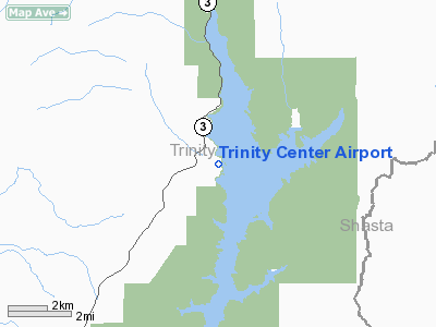
| Trinity Center Airport |
| IATA: none – ICAO: none – FAA LID: O86 |
| Summary |
| Airport type |
Public |
| Operator |
Trinity County |
| Location |
Trinity Center, California |
| Elevation AMSL |
2,390 ft / 728.5 m |
| Coordinates |
40°59′0″N 122°41′39″W / 40.983333°N 122.69417°W / 40.983333; -122.69417Coordinates: 40°59′0″N 122°41′39″W / 40.983333°N 122.69417°W / 40.983333; -122.69417 |
| Runways |
| Direction |
Length |
Surface |
| ft |
m |
| 14/32 |
3,215 |
980 |
Asphalt |
Trinity Center Airport (FAA LID: O86) is a public airport located in Trinity Center, serving Trinity County, California, USA. This general aviation airport covers 55 acres and has one runway.
The above content comes from Wikipedia and is published under free licenses – click here to read more.
Location
& QuickFacts
|
FAA
Information Effective: |
2006-09-28 |
|
Airport
Identifier: |
O86 |
|
Longitude/Latitude: |
122-41-39.0800W/40-58-59.5240N
-122.694189/40.983201 (Estimated) |
|
Elevation: |
2390 ft / 728.47 m (Surveyed) |
|
Land: |
55 acres |
|
From
nearest city: |
0 nautical miles E of Trinity Center, CA |
|
Location: |
Trinity County, CA |
|
Magnetic Variation: |
17E (1985) |
Owner
& Manager
|
Ownership: |
Publicly owned |
|
Owner: |
Trinity County |
|
Address: |
Po Box 476
Weaverville, CA 96093-0476 |
|
Phone number: |
916-623-9585 |
|
Manager: |
Wyatt Paxton |
|
Address: |
Po Box 476
Weaverville, CA 96093-0476 |
|
Phone number: |
916-623-1354 |
Airport
Operations and Facilities
|
Airport
Use: |
Open to public |
|
Wind
indicator: |
Yes |
|
Segmented
Circle: |
Yes |
|
Control
Tower: |
No |
|
Attendance
Schedule: |
UNATNDD |
|
Landing
fee charge: |
No |
|
Sectional
chart: |
Klamath Falls |
|
Region: |
AWP - Western-Pacific |
|
Traffic
Pattern Alt: |
800 ft |
|
Boundary
ARTCC: |
ZOA - Oakland |
|
Tie-in
FSS: |
RIU - Rancho Murieta |
|
FSS
on Airport: |
No |
|
FSS
Phone: |
916-354-0161 |
|
FSS
Toll Free: |
1-800-WX-BRIEF |
|
NOTAMs
Facility: |
RIU (NOTAM-d service avaliable) |
|
Federal Agreements: |
N1 |
Airport
Communications
|
Runway Information
Runway 14/32
|
Dimension: |
3215 x 50 ft / 979.9 x 15.2 m |
|
Surface: |
ASPH, Good Condition |
|
Weight
Limit: |
Single wheel: 10000 lbs. |
|
|
Runway 14 |
Runway 32 |
|
Traffic
Pattern: |
Left |
Right |
|
Markings: |
Basic, Good Condition |
Basic, Good Condition |
|
Displaced
threshold: |
200.00 ft |
200.00 ft |
|
Runway
End Identifier: |
No |
No |
|
Touchdown
Lights: |
No |
No |
|
Obstruction: |
100 ft trees, 1800.0 ft from runway, 16:1 slope
to clear
APCH RATIO 20:1 FM DSPLCD THLD.
+10
FT PVT DIRT ROAD 50' FM END OF RY. |
, 50:1 slope to clear |
|
Radio Navigation
Aids
|
ID |
Type |
Name |
Ch |
Freq |
Var |
Dist |
|
MOG |
NDB |
Montague |
|
404.00 |
19E |
45.7 nm |
|
FJS |
VOR/DME |
Fort Jones |
033X |
109.60 |
19E |
28.5 nm |
|
RDD |
VOR/DME |
Redding |
021X |
108.40 |
18E |
34.1 nm |
Based Aircraft
|
Aircraft
based on field: |
31 |
|
Single
Engine Airplanes: |
30 |
|
Multi
Engine Airplanes: |
1 |
Operational Statistics
|
Aircraft
Operations: |
47/Day |
|
General
Aviation Local: |
35.3% |
|
General
Aviation Itinerant: |
64.7% |
Trinity Center Airport
Address:
Trinity County, CA
Tel:
916-623-9585, 916-623-1354
Images
and information placed above are from
http://www.airport-data.com/airport/O86/
We
thank them for the data!
| General
Info |
| Country |
United
States |
| State |
CALIFORNIA
|
| FAA ID |
O86
|
| Latitude |
40-58-59.524N
|
| Longitude |
122-41-39.080W
|
| Elevation |
2390 feet
|
| Near City |
TRINITY
CENTER |
We don't guarantee the information is fresh and accurate. The data may
be wrong or outdated.
For more up-to-date information please refer to other sources.
|
|


