 |
|
Location
& QuickFacts
|
FAA
Information Effective: |
2006-09-28 |
|
Airport
Identifier: |
66CL |
|
Longitude/Latitude: |
120-27-52.6410W/36-59-54.8060N
-120.464623/36.998557 (Estimated) |
|
Elevation: |
130 ft / 39.62 m (Estimated) |
|
Land: |
0 acres |
|
From
nearest city: |
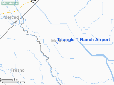
14 nautical miles SW of Chowchilla, CA |
|
Location: |
Madera County, CA |
|
Magnetic Variation: |
15E (1985) |
Owner
& Manager
|
Ownership: |
Privately owned |
|
Address: |
|
|
Manager: |
J. E. Wickersham |
|
Address: |
4408 Hays Drive
Chowchilla, CA 93610 |
|
Phone number: |
209-665-2964 |
Airport
Operations and Facilities
|
Airport Use: |
Private |
|
Wind indicator: |
Yes |
|
Segmented Circle: |
No |
|
Control Tower: |
No |
|
Attendance Schedule: |
UNATNDD |
|
Landing fee charge: |
No |
|
Sectional chart: |
San Francisco |
|
Region: |
AWP - Western-Pacific |
|
Boundary ARTCC: |
ZOA - Oakland |
|
Tie-in FSS: |
RIU - Rancho Murieta |
|
FSS on Airport: |
No |
|
FSS Phone: |
916-354-0161 |
|
FSS Toll Free: |
1-800-WX-BRIEF |
Airport
Services
|
Airframe
Repair: |
NONE |
|
Power
Plant Repair: |
NONE |
|
Runway
Information
Runway NW/SE
|
Dimension: |
2200 x 100 ft / 670.6 x 30.5 m |
|
Surface: |
DIRT, |
|
|
Runway NW |
Runway SE |
|
Traffic
Pattern: |
Left |
Left |
|
Radio Navigation
Aids
|
ID |
Type |
Name |
Ch |
Freq |
Var |
Dist |
|
FCH |
NDB |
Chandler |
|
344.00 |
15E |
34.5 nm |
|
CUK |
NDB |
Academy |
|
266.00 |
14E |
43.0 nm |
|
NLC |
TACAN |
Lemoore |
080X |
|
16E |
46.1 nm |
|
HYP |
VOR/DME |
El Nido |
089X |
114.20 |
15E |
13.6 nm |
|
MOD |
VOR/DME |
Modesto |
093X |
114.60 |
17E |
44.5 nm |
|
PXN |
VORTAC |
Panoche |
073X |
112.60 |
16E |
22.8 nm |
|
CZQ |
VORTAC |
Clovis |
076X |
112.90 |
15E |
31.9 nm |
|
FRA |
VORTAC |
Friant |
103X |
115.60 |
17E |
42.2 nm |
Remarks
- FEEDLOT
& FEEDMILL WITH 100' ELEVATOR NEAR RWY.
- 19
NM S OF MERCED MUNI ARPT.
Triangle T Ranch Airport
Address:
Madera County, CA
Tel:
209-665-2964
Images
and information placed above are from
http://www.airport-data.com/airport/66CL/
We
thank them for the data!
| General
Info |
| Country |
United
States |
| State |
CALIFORNIA
|
| FAA ID |
66CL
|
| Latitude |
36-59-54.806N
|
| Longitude |
120-27-52.641W
|
| Elevation |
130 feet
|
| Near City |
CHOWCHILLA
|
We don't guarantee the information is fresh and accurate. The data may
be wrong or outdated.
For more up-to-date information please refer to other sources.
|
|


