 |
|
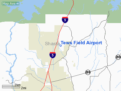
Location
& QuickFacts
|
FAA
Information Effective: |
2006-09-28 |
|
Airport
Identifier: |
CA53 |
|
Longitude/Latitude: |
122-20-30.0000W/40-40-21.0000N
-122.341667/40.672500 (Estimated) |
|
Elevation: |
740 ft / 225.55 m (Surveyed) |
|
Land: |
40 acres |
|
From
nearest city: |
5 nautical miles NE of Redding, CA |
|
Location: |
Shasta County, CA |
|
Magnetic Variation: |
17E (1990) |
Owner
& Manager
|
Ownership: |
Privately owned |
|
Owner: |
K. Richard Tews |
|
Address: |
1530 Beltline Rd.
Redding, CA 96003 |
|
Phone number: |
916-243-3932 |
|
Manager: |
K. Richard Tews |
|
Address: |
1530 Beltlinr Rd.
Redding, CA 96003 |
|
Phone number: |
916-243-3932 |
Airport
Operations and Facilities
|
Airport
Use: |
Private |
|
Wind
indicator: |
Yes |
|
Segmented
Circle: |
No |
|
Control
Tower: |
No |
|
Attendance
Schedule: |
UNATNDD |
|
Sectional
chart: |
Klamath Falls |
|
Region: |
AWP - Western-Pacific |
|
Boundary
ARTCC: |
ZOA - Oakland |
|
Tie-in
FSS: |
RIU - Rancho Murieta |
|
FSS
on Airport: |
No |
|
FSS
Phone: |
916-354-0161 |
|
FSS
Toll Free: |
1-800-WX-BRIEF |
|
Runway Information
Runway 08/26
|
Dimension: |
1800 x 24 ft / 548.6 x 7.3 m |
|
Surface: |
ASPH, |
|
|
Runway 08 |
Runway 26 |
|
Traffic
Pattern: |
Right |
Left |
|
Radio Navigation
Aids
|
ID |
Type |
Name |
Ch |
Freq |
Var |
Dist |
|
PBT |
NDB |
Proberta |
|
338.00 |
16E |
33.9 nm |
|
RDD |
VOR/DME |
Redding |
021X |
108.40 |
18E |
10.3 nm |
|
RBL |
VORTAC |
Red Bluff |
104X |
115.70 |
18E |
34.8 nm |
Remarks
Based Aircraft
|
Aircraft
based on field: |
7 |
|
Single
Engine Airplanes: |
6 |
|
Helicopters: |
1 |
Tews Field Airport
Address:
Shasta County, CA
Tel:
916-243-3932
Images
and information placed above are from
http://www.airport-data.com/airport/CA53/
We
thank them for the data!
| General
Info |
| Country |
United
States |
| State |
CALIFORNIA
|
| FAA ID |
CA53
|
| Latitude |
40-40-21.000N
|
| Longitude |
122-20-30.000W
|
| Elevation |
740 feet
|
| Near City |
REDDING
|
We don't guarantee the information is fresh and accurate. The data may
be wrong or outdated.
For more up-to-date information please refer to other sources.
|
|


