 |
|
Taft Airport
Taft-Kern County Airport |
| IATA: none – ICAO: none – FAA LID: L17 |
| Summary |
| Airport type |
Public |
| Operator |
County of Kern |
| Location |
Taft, California |
| Elevation AMSL |
875 ft / 266.7 m |
| Coordinates |
35°08′28″N 119°26′28″W / 35.14111°N 119.44111°W / 35.14111; -119.44111Coordinates: 35°08′28″N 119°26′28″W / 35.14111°N 119.44111°W / 35.14111; -119.44111 |
| Runways |
| Direction |
Length |
Surface |
| ft |
m |
| 7/25 |
3,550 |
1,082 |
Asphalt |
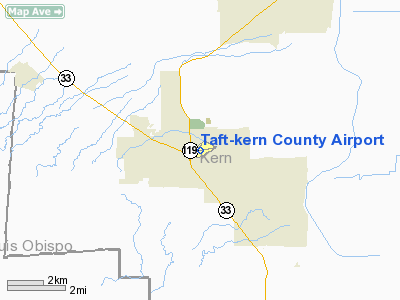
Taft Airport (FAA LID: L17), also known as Taft-Kern County Airport, is a public airport located one mile (1.6 km) east of Taft, serving Kern County, California, USA. This general aviation airport covers 71 acres (290,000 m) and has one runway.
The above content comes from Wikipedia and is published under free licenses – click here to read more.
Location
& QuickFacts
|
FAA
Information Effective: |
2006-09-28 |
|
Airport
Identifier: |
L17 |
|
Longitude/Latitude: |
119-26-28.4260W/35-08-27.8810N
-119.441229/35.141078 (Estimated) |
|
Elevation: |
875 ft / 266.70 m (Surveyed) |
|
Land: |
71 acres |
|
From
nearest city: |
1 nautical miles E of Taft, CA |
|
Location: |
Kern County, CA |
|
Magnetic Variation: |
14E (1985) |
Owner
& Manager
|
Ownership: |
Publicly owned |
|
Owner: |
County Of Kern Dept Of Airports |
|
Address: |
3701 Wings Way, Suite 300
Bakersfield, CA 93308-7026 |
|
Phone
number: |
661-391-1800 |
|
Manager: |
Jack Gotcher
CONTACT JACK GOTCHER, DEPUTY DIRECTOR OF AVIATION (661)391-1800 |
|
Address: |
3701 Wings Way, Suite 300
Bakersfield, CA 93308-7026 |
|
Phone
number: |
661-391-1800
CELL PHONE: (661) 747-4055 24 HRS: (661) 393-3868 FAX: (661)
391-1801 EMAIL: BFLSECURITY@CO.KERN.CA.US |
Airport
Operations and Facilities
|
Airport
Use: |
Open to public |
|
Wind
indicator: |
Yes |
|
Segmented
Circle: |
Yes |
|
Control
Tower: |
No |
|
Attendance
Schedule: |
ALL/SAT-SUN/1000-1600,ALL/MON-FRI/0800-1600 |
|
Lighting
Schedule: |
DUSK-DAWN
MIRL RY 07/25 AND PAPI RY 25 NIGHT USE ONLY ACTVT- CTAF. |
|
Beacon
Color: |
Clear-Green (lighted land airport) |
|
Landing
fee charge: |
No |
|
Sectional
chart: |
Los Angeles |
|
Region: |
AWP - Western-Pacific |
|
Traffic
Pattern Alt: |
800 ft |
|
Boundary
ARTCC: |
ZLA - Los Angeles |
|
Tie-in
FSS: |
RIU - Rancho Murieta |
|
FSS
on Airport: |
No |
|
FSS
Phone: |
916-354-0161 |
|
FSS
Toll Free: |
1-800-WX-BRIEF |
|
NOTAMs
Facility: |
RIU (NOTAM-d service avaliable) |
|
Federal Agreements: |
N |
Airport
Communications
|
CTAF: |
122.800 |
|
Unicom: |
122.800 |
Airport
Services
|
Airframe
Repair: |
MINOR |
|
Power
Plant Repair: |
MINOR |
|
Bottled
Oxygen: |
NONE |
|
Bulk
Oxygen: |
NONE |
|
Runway Information
Runway 07/25
|
Dimension: |
3550 x 60 ft / 1082.0 x 18.3 m |
|
Surface: |
ASPH, Poor Condition |
|
Weight
Limit: |
Single wheel: 4000 lbs. |
|
Edge
Lights: |
Medium |
|
|
Runway 07 |
Runway 25 |
|
Traffic
Pattern: |
Left |
Left |
|
Markings: |
Nonstandard,
MKD WITH X'S NO LDGS TKOF ONLY. |
Basic, Fair Condition |
|
Crossing
Height: |
0.00
ft |
40.00 ft |
|
VASI: |
|
2-light PAPI on left side |
|
Visual
Glide Angle: |
0.00� |
3.00� |
|
Runway
End Identifier: |
No |
No |
|
Centerline
Lights: |
No |
No |
|
Touchdown
Lights: |
No |
No |
|
Obstruction: |
25 ft pole, 385.0 ft from runway, 100 ft left
of centerline, 7:1 slope to clear |
, 50:1 slope to clear
RY 25 +4 FT BRUSH 150 FT FM EOR 50 FT RIGHT. |
|
Radio Navigation
Aids
|
ID |
Type |
Name |
Ch |
Freq |
Var |
Dist |
|
FLW |
VORTAC |
Fellows |
122X |
117.50 |
16E |
21.1 nm |
|
EHF |
VORTAC |
Shafter |
101X |
115.40 |
14E |
26.7 nm |
|
GMN |
VORTAC |
Gorman |
108X |
116.10 |
16E |
35.0 nm |
|
AVE |
VORTAC |
Avenal |
118X |
117.10 |
16E |
40.2 nm |
|
RZS |
VORTAC |
San Marcus |
096X |
114.90 |
14E |
41.3 nm |
|
GVO |
VORTAC |
Gaviota |
085X |
113.80 |
16E |
48.7 nm |
|
BFL |
VOT |
Bakersfield |
|
111.20 |
|
25.8 nm |
Remarks
- RY
25 STEEP UPHILL GRADE (2.2%).
- PART
77 OBSTNS-HANGARS, BCN, LGT POLE, FENCE & SIGN WEST OF RY 3 APCH
END.
- BE
ALERT TO LGTD CRANES WITHIN 5 NMR 200' AGL AND BELOW.
- RY
07/25 HAS A DRY STREAMBED NE END.
- RY
07 NO TKOF WITH TAILWINDS.
- NO
STUDENT SOLO FLIGHTS PERMITTED.
- FOR
ARPT INFORMATION CALL (661) 393-7990.
Based Aircraft
|
Aircraft
based on field: |
30 |
|
Single
Engine Airplanes: |
29 |
|
Multi
Engine Airplanes: |
1 |
Operational Statistics
|
Aircraft
Operations: |
193/Week |
|
Air Taxi: |
5.0% |
|
General
Aviation Local: |
75.0% |
|
General
Aviation Itinerant: |
20.0% |
Taft-kern County Airport
Address:
Kern County, CA
Tel:
661-391-1800
Images
and information placed above are from
http://www.airport-data.com/airport/L17/
We
thank them for the data!
| General
Info |
| Country |
United
States |
| State |
CALIFORNIA
|
| FAA ID |
L17
|
| Latitude |
35-08-27.881N
|
| Longitude |
119-26-28.426W
|
| Elevation |
875 feet
|
| Near City |
TAFT
|
We don't guarantee the information is fresh and accurate. The data may
be wrong or outdated.
For more up-to-date information please refer to other sources.
|
|


