 |
|
|
|
|
|
Location
& QuickFacts
|
FAA
Information Effective: |
2006-09-28 |
|
Airport
Identifier: |
1CA2 |
|
Longitude/Latitude: |
121-15-48.0000W/38-36-12.0000N
-121.263333/38.603333 (Estimated) |
|
Elevation: |
100 ft / 30.48 m (Estimated) |
|
Land: |
0 acres |
|
From
nearest city: |
2 nautical miles NW of Rancho Cordova, CA |
|
Location: |
Sacramento County, CA |
|
Magnetic Variation: |
15E (1985) |
Owner
& Manager
|
Ownership: |
Privately owned |
|
Owner: |
Scott Baker
LEASED FROM BLUE LAKE ENTERPRISES |
|
Address: |
11353 Sunrise Gold Cr.
Rancho Cordova, CA 95742 |
|
Phone
number: |
916-638-4354 |
|
Manager: |
Scott Baker |
|
Address: |
11353 Sunrise Gold Cr.
Rancho Cordova, CA 95742 |
|
Phone number: |
916-638-4354 |
Airport
Operations and Facilities
|
Airport
Use: |
Private |
|
Wind
indicator: |
Yes |
|
Segmented
Circle: |
No |
|
Control
Tower: |
No |
|
Attendance
Schedule: |
ALL/MON-SAT/0800-1800 |
|
Lighting
Schedule: |
PHONE REQ
FOR PERIMETER LGTS CALL 916-638-4354. |
|
Landing fee charge: |
Yes |
|
Sectional chart: |
San Francisco |
|
Region: |
AWP - Western-Pacific |
|
Boundary ARTCC: |
ZOA - Oakland |
|
Tie-in FSS: |
RIU - Rancho Murieta |
|
FSS Phone: |
916-354-0161 |
|
FSS Toll Free: |
1-800-WX-BRIEF |
Airport
Services
|
Runway Information
Helipad H1
|
Dimension: |
65 x 65 ft / 19.8 x 19.8 m |
|
Surface: |
CONC, |
|
|
Runway H1 |
Runway |
|
Traffic
Pattern: |
Left |
Left |
|
Radio Navigation
Aids
|
ID |
Type |
Name |
Ch |
Freq |
Var |
Dist |
|
MY |
NDB |
Halow |
|
222.00 |
16E |
37.7 nm |
|
BAB |
TACAN |
Beale |
023X |
|
16E |
33.0 nm |
|
SUU |
TACAN |
Travis |
113X |
|
17E |
38.6 nm |
|
TZZ |
VOR |
Travis |
|
116.40 |
17E |
30.1 nm |
|
MCC |
VOR/DME |
Mc Clellan |
029X |
109.20 |
17E |
7.7 nm |
|
HNW |
VOR/DME |
Hangtown |
102X |
115.50 |
17E |
25.2 nm |
|
MYV |
VOR/DME |
Marysville |
045X |
110.80 |
16E |
33.1 nm |
|
CCR |
VOR/DME |
Concord |
117X |
117.00 |
17E |
49.9 nm |
|
SAC |
VORTAC |
Sacramento |
099X |
115.20 |
17E |
16.6 nm |
|
LIN |
VORTAC |
Linden |
095X |
114.80 |
17E |
34.1 nm |
|
ILA |
VORTAC |
Williams |
091X |
114.40 |
18E |
45.5 nm |
|
ECA |
VORTAC |
Manteca |
107X |
116.00 |
17E |
46.5 nm |
|
SAC |
VOT |
Sacramento Executive |
|
111.40 |
|
12.3 nm |
|
SMF |
VOT |
Sacramento Metropolitan |
|
111.40 |
|
16.3 nm |
Remarks
Based Aircraft
|
Aircraft
based on field: |
9 |
|
Helicopters: |
9 |
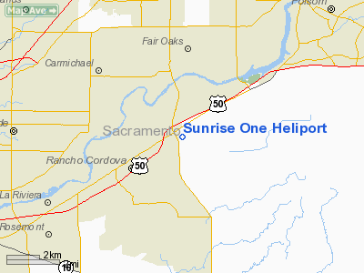
Sunrise One Heliport
Address:
Sacramento County, CA
Tel:
916-638-4354
Images
and information placed above are from
http://www.airport-data.com/airport/1CA2/
We
thank them for the data!
| General
Info |
| Country |
United
States |
| State |
CALIFORNIA
|
| FAA ID |
1CA2
|
| Latitude |
38-36-12.000N
|
| Longitude |
121-15-48.000W
|
| Elevation |
100 feet
|
| Near City |
RANCHO
CORDOVA |
We don't guarantee the information is fresh and accurate. The data may
be wrong or outdated.
For more up-to-date information please refer to other sources.
|
|


