 |
|
|
|
|
|
Location
& QuickFacts
|
FAA
Information Effective: |
2006-09-28 |
|
Airport
Identifier: |
1Q2 |
|
Longitude/Latitude: |
120-46-06.6320W/40-39-01.1000N
-120.768509/40.650306 (Estimated) |
|
Elevation: |
5116 ft / 1559.36 m (Surveyed) |
|
Land: |
78 acres |
|
From
nearest city: |
16 nautical miles NW of Susanville, CA |
|
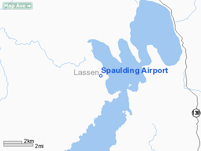
Location: |
Lassen County, CA |
|
Magnetic Variation: |
17E (1985) |
Owner
& Manager
|
Ownership: |
Publicly owned |
|
Owner: |
County Of Lassen |
|
Address: |
707 Nevada St
Susanville, CA 96130 |
|
Phone
number: |
916-251-8288 |
|
Manager: |
Tracy Trotten
LASSEN COUNTY ASSISTANT DIRECTOR OF PUBLIC WORKS. |
|
Address: |
707 Nevada St
Susanville, CA 96130 |
|
Phone
number: |
916-251-8299
LASSEN COUNTY PUBLIC WORKS OFFICE SUSANVILLE. |
Airport
Operations and Facilities
|
Airport
Use: |
Open to public |
|
Wind
indicator: |
Yes |
|
Segmented
Circle: |
Yes |
|
Control
Tower: |
No |
|
Attendance
Schedule: |
UNATNDD |
|
Lighting
Schedule: |
DUSK-DAWN
ACTVT MIRL RY 16/34 FREQ - 122.8. |
|
Beacon
Color: |
Clear-Green (lighted land airport) |
|
Landing
fee charge: |
No |
|
Sectional
chart: |
Klamath Falls |
|
Region: |
AWP - Western-Pacific |
|
Traffic
Pattern Alt: |
800 ft |
|
Boundary
ARTCC: |
ZOA - Oakland |
|
Tie-in
FSS: |
RNO - Reno |
|
FSS
on Airport: |
No |
|
FSS
Phone: |
775-858-1300 |
|
FSS
Toll Free: |
1-800-WX-BRIEF |
|
NOTAMs
Facility: |
RNO (NOTAM-d service avaliable) |
Airport
Communications
Airport
Services
|
Airframe
Repair: |
NONE |
|
Power
Plant Repair: |
NONE |
|
Bottled
Oxygen: |
NONE |
|
Bulk
Oxygen: |
NONE |
|
Runway Information
Runway 16/34
|
Dimension: |
4600 x 50 ft / 1402.1 x 15.2 m |
|
Surface: |
ASPH, Poor Condition
PAVEMENT SURFACE IS DETERIORATED. |
|
Weight
Limit: |
Single wheel: 12500 lbs. |
|
Edge
Lights: |
Medium |
|
|
Runway 16 |
Runway 34 |
|
Longitude: |
120-46-06.2790W |
120-46-06.9850W |
|
Latitude: |
40-39-23.8060N |
40-38-38.3930N |
|
Elevation: |
5114.00 ft |
5116.00 ft |
|
Alignment: |
127 |
1 |
|
Traffic
Pattern: |
Left |
Right |
|
Markings: |
Basic, Poor Condition
& RY 34 MARKINGS FADED. |
Basic, Poor Condition |
|
Runway
End Identifier: |
No |
No |
|
Centerline
Lights: |
No |
No |
|
Touchdown
Lights: |
No |
No |
|
Radio Navigation
Aids
|
ID |
Type |
Name |
Ch |
Freq |
Var |
Dist |
|
AHC |
VOR/DME |
Amedee |
027X |
109.00 |
17E |
36.4 nm |
Remarks
- TREES
OBSTRUCT THE WESTERN EDGE OF THE PRIMARY SURFACE AND PENETRATE THE 7:1
TRANSITIONAL SURFACE
Based Aircraft
|
Aircraft
based on field: |
2 |
|
Single
Engine Airplanes: |
2 |
Operational Statistics
|
Aircraft
Operations: |
58/Week |
|
General
Aviation Local: |
16.7% |
|
General
Aviation Itinerant: |
83.3% |
Spaulding Airport
Address:
Lassen County, CA
Tel:
916-251-8288,
916-251-8299
Images
and information placed above are from
http://www.airport-data.com/airport/1Q2/
We
thank them for the data!
| General
Info |
| Country |
United
States |
| State |
CALIFORNIA
|
| FAA ID |
1Q2
|
| Latitude |
40-39-01.100N
|
| Longitude |
120-46-06.632W
|
| Elevation |
5116 feet
|
| Near City |
SUSANVILLE
|
We don't guarantee the information is fresh and accurate. The data may
be wrong or outdated.
For more up-to-date information please refer to other sources.
|
|


