 |
|
|
|
|
|
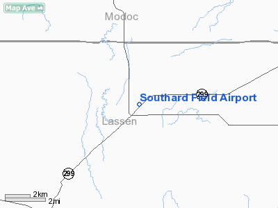
Location
& QuickFacts
|
FAA
Information Effective: |
2006-09-28 |
|
Airport
Identifier: |
O55 |
|
Longitude/Latitude: |
121-07-25.9010W/41-08-22.6000N
-121.123861/41.139611 (Estimated) |
|
Elevation: |
4158 ft / 1267.36 m (Surveyed) |
|
Land: |
60 acres |
|
From
nearest city: |
2 nautical miles NE of Bieber, CA |
|
Location: |
Lassen County, CA |
|
Magnetic Variation: |
17E (1985) |
Owner
& Manager
|
Ownership: |
Publicly owned |
|
Owner: |
County Of Lassen |
|
Address: |
707 Nevada St
Susanville, CA 96130 |
|
Phone
number: |
530-251-8288 |
|
Manager: |
Tracy Trotten
LASSEN COUNTY ASSISTANT DIRECTOR OF PUBLIC WORKS. |
|
Address: |
707 Nevada St
Susanville, CA 96130 |
|
Phone number: |
530-251-8299
PUBLIC WORKS DEPARTMENT, SUSANVILLE. |
Airport
Operations and Facilities
|
Airport
Use: |
Open to public |
|
Wind
indicator: |
Yes |
|
Segmented
Circle: |
Yes |
|
Control
Tower: |
No |
|
Attendance
Schedule: |
UNATNDD |
|
Lighting
Schedule: |
DUSK-DAWN
ACTVT LIRL RY 04/22 - CTAF. |
|
Beacon
Color: |
Clear-Green (lighted land airport) |
|
Landing
fee charge: |
No |
|
Sectional
chart: |
Klamath Falls |
|
Region: |
AWP - Western-Pacific |
|
Boundary
ARTCC: |
ZSE - Seattle |
|
Tie-in
FSS: |
RIU - Rancho Murieta |
|
FSS
on Airport: |
No |
|
FSS
Phone: |
916-354-0161 |
|
FSS
Toll Free: |
1-800-WX-BRIEF |
|
NOTAMs
Facility: |
RIU (NOTAM-d service avaliable) |
Airport
Communications
Airport
Services
|
Airframe
Repair: |
NONE |
|
Power
Plant Repair: |
NONE |
|
Bottled
Oxygen: |
NONE |
|
Bulk
Oxygen: |
NONE |
|
Runway Information
Runway 04/22
|
Dimension: |
2980 x 35 ft / 908.3 x 10.7 m |
|
Surface: |
ASPH, Fair Condition
LATERAL CRACKS FULL LENGTH OF RY SFC. |
|
Weight
Limit: |
Single wheel: 12500 lbs.
|
|
Edge
Lights: |
Low |
|
|
Runway 04 |
Runway 22 |
|
Traffic
Pattern: |
Left |
Left |
|
Markings: |
Nonstandard, Poor Condition
FADED RUNWAY NUMBERS, NO CERTERLINE, NO THRESHOLD MARKING |
Nonstandard, Poor Condition
FADED RUNWAY NUMBERS, NO CENTERLINE, NO THRESHOLD MARKING |
|
Displaced
threshold: |
0.00
ft |
500.00 ft |
|
Runway
End Identifier: |
No |
No |
|
Centerline
Lights: |
No |
No |
|
Touchdown
Lights: |
No |
No |
|
Obstruction: |
65 ft trees, 1600.0 ft from runway, 100 ft
right of centerline, 21:1 slope to clear |
15 ft road, 200.0 ft from runway, 100 ft left
of centerline
APCH RATIO 46:1 TO DSPLCD THR.
+3'
FENCE 0-60' DIAGONALLY ACROSS PRIMARY SURFACE. |
|
Radio Navigation
Aids
|
ID |
Type |
Name |
Ch |
Freq |
Var |
Dist |
|
ARU |
NDB |
Alturas |
|
215.00 |
18E |
32.5 nm |
Remarks
Based Aircraft
|
Aircraft
based on field: |
2 |
|
Single
Engine Airplanes: |
2 |
Operational Statistics
|
Aircraft
Operations: |
29/Week |
|
General
Aviation Local: |
66.7% |
|
General
Aviation Itinerant: |
33.3% |
Southard Field Airport
Address:
Lassen County, CA
Tel:
530-251-8288,
530-251-8299
Images
and information placed above are from
http://www.airport-data.com/airport/O55/
We
thank them for the data!
| General
Info |
| Country |
United
States |
| State |
CALIFORNIA
|
| FAA ID |
O55
|
| Latitude |
41-08-22.600N
|
| Longitude |
121-07-25.901W
|
| Elevation |
4158 feet
|
| Near City |
BIEBER
|
We don't guarantee the information is fresh and accurate. The data may
be wrong or outdated.
For more up-to-date information please refer to other sources.
|
|


