|
|
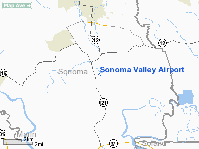
| Sonoma Valley Airport |
| IATA: none – ICAO: none – FAA LID: 0Q3 |
| Summary |
| Airport type |
Public |
| Owner |
Marty Reichelt |
| Location |
Sonoma, California |
| Elevation AMSL |
10 ft / 3 m |
| Coordinates |
38°13′23.8″N 122°26′52.00″W / 38.223278°N 122.44778°W / 38.223278; -122.44778Coordinates: 38°13′23.8″N 122°26′52.00″W / 38.223278°N 122.44778°W / 38.223278; -122.44778 |
| Runways |
| Direction |
Length |
Surface |
| ft |
m |
| 7/25 |
2,780 |
847 |
Asphalt |
| 17/35 |
1,469 |
447 |
Asphalt |
|
Rwy 17/35 restricted
|
Sonoma Valley Airport (FAA LID: 0Q3) is a public-use airstrip opened on August 1959 in Schellville, Sonoma, California, USA. Located 4.14 nautical miles south of central district of Sonoma (4.76 mi, 7.67 km) and 26.9 nm north of San Francisco (30.94 mi, 49.8 km), the airfield offers two asphalt runways, of which the 17/35 is restricted, with prior permission required.
Open to public use for light aircraft, Sonoma Valley Airport does not allow ultralight and rotorcraft operations, except for MEDEVAC or law enforcement helicopters.
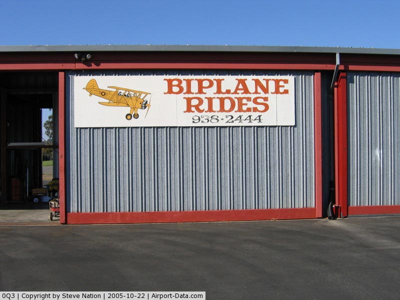
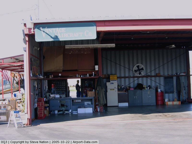
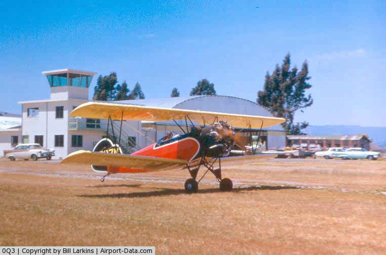
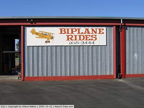
Among other fixed-wing aircraft, vintage planes can be seen on Sonoma Valley's apron, such as a fully restored, flying Curtiss P-40, a North American SNJ-4, three Boeing-Stearman PT-17 biplanes, a Globe Swift, a Cessna 195, a Douglas DC-3, a Dornier Do 27 or a Seabee amphibious. Others are being restored, like a Howard DGA-15.
The above content comes from Wikipedia and is published under free licenses – click here to read more.
|
 |
(Click on the photo to enlarge) |
|
 |
(Click on the photo to enlarge) |
|
 |
(Click on the photo to enlarge) |
Location
& QuickFacts
|
FAA
Information Effective: |
2006-09-28 |
|
Airport
Identifier: |
0Q3 |
|
Longitude/Latitude: |
122-26-58.9240W/38-13-24.6990N
-122.449701/38.223527 (Estimated) |
|
Elevation: |
10 ft / 3.05 m (Estimated) |
|
Land: |
79 acres |
|
From
nearest city: |
4 nautical miles S of Schellville/sonoma,
CA |
|
Location: |
Sonoma County, CA |
|
Magnetic Variation: |
16E (1985) |
Owner
& Manager
|
Ownership: |
Privately owned |
|
Owner: |
L. Reichelt |
|
Address: |
217 W Spain St
Sonoma, CA 95476 |
|
Phone number: |
707-938-5382 |
|
Manager: |
M. Reichelt |
|
Address: |
23980 Arnold Dr
Sonoma, CA 95476 |
|
Phone number: |
707-570-1235 |
Airport
Operations and Facilities
|
Airport
Use: |
Open to public |
|
Wind
indicator: |
Yes |
|
Segmented
Circle: |
Yes |
|
Control
Tower: |
No |
|
Attendance
Schedule: |
ALL/ALL/0700-1800 |
|
Landing
fee charge: |
No |
|
Sectional
chart: |
San Francisco |
|
Region: |
AWP - Western-Pacific |
|
Traffic
Pattern Alt: |
800 ft |
|
Boundary
ARTCC: |
ZOA - Oakland |
|
Tie-in
FSS: |
OAK - Oakland |
|
FSS
on Airport: |
No |
|
FSS
Phone: |
510-273-6111 |
|
FSS
Toll Free: |
1-800-WX-BRIEF |
|
NOTAMs
Facility: |
OAK (NOTAM-d service avaliable) |
Airport
Communications
Airport
Services
|
Fuel
available: |
100LL |
|
Airframe
Repair: |
MAJOR |
|
Power
Plant Repair: |
MAJOR |
|
Bottled
Oxygen: |
NONE |
|
Bulk
Oxygen: |
NONE |
|
Runway Information
Runway 07/25
|
Dimension: |
2700 x 45 ft / 823.0 x 13.7 m |
|
Surface: |
ASPH, Good Condition |
|
Weight
Limit: |
Single wheel: 12500 lbs. |
|
|
Runway 07 |
Runway 25 |
|
Elevation: |
5.00
ft |
5.00
ft |
|
Traffic
Pattern: |
Right |
Left |
|
Runway
End Identifier: |
No |
No |
|
Centerline
Lights: |
No |
No |
|
Touchdown
Lights: |
No |
No |
|
Obstruction: |
18 ft bldg, 560.0 ft from runway, 60 ft right
of centerline, 31:1 slope to clear |
60 ft tree, 1200.0 ft from runway, 100 ft left
of centerline, 16:1 slope to clear |
|
Runway 17/35
|
Dimension: |
1500 x 50 ft / 457.2 x 15.2 m |
|
Surface: |
ASPH, Good Condition |
|
Weight
Limit: |
Single wheel: 12500 lbs. |
|
|
Runway 17 |
Runway 35 |
|
Traffic
Pattern: |
Left |
Right |
|
Obstruction: |
35 ft pole, 1600.0 ft from runway, 200 ft right
of centerline, 40:1 slope to clear |
215 ft trees, 5227.0 ft from runway, 23:1 slope
to clear |
|
Radio Navigation
Aids
|
ID |
Type |
Name |
Ch |
Freq |
Var |
Dist |
|
LV |
NDB |
Reiga |
|
374.00 |
16E |
48.3 nm |
|
SUU |
TACAN |
Travis |
113X |
|
17E |
23.9 nm |
|
TZZ |
VOR |
Travis |
|
116.40 |
17E |
31.0 nm |
|
CCR |
VOR/DME |
Concord |
117X |
117.00 |
17E |
21.9 nm |
|
STS |
VOR/DME |
Santa Rosa |
077X |
113.00 |
16E |
24.1 nm |
|
SFO |
VOR/DME |
San Francisco |
105X |
115.80 |
17E |
36.5 nm |
|
SGD |
VORTAC |
Scaggs Island |
058X |
112.10 |
17E |
4.5 nm |
|
PYE |
VORTAC |
Point Reyes |
084X |
113.70 |
17E |
21.6 nm |
|
SAU |
VORTAC |
Sausalito |
109X |
116.20 |
17E |
22.4 nm |
|
OAK |
VORTAC |
Oakland |
115X |
116.80 |
17E |
31.8 nm |
|
SAC |
VORTAC |
Sacramento |
099X |
115.20 |
17E |
44.4 nm |
|
SFO |
VOT |
San Francisco Intl |
|
111.00 |
|
36.5 nm |
|
SAC |
VOT |
Sacramento Executive |
|
111.40 |
|
48.1 nm |
|
SMF |
VOT |
Sacramento Metropolitan |
|
111.40 |
|
49.2 nm |
Remarks
- RY
07/25 ELEVATED 3'-5' ABV NORTH TERRAIN WITH 6:1 SIDE SLOPES.
- RY
07/25 NO TGL; RIGHT 20 DEG TURN AFTER TKOF; RWY 25 TURN CROSSWIND AFTER
600 FT.
- BE
ALERT TO GLIDER ACTIVITIES INVOF ARPT.
- PREDATES
1958 FA ACT.
Based Aircraft
|
Aircraft
based on field: |
333 |
|
Single
Engine Airplanes: |
180 |
|
Multi
Engine Airplanes: |
150 |
|
Helicopters: |
1 |
|
Ultralights: |
2 |
Operational Statistics
|
Aircraft
Operations: |
222/Week |
|
General
Aviation Local: |
65.2% |
|
General
Aviation Itinerant: |
34.8% |
Sonoma Valley Airport
Address:
Sonoma County, CA
Tel:
707-938-5382, 707-570-1235
Images
and information placed above are from
http://www.airport-data.com/airport/0Q3/
We
thank them for the data!
| General
Info |
| Country |
United
States |
| State |
CALIFORNIA
|
| FAA ID |
0Q3
|
| Latitude |
38-13-24.699N
|
| Longitude |
122-26-58.924W
|
| Elevation |
10 feet
|
| Near City |
SCHELLVILLE/SONOMA
|
We don't guarantee the information is fresh and accurate. The data may
be wrong or outdated.
For more up-to-date information please refer to other sources.
|
|