 |
|
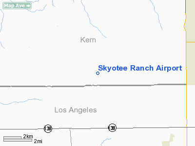
Location
& QuickFacts
|
FAA
Information Effective: |
2006-09-28 |
|
Airport
Identifier: |
CL74 |
|
Longitude/Latitude: |
118-24-03.2910W/34-49-54.9220N
-118.400914/34.831923 (Estimated) |
|
Elevation: |
2600 ft / 792.48 m (Estimated) |
|
Land: |
0 acres |
|
From
nearest city: |
30 nautical miles NW of Rosamond, CA |
|
Location: |
Kern County, CA |
|
Magnetic Variation: |
14E (1990) |
Owner
& Manager
|
Ownership: |
Privately owned |
|
Owner: |
Jules Marcogliese |
|
Address: |
818 155th St. West
Rosamond, CA 93560 |
|
Phone
number: |
805-256-8302 |
|
Manager: |
Jules Marcogliese |
|
Address: |
4373 Santa Anita Ave.
El Monte, CA 91731 |
|
Phone number: |
818-574-9409 |
Airport
Operations and Facilities
|
Airport
Use: |
Private |
|
Wind
indicator: |
Yes |
|
Segmented
Circle: |
No |
|
Control
Tower: |
No |
|
Attendance
Schedule: |
ALL/ALL/ALL |
|
Sectional
chart: |
Los Angeles |
|
Region: |
AWP - Western-Pacific |
|
Boundary
ARTCC: |
ZLA - Los Angeles |
|
Tie-in
FSS: |
RAL - Riverside |
|
FSS
on Airport: |
No |
|
FSS
Phone: |
951-351-3020 |
|
FSS
Toll Free: |
1-800-WX-BRIEF |
|
Runway Information
Runway 07/25
|
Dimension: |
2600 x 100 ft / 792.5 x 30.5 m |
|
Surface: |
DIRT, |
|
|
Runway 07 |
Runway 25 |
|
Traffic
Pattern: |
Left |
Left |
|
Displaced
threshold: |
400.00 ft |
0.00
ft |
|
Radio Navigation
Aids
|
ID |
Type |
Name |
Ch |
Freq |
Var |
Dist |
|
GWF |
NDB |
Gen William J Fox |
|
282.00 |
15E |
10.7 nm |
|
PAI |
NDB |
Pacoima |
|
370.00 |
15E |
34.4 nm |
|
EMT |
NDB |
El Monte |
|
359.00 |
15E |
48.3 nm |
|
VNY |
VOR/DME |
Van Nuys |
078X |
113.10 |
15E |
36.8 nm |
|
SMO |
VOR/DME |
Santa Monica |
045X |
110.80 |
15E |
49.5 nm |
|
LHS |
VORTAC |
Lake Hughes |
021X |
108.40 |
15E |
12.5 nm |
|
PMD |
VORTAC |
Palmdale |
092X |
114.50 |
15E |
20.6 nm |
|
GMN |
VORTAC |
Gorman |
108X |
116.10 |
16E |
22.8 nm |
|
EDW |
VORTAC |
Edwards |
111X |
116.40 |
15E |
34.2 nm |
|
FIM |
VORTAC |
Fillmore |
072X |
112.50 |
15E |
37.2 nm |
|
BFL |
VOT |
Bakersfield |
|
111.20 |
|
47.7 nm |
Skyotee Ranch Airport
Address:
Kern County, CA
Tel:
805-256-8302,
818-574-9409
Images
and information placed above are from
http://www.airport-data.com/airport/CL74/
We
thank them for the data!
| General
Info |
| Country |
United
States |
| State |
CALIFORNIA
|
| FAA ID |
CL74
|
| Latitude |
34-49-54.922N
|
| Longitude |
118-24-03.291W
|
| Elevation |
2600 feet
|
| Near City |
ROSAMOND
|
We don't guarantee the information is fresh and accurate. The data may
be wrong or outdated.
For more up-to-date information please refer to other sources.
|
|


