 |
|
|
|
|
|
Location
& QuickFacts
|
FAA
Information Effective: |
2006-09-28 |
|
Airport
Identifier: |
L61 |
|
Longitude/Latitude: |
116-16-10.0980W/35-58-06.8640N
-116.269472/35.968573 (Estimated) |
|
Elevation: |
1568 ft / 477.93 m (Surveyed) |
|
Land: |
20 acres |
|
From
nearest city: |
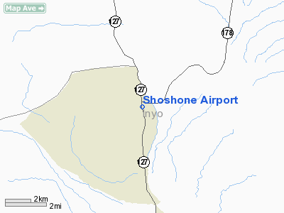
1 nautical miles S of Shoshone, CA |
|
Location: |
Inyo County, CA |
|
Magnetic Variation: |
14E (1985) |
Owner
& Manager
|
Ownership: |
Publicly owned |
|
Owner: |
County Of Inyo |
|
Address: |
168 N Edwards
Independence, CA 93526 |
|
Phone
number: |
760-878-0201 |
|
Manager: |
Steven Ivey
DIR OF PUBLIC WORKS INY0 COUNTY. |
|
Address: |
Po Drawer Q
Independence, CA 93526 |
|
Phone number: |
760-872-2971 |
Airport
Operations and Facilities
|
Airport
Use: |
Open to public |
|
Wind
indicator: |
Yes |
|
Segmented
Circle: |
Yes |
|
Control
Tower: |
No |
|
Attendance
Schedule: |
UNATNDD |
|
Lighting
Schedule: |
RDO-CTL
ACTVT MIRL RY 15/33 - 122.8. |
|
Landing
fee charge: |
No |
|
Sectional
chart: |
Las Vegas |
|
Region: |
AWP - Western-Pacific |
|
Traffic
Pattern Alt: |
800 ft |
|
Boundary
ARTCC: |
ZLA - Los Angeles |
|
Tie-in
FSS: |
RAL - Riverside |
|
FSS
on Airport: |
No |
|
FSS
Phone: |
951-351-3020 |
|
FSS
Toll Free: |
1-800-WX-BRIEF |
|
NOTAMs
Facility: |
RAL (NOTAM-d service avaliable) |
Airport
Communications
Airport
Services
|
Airframe
Repair: |
NONE |
|
Power
Plant Repair: |
NONE |
|
Bottled
Oxygen: |
NONE |
|
Bulk
Oxygen: |
NONE |
|
Runway Information
Runway 15/33
|
Dimension: |
2380 x 30 ft / 725.4 x 9.1 m |
|
Surface: |
ASPH, Fair Condition |
|
Edge
Lights: |
Non-standard lighting system
NSTD MIRL; THLD LGTS 35 FT OUTBOARD OF DESIGNATED THLD OF RY. |
|
|
Runway 15 |
Runway 33 |
|
Traffic
Pattern: |
Left |
Right |
|
Markings: |
Basic, Good Condition |
Basic, Good Condition |
|
Centerline
Lights: |
No |
No |
|
Obstruction: |
30 ft trees, 600.0 ft from runway, 100 ft left
of centerline, 13:1 slope to clear
+15 FT ROAD 0 FT FM THLD 110 FT R TO 200 FT FM THLD 60 FT
R. |
7 ft berm, 200.0 ft from runway, 115 ft right
of centerline
+7 FT BERM 0 FT FM THLD 125 FT R TO 200 FT FM THLD 115 FT
R. |
|
Radio Navigation
Aids
|
ID |
Type |
Name |
Ch |
Freq |
Var |
Dist |
|
MCY |
NDB |
Mercury |
|
326.00 |
16E |
41.3 nm |
|
INS |
TACAN |
Indian Springs |
067X |
|
15E |
47.1 nm |
Remarks
- OBSTNS
PART 77 MTNS N OF ARPT, P-LINE E OF RWY & HILL SE EOR.
- RY
15/33 CLSD TO HELICOPTERS.
- ESTABD
PRIOR TO 5/15/59.
Operational Statistics
|
Aircraft
Operations: |
14/Week |
|
General
Aviation Itinerant: |
100.0% |
Shoshone Airport
Address:
Inyo County, CA
Tel:
760-878-0201,
760-872-2971
Images
and information placed above are from
http://www.airport-data.com/airport/L61/
We
thank them for the data!
| General
Info |
| Country |
United
States |
| State |
CALIFORNIA
|
| FAA ID |
L61
|
| Latitude |
35-58-06.864N
|
| Longitude |
116-16-10.098W
|
| Elevation |
1568 feet
|
| Near City |
SHOSHONE |
We don't guarantee the information is fresh and accurate. The data may
be wrong or outdated.
For more up-to-date information please refer to other sources.
|
|


