 |
|
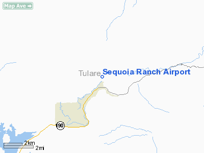
Location
& QuickFacts
|
FAA
Information Effective: |
2006-09-28 |
|
Airport
Identifier: |
CA44 |
|
Longitude/Latitude: |
118-48-08.3370W/36-08-59.8130N
-118.802316/36.149948 (Estimated) |
|
Elevation: |
1153 ft / 351.43 m (Estimated) |
|
Land: |
0 acres |
|
From
nearest city: |
2 nautical miles NE of Springville, CA |
|
Location: |
Tulare County, CA |
|
Magnetic Variation: |
15E (1985) |
Top
Owner
& Manager
|
Ownership: |
Privately owned |
|
Owner: |
Bruce W. Borror |
|
Address: |
Rt 2, Box 300
Springville, CA 93265 |
|
Phone number: |
209-539-2351 |
|
Address: |
|
Top
Airport
Operations and Facilities
|
Airport Use: |
Private |
|
Wind indicator: |
Yes |
|
Segmented Circle: |
No |
|
Control Tower: |
No |
|
Attendance Schedule: |
UNATNDD |
|
Landing fee charge: |
No |
|
Sectional chart: |
San Francisco |
|
Region: |
AWP - Western-Pacific |
|
Boundary ARTCC: |
ZOA - Oakland |
|
Tie-in FSS: |
RIU - Rancho Murieta |
|
FSS on Airport: |
No |
|
FSS Phone: |
916-354-0161 |
|
FSS Toll Free: |
1-800-WX-BRIEF |
Airport
Services
|
Airframe
Repair: |
NONE |
|
Power
Plant Repair: |
NONE |
|
Top
Runway
Information
Runway N/S
|
Dimension: |
2800 x 100 ft / 853.4 x 30.5 m |
|
Surface: |
ASPH-TURF,
1000' ASPH REST TURF. |
|
|
Runway N |
Runway S |
|
Traffic
Pattern: |
Left |
Left |
|
Top
Radio Navigation
Aids
|
ID |
Type |
Name |
Ch |
Freq |
Var |
Dist |
|
COR |
NDB |
Salyer Farms |
|
205.00 |
16E |
36.0 nm |
|
TTE |
VOR/DME |
Tule |
029X |
109.20 |
16E |
17.8 nm |
|
VIS |
VOR/DME |
Visalia |
031X |
109.40 |
16E |
35.4 nm |
|
EHF |
VORTAC |
Shafter |
101X |
115.40 |
14E |
42.5 nm |
|
BFL |
VOT |
Bakersfield |
|
111.20 |
|
45.2 nm |
Top
Remarks
- WATCH
FOR LIVESTOCK ON RWY.
- ESTABD
PRIOR TO 15 MAY 1959.
Based Aircraft
|
Aircraft
based on field: |
1 |
|
Single
Engine Airplanes: |
1 |
Sequoia Ranch Airport
Address: Sitka
County, AK
Tel:
907-789-6221
Images
and information placed above are from
http://www.airport-data.com/airport/CA44/
We
thank them for the data!
| General
Info |
| Country |
United
States |
| State |
CALIFORNIA
|
| FAA ID |
CA44
|
| Latitude |
36-08-59.813N
|
| Longitude |
118-48-08.337W
|
| Elevation |
1153 feet
|
| Near City |
SPRINGVILLE
|
We don't guarantee the information is fresh and accurate. The data may
be wrong or outdated.
For more up-to-date information please refer to other sources.
|
|


