 |
|
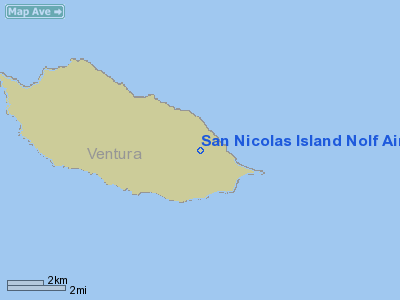
San Nicolas Island Nolf Airport |
| NOLF San Nicolas Island |
| IATA: none – ICAO: KNSI – FAA LID: NSI |
| Summary |
| Airport type |
Military |
| Operator |
US Navy |
| Location |
San Nicolas Island, Ventura County, California, USA |
| Elevation AMSL |
506 ft / 154.2 m |
| Coordinates |
33°14′23″N 119°27′29″W / 33.23972°N 119.45806°W / 33.23972; -119.45806Coordinates: 33°14′23″N 119°27′29″W / 33.23972°N 119.45806°W / 33.23972; -119.45806 |
| Runways |
| Direction |
Length |
Surface |
| ft |
m |
| 12/30 |
10,002 |
3,049 |
PEM |
Naval Outlying Field San Nicolas Island or NOLF San Nicolas Island (ICAO: KNSI, FAA LID: NSI) is a military airport located on San Nicolas Island, in Ventura County, California, USA.
Although most U.S. airports and airbases use the same three-letter location identifier for the FAA and IATA, NOLF San Nicolas Island is assigned NSI by the FAA but has no designation from the IATA (which assigned NSI to Nsimalen International Airport in Yaoundé, Cameroon). The airport's ICAO identifier is KNSI.
The above content comes from Wikipedia and is published under free licenses – click here to read more.
Location
& QuickFacts
|
FAA
Information Effective: |
2006-09-28 |
|
Airport
Identifier: |
NSI |
|
Longitude/Latitude: |
119-27-29.4000W/33-14-23.4000N
-119.458167/33.239833 (Estimated) |
|
Elevation: |
506 ft / 154.23 m (Estimated) |
|
Land: |
0 acres |
|
From
nearest city: |
0 nautical miles E of San Nicolas Island,
CA |
|
Location: |
Santa Cruz County, CA |
|
Magnetic Variation: |
14E (2000) |
Owner
& Manager
|
Ownership: |
Navy owned |
|
Owner: |
Us Navy |
|
Address: |
Oceanographic Ofc - Code 3142
Washington, DC 20373 |
|
Address: |
|
Airport
Operations and Facilities
|
Airport
Use: |
Private |
|
Segmented
Circle: |
No |
|
Control
Tower: |
Yes |
|
Lighting
Schedule: |
DUSK-DAWN |
|
Beacon
Color: |
Split-Clear-Green (lighted military airport) |
|
Sectional
chart: |
Los Angeles |
|
Region: |
AWP - Western-Pacific |
|
Boundary
ARTCC: |
ZLA - Los Angeles |
|
Tie-in
FSS: |
HHR - Hawthorne |
|
FSS
on Airport: |
No |
|
FSS
Phone: |
310-970-0102 |
|
FSS
Toll Free: |
1-800-WX-BRIEF |
|
NOTAMs
Facility: |
NSI (NOTAM-d service avaliable) |
|
Runway Information
Runway 12/30
|
Dimension: |
10002 x 194 ft / 3048.6 x 59.1 m |
|
Surface: |
PEM, |
|
Pavement
Class: |
63/R/C/W/T |
|
Edge
Lights: |
High |
|
|
Runway 12 |
Runway 30 |
|
Longitude: |
119-28-12.8500W |
119-26-46.1700W |
|
Latitude: |
33-14-56.7000N |
33-13-49.7200N |
|
Elevation: |
485.00 ft |
498.00 ft |
|
ILS
Type: |
|
LOC/GS |
|
Traffic
Pattern: |
Left |
Right |
|
Arresting: |
E28(B) |
|
|
Displaced
threshold: |
990.00 ft |
0.00
ft |
|
Centerline
Lights: |
No |
No |
|
Radio Navigation
Aids
|
ID |
Type |
Name |
Ch |
Freq |
Var |
Dist |
|
NSI |
NDB |
San Nicolas Island |
|
203.00 |
14E |
0.5 nm |
|
NUC |
NDB |
San Clemente |
|
350.00 |
15E |
46.4 nm |
|
NSI |
TACAN |
San Nicolas |
039X |
|
15E |
0.3 nm |
|
NUC |
TACAN |
San Clemente |
123X |
|
15E |
46.0 nm |
Remarks
- RSTD:
OFFL BUS ONLY. 24 HR PPR FOR ALL ACFT OPR OT; 48 HR PPR FOR C-5 AND
ACFT EXCEEDING PUBL LDG WT FR SAN NICOLAS ATC DSN 351-2253, C805-989-2253.
- A-GEAR:
RWY-30, HOOK E28(B)(3250')
- JASU:
1(GTC-85) 1(NC-10C) 1(NCPP-105)
- TFC
PAT: RGT TFC RWY 30.
- CAUTION:
POSSIBLE TURBULENCE SHORT FINAL RWY 30.
- FUEL:
J5
- RSTD:
RWY 12 TKOF AND LDG 9002'.
- OPR
1500-2400Z++ MON-THU/ALTN FRI. CLSD ALTN FRI; ALL SAT, SUN AND HOL.
- RSTD:
POSSIBLE DIVERT ALL ACFT EXC EMERG TO PT MUGU NAWS DUE DRONE MISL OPR.
- NS
ABTMT: REMAIN AT LEAST 1 MILE OFFSHORE OR 1000' MSL.
- MISC:
CALL PLEAD CON 127.55 280.7 OR POINT MUGU APP 128.65 325.0 PRIOR TO
ENTERING W289.
- MISC:
HGR SPACE MAINT NOT AVBL.
San Nicolas Island Nolf Airport
Address:
Santa Cruz County, CA
Tel:
Images
and information placed above are from
http://www.airport-data.com/airport/NSI/
We
thank them for the data!
| General
Info |
| Country |
United
States |
| State |
CALIFORNIA
|
| FAA ID |
NSI
|
| Latitude |
33-14-23.210N
|
| Longitude |
119-27-29.481W
|
| Elevation |
504 feet
|
| Near City |
SAN NICOLAS
ISLAND |
We don't guarantee the information is fresh and accurate. The data may
be wrong or outdated.
For more up-to-date information please refer to other sources.
|
|


