 |
|
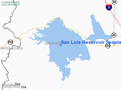
San Luis Reservoir Seaplane Base |
|
|
Location
& QuickFacts
|
FAA
Information Effective: |
2006-09-28 |
|
Airport
Identifier: |
0O0 |
|
Longitude/Latitude: |
121-07-33.7250W/37-03-29.7990N
-121.126035/37.058278 (Estimated) |
|
Elevation: |
544 ft / 165.81 m (Estimated)
SPILLWAY & WATER SFC ELEVATIONS CHANGE SEASONALLY &
MAY BE AS LOW AS 340 FT MSL. |
|
Land: |
8500 acres |
|
From
nearest city: |
12 nautical miles W of Los Banos, CA |
|
Location: |
Merced County, CA |
|
Magnetic Variation: |
15E (1985) |
Owner
& Manager
|
Ownership: |
Publicly owned |
|
Owner: |
State Of California
DEPT OF PARKS & RECREATION. |
|
Address: |
1416 9th St, P.o. Box 2390
Sacramento, CA 95811 |
|
Phone
number: |
916-653-4272 |
|
Manager: |
Joseph Hardcastle |
|
Address: |
31426 Gonzaga Road
Santa Nella, CA 95322 |
|
Phone
number: |
209-826-1196
EMERG DISPATCH FONE FOR STATE PARK RANGERS 916-988-4346. |
Airport
Operations and Facilities
|
Airport
Use: |
Open to public |
|
Segmented
Circle: |
No |
|
Control
Tower: |
No |
|
Attendance
Schedule: |
UNATNDD |
|
Landing
fee charge: |
No |
|
Sectional
chart: |
San Francisco |
|
Region: |
AWP - Western-Pacific |
|
Traffic
Pattern Alt: |
800 ft |
|
Boundary
ARTCC: |
ZOA - Oakland |
|
Tie-in
FSS: |
RIU - Rancho Murieta |
|
FSS
on Airport: |
No |
|
FSS
Phone: |
916-354-0161 |
|
FSS
Toll Free: |
1-800-WX-BRIEF |
|
NOTAMs
Facility: |
RIU (NOTAM-d service avaliable) |
Airport
Communications
|
Runway
Information
Runway ALL/WAY
|
Dimension: |
15840
x 4000 ft / 4828.0 x 1219.2 m
RWY WIDTH 13200'. |
|
Surface: |
WATER, |
|
|
Runway ALL |
Runway WAY |
|
Traffic
Pattern: |
Left |
Left |
|
Radio Navigation
Aids
|
ID |
Type |
Name |
Ch |
Freq |
Var |
Dist |
|
PDG |
NDB |
Pajar |
|
327.00 |
17E |
33.9 nm |
|
UAD |
NDB |
Chualar |
|
263.00 |
16E |
38.0 nm |
|
TCY |
NDB |
Tracy |
|
203.00 |
15E |
41.0 nm |
|
LV |
NDB |
Reiga |
|
374.00 |
16E |
46.5 nm |
|
NUQ |
TACAN |
Moffett |
123X |
|
17E |
49.9 nm |
|
MOD |
VOR/DME |
Modesto |
093X |
114.60 |
17E |
35.1 nm |
|
HYP |
VOR/DME |
El Nido |
089X |
114.20 |
15E |
36.1 nm |
|
SJC |
VOR/DME |
San Jose |
088X |
114.10 |
16E |
43.6 nm |
|
PXN |
VORTAC |
Panoche |
073X |
112.60 |
16E |
26.5 nm |
|
SNS |
VORTAC |
Salinas |
120X |
117.30 |
17E |
33.0 nm |
|
ECA |
VORTAC |
Manteca |
107X |
116.00 |
17E |
46.7 nm |
Remarks
- SEA
PLANE LNDG AREA SUBJECT TO GUSTY WIND CONDITIONS.
- PUBLIC
USE; VFR CONDITIONS ONLY.
Operational Statistics
|
Aircraft
Operations: |
5/Month |
|
General
Aviation Itinerant: |
100.0% |
San Luis Reservoir Seaplane Base
Address:
Merced County, CA
Tel:
916-653-4272,
209-826-1196
Images
and information placed above are from
http://www.airport-data.com/airport/0O0/
We
thank them for the data!
| General
Info |
| Country |
United
States |
| State |
CALIFORNIA
|
| FAA ID |
0O0
|
| Latitude |
37-03-29.799N
|
| Longitude |
121-07-33.725W
|
| Elevation |
544 feet
|
| Near City |
LOS BANOS
|
We don't guarantee the information is fresh and accurate. The data may
be wrong or outdated.
For more up-to-date information please refer to other sources.
|
|


