 |
|
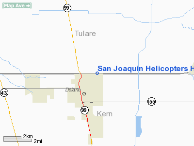
San Joaquin Helicopters Heliport |
Location
& QuickFacts
|
FAA
Information Effective: |
2006-09-28 |
|
Airport
Identifier: |
5CA6 |
|
Longitude/Latitude: |
119-13-48.3910W/35-47-27.8320N
-119.230109/35.791064 (Estimated) |
|
Elevation: |
335 ft / 102.11 m (Estimated) |
|
Land: |
0 acres |
|
From
nearest city: |
1 nautical miles NE of Delano, CA |
|
Location: |
Tulare County, CA |
|
Magnetic Variation: |
15E (1985) |
Owner
& Manager
|
Ownership: |
Privately owned |
|
Owner: |
Jim Josephson/lee Brown |
|
Address: |
Route 1, Box 422
Delano, CA 93215 |
|
Phone number: |
805-725-1898 |
|
Address: |
|
Airport
Operations and Facilities
|
Airport
Use: |
Private |
|
Wind
indicator: |
Yes |
|
Segmented
Circle: |
No |
|
Control
Tower: |
No |
|
Attendance
Schedule: |
UNATNDD |
|
Landing
fee charge: |
No |
|
Sectional
chart: |
Los Angeles |
|
Region: |
AWP - Western-Pacific |
|
Boundary
ARTCC: |
ZLA - Los Angeles |
|
Tie-in
FSS: |
RIU - Rancho Murieta |
|
FSS
on Airport: |
No |
|
FSS
Phone: |
916-354-0161 |
|
FSS
Toll Free: |
1-800-WX-BRIEF |
|
Runway Information
Helipad H1
|
Dimension: |
215 x 146 ft / 65.5 x 44.5 m |
|
Surface: |
CONC, |
|
|
Runway H1 |
Runway |
|
Traffic
Pattern: |
Left |
Left |
|
Radio Navigation
Aids
|
ID |
Type |
Name |
Ch |
Freq |
Var |
Dist |
|
COR |
NDB |
Salyer Farms |
|
205.00 |
16E |
22.3 nm |
|
NLC |
TACAN |
Lemoore |
080X |
|
16E |
48.8 nm |
|
TTE |
VOR/DME |
Tule |
029X |
109.20 |
16E |
12.6 nm |
|
VIS |
VOR/DME |
Visalia |
031X |
109.40 |
16E |
36.7 nm |
|
EHF |
VORTAC |
Shafter |
101X |
115.40 |
14E |
19.5 nm |
|
AVE |
VORTAC |
Avenal |
118X |
117.10 |
16E |
37.5 nm |
|
BFL |
VOT |
Bakersfield |
|
111.20 |
|
23.8 nm |
Remarks
San Joaquin Helicopters Heliport
Address:
Tulare County, CA
Tel:
805-725-1898
Images
and information placed above are from
http://www.airport-data.com/airport/5CA6/
We
thank them for the data!
| General
Info |
| Country |
United
States |
| State |
CALIFORNIA
|
| FAA ID |
5CA6
|
| Latitude |
35-47-27.832N
|
| Longitude |
119-13-48.391W
|
| Elevation |
335 feet
|
| Near City |
DELANO
|
We don't guarantee the information is fresh and accurate. The data may
be wrong or outdated.
For more up-to-date information please refer to other sources.
|
|


