|
|
Sacramento International Airport |
| Sacramento International Airport |
 |
| IATA: SMF – ICAO: KSMF – FAA LID: SMF
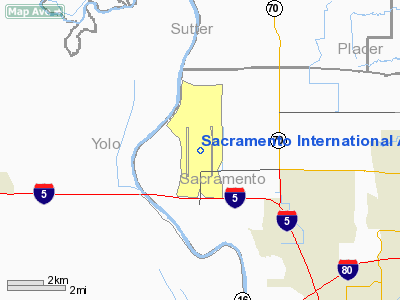
Location of the Sacramento International Airport
|
| Summary |
| Airport type |
public |
| Owner |
County of Sacramento |
| Serves |
Sacramento, California |
| Elevation AMSL |
27 ft / 8.2 m |
| Coordinates |
38°41′44″N 121°35′27″W / 38.69556°N 121.59083°W / 38.69556; -121.59083 |
| Website |
http://www.sacairports.org/int |
| Runways |
| Direction |
Length |
Surface |
| ft |
m |
| 16L/34R |
8,601 |
2,622 |
Concrete |
| 16R/34L |
8,600 |
2,621 |
Asphalt |
| Statistics (2006) |
| Passengers |
10.4 million |
| Commercial flights/day |
> 150 |
Sacramento International Airport (IATA: SMF, ICAO: KSMF, FAA LID: SMF) is a public airport located 10 miles (16 km) northwest of the central business district (CBD) of Sacramento, in Sacramento County, California, USA. It is run by Sacramento County. Southwest Airlines currently accounts for about half of all airline passenger traffic. History
Due to the vast housing growth around Sacramento Executive Airport, the City of Sacramento Planning Department and the Sacramento County Board of Supervisors commissioned a study to move large commercial air operations to a less populated area. Choosing on a location adjacent to the then being constructed Interstate 5 in the farming area to the northwest of the city, the airport first opened on October 21, 1967 as Sacramento Metropolitan Airport. On June 24, 1988 it hosted a Concorde, coinciding with the activation of the airports second runway. In 1998 with the opening of a new terminal building, it was renamed Sacramento International Airport; though it didn't receive its first international flights until 2002 when Mexicana initiated nonstop service to Guadalajara. The airport was officially designated a port of entry on October 5, 2006. On August 2, 2010, Mexicana filed for bankrupcty and suspended operations. On August 28, 2010, Mexicana ceased all operations, which means that there are no longer flights to Mexico, until Alaska Airlines will begin routes from Sacramento to Guadalajara, Mexico until December 16, 2010.
Airline Market Share
Southwest Airlines is the largest carrier at Sacramento with 49.8% of total passenger volume during the 2007 calendar year. United Airlines / United Express is the second largest with a market share of 10.9%. Delta Air Lines / Delta Connection is the third largest with a market share of 6.4%. US Airways / US Airways Express has 5.7% of the market.
Facilities
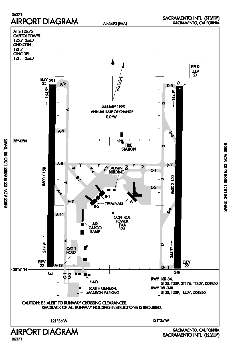
Sacramento International Airport covers 5,500 acres (22 km²) and has two runways:
- Runway 16L/34R: 8,601 x 150 ft. (2,622 x 46 m), Surface: Concrete
- Runway 16R/34L: 8,600 x 150 ft. (2,621 x 46 m), Surface: Asphalt
All indoor public areas feature free public wi-fi (wireless Internet) provided by the Sacramento County Airport System.
Expansion Project
On June 7, 2006, plans were announced to replace the aging Terminal B with a brand new terminal by the year 2012 at a total estimated cost of $1.27 billion. Ground was broken on June 2008 to begin preliminary work on the new terminal. On October 28, 2008 the existing airport hotel was demolished to make way for the new four story steel and glass Terminal B. According to the plan, Terminal B will be demolished after all airlines have been phased into new locations in Central Terminal B, designed by Corgan Associates, Inc. in association with Fentress Architects and existing Terminal A. Southwest Airlines, American Airlines, jetBlue, Frontier,and Hawaiian airlines have confirmed they will be moving to the new terminal. The project is ahead of schedule and estimated to open in late 2011.
Public transportation
Yolobus bus #42 connects the airport to downtown Sacramento and the nearby communities of Woodland and Davis. Sacramento light rail will also provide service to the airport when the Green Line is finished in 2011.
Terminals, airlines, and destinations
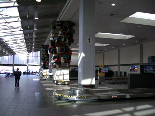 | |
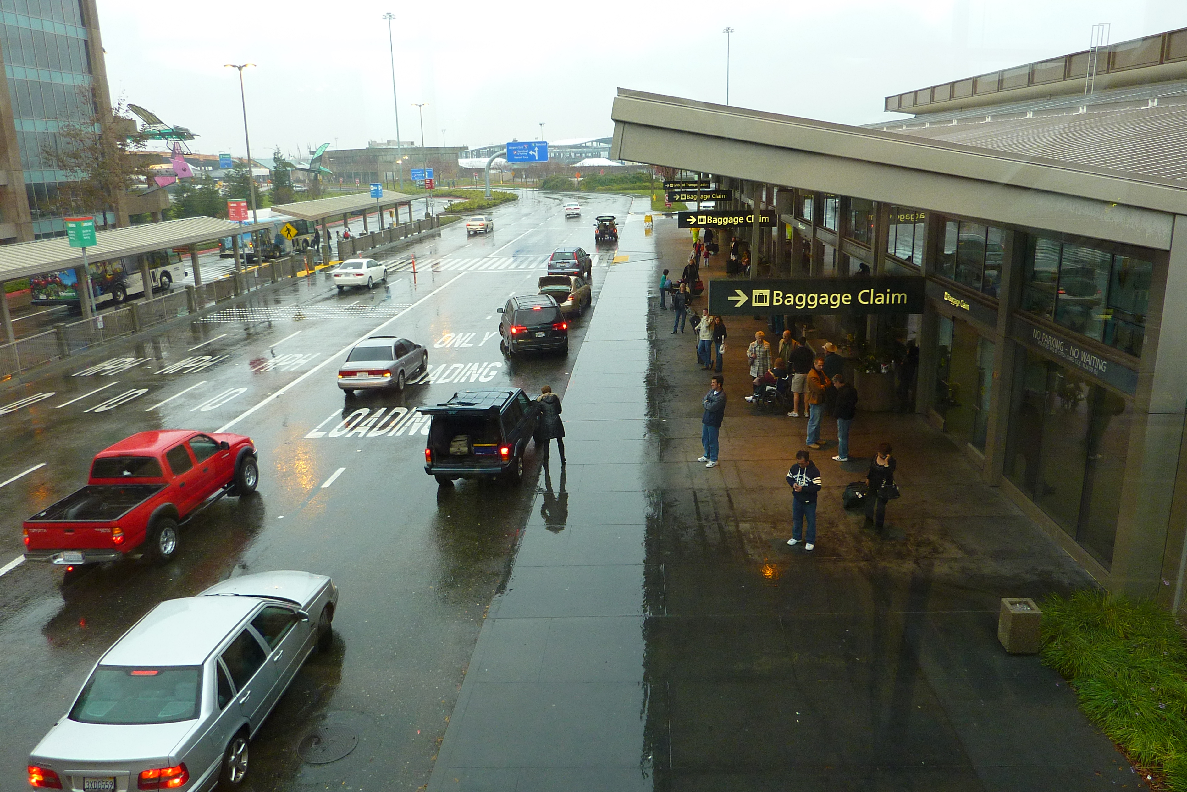
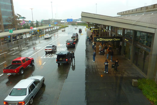
Terminal A's baggage claim |
 | |
Terminal A |
| Airlines |
Destinations |
Terminal |
| Alaska Airlines |
Guadalajara [begins December 16], Kahului, Seattle/Tacoma |
B2 |
| American Airlines |
Dallas/Fort Worth |
B2 |
| Continental Airlines |
Houston-Intercontinental |
B2 |
| Delta Air Lines |
Atlanta, Detroit [seasonal], Minneapolis/St. Paul, Salt Lake City |
A |
| Delta Connection operated by SkyWest Airlines |
Salt Lake City |
A |
| Frontier Airlines |
Denver |
B1 (check-in)
B2 (gate operations) |
| Hawaiian Airlines |
Honolulu |
A |
| Horizon Air |
Boise, Palm Springs, Portland (OR), San Jose (CA), Spokane |
B2 |
| JetBlue Airways |
Long Beach, New York-JFK |
B2 |
| Southwest Airlines |
Burbank, Chicago-Midway, Denver, Las Vegas, Los Angeles, Ontario, Orange County, Phoenix, Portland (OR), San Diego, Seattle/Tacoma |
A |
| United Airlines |
Chicago-O'Hare, Denver, Washington-Dulles |
B1 |
| United Express operated by SkyWest Airlines |
Arcata/Eureka, Denver, Los Angeles, San Francisco |
B1 |
| US Airways |
Charlotte [seasonal], Philadelphia, Phoenix |
A |
US Airways Express operated by
Mesa Airlines |
Phoenix |
A |
Accidents and Incidents
On the morning of September 25, 1978, a Boeing 727-200 operating flight PSA Flight 182 on the Sacramento-Los Angeles-San Diego Route collided in mid-air with a Cessna 172 while attempting to land at San Diego Airport. The two aircraft collided over San Diego's North Park, killing all 135 people on Flight 182 and the two people on the Cessna, along with 7 people on the ground.
On the afternoon of Thursday, August 26, 2010, JetBlue Airbus A320 Flight 262 en route from Long Beach, CA blew four tires upon landing, creating a fire around the plane and causing passengers to evacuate. Out of the 87 passengers and five crew, 15 sustained injuries, although none of them were particularly serious. Five passengers were hospitalized, but none were killed. A JetBlue spokesman said that the flight reported an issue with the brakes.
The above content comes from Wikipedia and is published under free licenses – click here to read more.
|
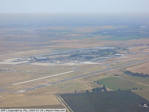 |
(Click on the photo to enlarge) |
Location
& QuickFacts
|
FAA
Information Effective: |
2006-09-28 |
|
Airport
Identifier: |
SMF |
|
Longitude/Latitude: |
121-35-26.8000W/38-41-43.5000N
-121.590778/38.695417 (Estimated) |
|
Elevation: |
27 ft / 8.23 m (Surveyed) |
|
Land: |
5500 acres |
|
From
nearest city: |
10 nautical miles NW of Sacramento, CA |
|
Location: |
Sacramento County, CA |
|
Magnetic Variation: |
16E (1985) |
Owner
& Manager
|
Ownership: |
Publicly owned |
|
Owner: |
County Of Sacramento |
|
Address: |
6900 Airport Blvd
Sacramento, CA 95837 |
|
Phone
number: |
916-929-5411 |
|
Manager: |
G. Hardy Acree
DIR OF ARPTS - G. HARDY ACREE. DIR. OPS & MAINT - FRANCES
SHERERTZ & ROBERT LEONARD ASST. DEPUTY DIRECTOR FOR
PLANNING & DEV - LEONARD TAKAYAMA (916) 874-0619. |
|
Address: |
6900 Airport Blvd
Sacramento, CA 95837 |
|
Phone number: |
916-874-0600 |
Airport
Operations and Facilities
|
Airport
Use: |
Open to public |
|
Wind
indicator: |
Yes |
|
Segmented
Circle: |
No |
|
Control
Tower: |
Yes |
|
Attendance
Schedule: |
ALL/ALL/ALL |
|
Lighting
Schedule: |
DUSK-DAWN |
|
Beacon
Color: |
Clear-Green (lighted land airport) |
|
Landing
fee charge: |
No |
|
Sectional
chart: |
San Francisco |
|
Region: |
AWP - Western-Pacific |
|
Boundary
ARTCC: |
ZOA - Oakland |
|
Tie-in
FSS: |
RIU - Rancho Murieta |
|
FSS
on Airport: |
No |
|
FSS
Phone: |
916-354-0161 |
|
FSS
Toll Free: |
1-800-WX-BRIEF |
|
NOTAMs
Facility: |
SMF (NOTAM-d service avaliable) |
|
Certification type/date: |
I CS 5/1973 |
|
Federal Agreements: |
NGHY |
Airport
Communications
Airport
Services
|
Fuel
available: |
100LLA |
|
Bottled
Oxygen: |
NONE |
|
Bulk
Oxygen: |
NONE |
|
Runway Information
Runway 16L/34R
|
Dimension: |
8601 x 150 ft / 2621.6 x 45.7 m |
|
Surface: |
CONC, Good Condition |
|
Surface
Treatment: |
Saw-cut or plastic Grooved |
|
Weight
Limit: |
Single wheel: 100000 lbs.
Dual wheel: 209000 lbs.
Dual tandem wheel: 407000 lbs.
Dual dual tandem wheel: 850000 lbs.
CLSD
TO ACFT OVER 30000 LBS EXCEPT PPR CTC ATCT. |
|
Edge
Lights: |
High |
|
|
Runway 16L |
Runway 34R |
|
Longitude: |
121-34-48.2124W |
121-34-49.6376W |
|
Latitude: |
38-42-25.6535N |
38-41-00.6475N |
|
Elevation: |
27.00 ft |
22.00
ft |
|
Alignment: |
127 |
1 |
|
ILS
Type: |
ILS/DME |
|
|
Traffic
Pattern: |
Left |
Right |
|
Markings: |
Precision instrument, Good Condition |
Non-precision instrument, Good Condition |
|
Crossing
Height: |
64.00 ft |
64.00 ft |
|
VASI: |
4-light PAPI on left side |
4-light PAPI on left side |
|
Visual
Glide Angle: |
3.00� |
3.00� |
|
Approach
lights: |
MALSR |
|
|
Centerline
Lights: |
Yes |
Yes |
|
Touchdown
Lights: |
Yes |
|
|
Runway 16R/34L
|
Dimension: |
8600 x 150 ft / 2621.3 x 45.7 m |
|
Surface: |
ASPH, Good Condition |
|
Surface
Treatment: |
Porous Friction Course |
|
Weight
Limit: |
Single wheel: 100000 lbs.
Dual wheel: 209000 lbs.
Dual tandem wheel: 407000 lbs.
Dual dual tandem wheel: 850000 lbs.
CLSD
TO ACFT OVER 30000 LBS EXCEPT PPR CTC ATCT. |
|
Edge
Lights: |
High |
|
|
Runway 16R |
Runway 34L |
|
Longitude: |
121-36-03.8930W |
121-36-05.3031W |
|
Latitude: |
38-42-26.4292N |
38-41-01.4256N |
|
Elevation: |
25.00 ft |
22.00
ft |
|
Alignment: |
127 |
1 |
|
ILS
Type: |
ILS/DME |
ILS |
|
Traffic
Pattern: |
Right |
Left |
|
Markings: |
Precision instrument, Good Condition |
Precision instrument, Good Condition |
|
Crossing
Height: |
72.00 ft |
59.00 ft |
|
VASI: |
4-light PAPI on right side |
4-box on left side |
|
Visual
Glide Angle: |
3.00� |
3.00� |
|
RVR
Equipment: |
touchdown, midfield, rollout |
touchdown, midfield, rollout |
|
Approach
lights: |
ALSF2
ALSF2 UNMONITORED. |
MALSR |
|
Runway
End Identifier: |
No |
No |
|
Centerline
Lights: |
Yes |
Yes |
|
Touchdown
Lights: |
Yes |
No |
|
Radio Navigation
Aids
|
ID |
Type |
Name |
Ch |
Freq |
Var |
Dist |
|
MY |
NDB |
Halow |
|
222.00 |
16E |
28.5 nm |
|
OVE |
NDB |
Oroville |
|
212.00 |
16E |
48.1 nm |
|
BAB |
TACAN |
Beale |
023X |
|
16E |
27.3 nm |
|
SUU |
TACAN |
Travis |
113X |
|
17E |
31.8 nm |
|
TZZ |
VOR |
Travis |
|
116.40 |
17E |
23.5 nm |
|
MCC |
VOR/DME |
Mc Clellan |
029X |
109.20 |
17E |
8.9 nm |
|
MYV |
VOR/DME |
Marysville |
045X |
110.80 |
16E |
24.3 nm |
|
HNW |
VOR/DME |
Hangtown |
102X |
115.50 |
17E |
39.5 nm |
|
CCR |
VOR/DME |
Concord |
117X |
117.00 |
17E |
44.6 nm |
|
SAC |
VORTAC |
Sacramento |
099X |
115.20 |
17E |
15.2 nm |
|
ILA |
VORTAC |
Williams |
091X |
114.40 |
18E |
30.4 nm |
|
LIN |
VORTAC |
Linden |
095X |
114.80 |
17E |
46.4 nm |
|
MXW |
VORTAC |
Maxwell |
037X |
110.00 |
18E |
47.6 nm |
|
SGD |
VORTAC |
Scaggs Island |
058X |
112.10 |
17E |
48.2 nm |
|
SMF |
VOT |
Sacramento Metropolitan |
|
111.40 |
|
0.3 nm |
|
SAC |
VOT |
Sacramento Executive |
|
111.40 |
|
11.7 nm |
Remarks
- BIRDS
ON AND IN VICINITY OF ARPT.
- (A49A-16R)
ALSF2 OPERS AS SSALR TILL WEATHER GOES BELOW VFR.
- ALLOWABLE
GROSS ACFT LOAD FOR TWY G1, G2 AND THE WEST HALF OF GA APRON IS: 70,000
LBS FOR SINGLE GEAR ACFT; 100,000 LBS FOR DUAL GEAR ACFT; 150,000 LBS
FOR DUAL TANDEM GEAR ACFT.
- ALLOWABLE
GROSS ACFT LOAD FOR THE EAST HALF OF THE GA PARKING APRON IS: 55,000
LBS FOR SINGLE GEAR ACFT; 75,000 LBS FOR DUAL GEAR ACFT; 115,000 LBS
FOR DUAL TANDEM GEAR ACFT.
- FAA
GWT STRENGTH EVALUATION DC-10-10 = 410000 LBS; DC-10-30 = 530000 LBS.
- NOISE
SENSITIVE AREAS W OF ARPT ON SAC RIVER. LCL TURN DISCOURAGED FOR JET
ACFT. WHEN CONDUCTING IFR APCH IN VFR CONDITIONS EXECUTE MISSED APCH
AT DEP END OF RYS. PLAN
VFR PATTERNS TO E. USE MIN POWER SETTINGS.
- ALL
ACFT CTC ATC GND CTL PRIOR TO MOVEMENT ON RAMP.
- CROP
DUSTERS OPER INVOF ARPT AT OR BELOW 200 FT AGL.
Based Aircraft
|
Aircraft
based on field: |
16 |
|
Single
Engine Airplanes: |
8 |
|
Multi
Engine Airplanes: |
2 |
|
Jet Engine
Airplanes: |
6 |
Major Carriers
Serving This Airport
| Southwest Airlines |
54.4% |
| Sky West Airlines |
11.0% |
| United Airlines |
8.7% |
| America West Airlines |
5.9% |
| Alaska Airlines |
4.5% |
| American Airlines |
4.3% |
| Delta Air Lines |
4.3% |
| Continental Airlines |
2.2% |
| Northwest Airlines |
1.5% |
| Jetblue Airways |
1.5% |
Most Popular Destinations
| Los Angeles Intl (LAX) |
11.4% |
| San Diego Intl (SAN) |
9.7% |
|
Phoenix Sky Harbor Intl (PHX) |
8.5% |
| Ontario Intl (ONT) |
8.4% |
| Mc Carran Intl (LAS) |
7.4% |
| Bob Hope (BUR) |
6.9% |
| Seattle-tacoma Intl (SEA) |
6.5% |
| San Francisco Intl (SFO) |
5.7% |
| Portland Intl (PDX) |
4.9% |
|
John Wayne Airport-orange County (SNA) |
4.9% |
Most Popular Aircraft
|
N692SW |
0.3% |
| N292SW |
0.3% |
|
N680 |
0.3% |
| N307SW |
0.3% |
|
N646SW |
0.3% |
| N328AW |
0.3% |
|
N661SW |
0.3% |
| N344 |
0.2% |
|
N656SW |
0.2% |
| N642WN |
0.2% |
Operational Statistics
|
Aircraft
Operations: |
523/Day |
|
Air Carrier: |
37.6% |
|
Air Taxi: |
9.9% |
|
General
Aviation Local: |
13.4% |
|
Military: |
1.6% |
Sacramento International Airport
Address:
Sacramento County, CA
Tel:
916-929-5411,
916-874-060
Images
and information placed above are from
http://www.airport-data.com/airport/SMF/
We
thank them for the data!
| General
Info |
| Country |
United
States |
| State |
CALIFORNIA
|
| FAA ID |
SMF
|
| Latitude |
38-41-43.500N
|
| Longitude |
121-35-26.800W
|
| Elevation |
27 feet
|
| Near City |
SACRAMENTO
|
We don't guarantee the information is fresh and accurate. The data may
be wrong or outdated.
For more up-to-date information please refer to other sources.
|
|