 |
|
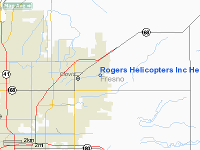
Rogers Helicopters Inc Heliport |
|
|
Location
& QuickFacts
|
FAA
Information Effective: |
2006-09-28 |
|
Airport
Identifier: |
7CL2 |
|
Longitude/Latitude: |
119-40-06.5030W/36-49-25.8190N
-119.668473/36.823839 (Estimated) |
|
Elevation: |
370 ft / 112.78 m (Estimated) |
|
Land: |
8 acres |
|
From
nearest city: |
1 nautical miles E of Clovis, CA |
|
Location: |
Fresno County, CA |
|
Magnetic Variation: |
15E (1985) |
Owner
& Manager
|
Ownership: |
Privately owned |
|
Owner: |
Wanda L. Rogers, President |
|
Address: |
Po Box 4
Clovis, CA 93613 |
|
Phone number: |
559-292-5248 |
|
Manager: |
Wanda L. Rogers, President |
|
Address: |
Po Box 4
Clovis, CA 93613 |
|
Phone number: |
559-292-5248 |
Airport
Operations and Facilities
|
Airport
Use: |
Private |
|
Wind
indicator: |
Yes |
|
Segmented
Circle: |
Yes |
|
Control
Tower: |
No |
|
Attendance
Schedule: |
ALL/MON-SAT/0900-1730 |
|
Lighting
Schedule: |
RDO-CTL
FOR ROTG BCN - 122.8. |
|
Beacon Color: |
Clear-Green-Yellow (heliport) |
|
Landing fee charge: |
No |
|
Sectional chart: |
San Francisco |
|
Region: |
AWP - Western-Pacific |
|
Boundary ARTCC: |
ZOA - Oakland |
|
Tie-in FSS: |
RIU - Rancho Murieta |
|
FSS on Airport: |
No |
|
FSS Phone: |
916-354-0161 |
|
FSS Toll Free: |
1-800-WX-BRIEF |
Airport
Communications
|
Unicom: |
122.800
MULTICOM FREQ 123.05. |
Airport
Services
|
Fuel
available: |
A |
|
Airframe
Repair: |
NONE |
|
Power
Plant Repair: |
NONE |
|
Runway Information
Helipad H1
|
Dimension: |
400 x 200 ft / 121.9 x 61.0 m |
|
Surface: |
TURF, |
|
|
Runway H1 |
Runway |
|
Elevation: |
340.00 ft |
0.00
ft |
|
Traffic
Pattern: |
Left |
Left |
|
Radio Navigation
Aids
|
ID |
Type |
Name |
Ch |
Freq |
Var |
Dist |
|
CUK |
NDB |
Academy |
|
266.00 |
14E |
5.9 nm |
|
FCH |
NDB |
Chandler |
|
344.00 |
15E |
10.0 nm |
|
COR |
NDB |
Salyer Farms |
|
205.00 |
16E |
46.0 nm |
|
NLC |
TACAN |
Lemoore |
080X |
|
16E |
32.2 nm |
|
VIS |
VOR/DME |
Visalia |
031X |
109.40 |
16E |
28.9 nm |
|
HYP |
VOR/DME |
El Nido |
089X |
114.20 |
15E |
42.4 nm |
|
CZQ |
VORTAC |
Clovis |
076X |
112.90 |
15E |
7.9 nm |
|
FRA |
VORTAC |
Friant |
103X |
115.60 |
17E |
17.2 nm |
Based Aircraft
|
Aircraft
based on field: |
10 |
|
Helicopters: |
10 |
Rogers Helicopters Inc Heliport
Address:
Fresno County, CA
Tel:
559-292-5248
Images
and information placed above are from
http://www.airport-data.com/airport/7CL2/
We
thank them for the data!
| General
Info |
| Country |
United
States |
| State |
CALIFORNIA
|
| FAA ID |
7CL2
|
| Latitude |
36-49-25.819N
|
| Longitude |
119-40-06.503W
|
| Elevation |
370 feet
|
| Near City |
CLOVIS
|
We don't guarantee the information is fresh and accurate. The data may
be wrong or outdated.
For more up-to-date information please refer to other sources.
|
|


