 |
|
| Rogers Field |
| IATA: none – ICAO: none – FAA LID: O05 |
| Summary |
| Airport type |
Public |
| Location |
Chester, California |
| Elevation AMSL |
4,528 ft / 1,380 m |
| Coordinates |
40°16′56.470″N 121°14′28.206″W / 40.2823528°N 121.24116833°W / 40.2823528; -121.24116833Coordinates: 40°16′56.470″N 121°14′28.206″W / 40.2823528°N 121.24116833°W / 40.2823528; -121.24116833 |
| Runways |
| Direction |
Length |
Surface |
| ft |
m |
| 16/34 |
5,000 |
1,524 |
Asphalt |
| 5/23 |
5,320 |
1,622 |
Gravel |
Rogers Field (FAA LID: O05) is a public airport bordering the southwest of the town of Chester, serving Plumas County, California, USA. The airport has two runways and is mostly used for general aviation and USFS/CDF access.
In addition to its civil-aviation role it also serves as the Chester Air Attack Base, a logistical & coordination facility owned and managed by Lassen National Forest, (LNF) USFS, for the support of the LNF Air Attack 06, Copter 510, California Department of Forestry's aerial firefighting aircraft (both fixed-wing and helicopter) and other air tankers and Heli-tankers leased by the USFS. Resources include fueling, retardant loading for aerial tankers, communications, and some quartering for aircrew, helitack, and ground fire-fighting teams.
Facilities
Rogers Field has two runways:
- Runway 16/34: 5,000 x 100 ft (1,524 x 30 m). Surface: Asphalt
- Runway 5/23: 5,320 x 120 ft (1,622 x 37 m). Surface: Gravel
Runway 5/23 is closed indefinitely and no longer maintained.
The above content comes from Wikipedia and is published under free licenses – click here to read more.
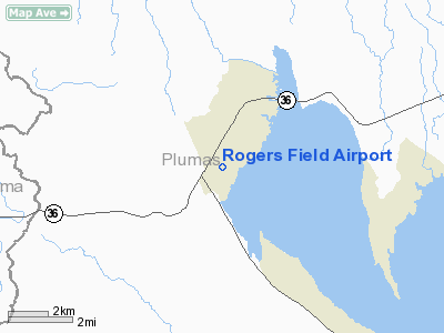
Location
& QuickFacts
|
FAA
Information Effective: |
2006-09-28 |
|
Airport
Identifier: |
O05 |
|
Longitude/Latitude: |
121-14-28.2060W/40-16-56.4700N
-121.241168/40.282353 (Estimated) |
|
Elevation: |
4528 ft / 1380.13 m (Estimated) |
|
Land: |
890 acres |
|
From
nearest city: |
2 nautical miles SW of Chester, CA |
|
Location: |
Plumas County, CA |
|
Magnetic Variation: |
17E (1985) |
Owner
& Manager
|
Ownership: |
Publicly owned |
|
Owner: |
County Of Plumas |
|
Address: |
555 W Main Street
Quincy, CA 95971 |
|
Phone
number: |
530-283-6210 |
|
Manager: |
John Mcmorrow |
|
Address: |
555 W Main Street
Quincy, CA 95971 |
|
Phone number: |
530-283-7011
AIRPORT FBO PHONE. |
Airport
Operations and Facilities
|
Airport
Use: |
Open to public |
|
Wind
indicator: |
Yes |
|
Segmented
Circle: |
Yes |
|
Control
Tower: |
No |
|
Attendance
Schedule: |
ALL/ALL/0800-DUSK |
|
Lighting
Schedule: |
DUSK-DAWN
ACTVT MIRL RY 16/34 & PAPI RYS 16 & 34 - CTAF. |
|
Beacon
Color: |
Clear-Green (lighted land airport) |
|
Landing
fee charge: |
No |
|
Sectional
chart: |
Klamath Falls |
|
Region: |
AWP - Western-Pacific |
|
Traffic
Pattern Alt: |
1000 ft |
|
Boundary
ARTCC: |
ZOA - Oakland |
|
Tie-in
FSS: |
RIU - Rancho Murieta |
|
FSS
on Airport: |
No |
|
FSS
Phone: |
916-354-0161 |
|
FSS
Toll Free: |
1-800-WX-BRIEF |
|
NOTAMs
Facility: |
RIU (NOTAM-d service avaliable) |
|
Federal Agreements: |
NGY |
Airport
Communications
|
CTAF: |
122.800 |
|
Unicom: |
122.800 |
Airport
Services
|
Fuel
available: |
100LLA |
|
Airframe
Repair: |
MAJOR |
|
Power
Plant Repair: |
MAJOR |
|
Bottled
Oxygen: |
NONE |
|
Bulk
Oxygen: |
NONE |
|
Runway Information
Runway 05/23
|
Dimension: |
5320
x 120 ft / 1621.5 x 36.6 m
300 FT STOPWAY EAST END. |
|
Surface: |
GRAVEL, Good Condition |
|
Weight
Limit: |
Single wheel: 12000 lbs.
ESTIMATED BY OWNER. |
|
|
Runway 05 |
Runway 23 |
|
Traffic
Pattern: |
Left |
Left |
|
Markings: |
None, |
,
END MKD WITH PAINTED TIRES. |
|
Runway
End Identifier: |
No |
No |
|
Centerline
Lights: |
No |
No |
|
Touchdown
Lights: |
No |
No |
|
Obstruction: |
80 ft trees, 60.0 ft from runway, 125 ft left
of centerline |
40 ft tree, 600.0 ft from runway, 60 ft left
of centerline, 15:1 slope to clear |
|
Runway 16/34
|
Dimension: |
5000
x 100 ft / 1524.0 x 30.5 m
300 FT STOPWAY EAST END. |
|
Surface: |
ASPH, Good Condition |
|
Weight
Limit: |
Single wheel: 60000 lbs.
Dual wheel: 110000 lbs.
ESTIMATED
BY OWNER. |
|
Edge
Lights: |
Medium |
|
|
Runway 16 |
Runway 34 |
|
Longitude: |
121-14-32.0000W |
121-14-24.0000W |
|
Latitude: |
40-17-21.0000N |
40-16-31.0000N |
|
Elevation: |
4527.00 ft |
4506.00 ft |
|
Traffic
Pattern: |
Left |
Right |
|
Markings: |
Basic, Good Condition |
Basic, Good Condition |
|
Crossing
Height: |
0.00
ft |
32.00 ft |
|
VASI: |
2-light PAPI on left side |
2-light PAPI on left side |
|
Visual
Glide Angle: |
3.00� |
3.00� |
|
Runway
End Identifier: |
No |
No |
|
Centerline
Lights: |
No |
No |
|
Touchdown
Lights: |
No |
No |
|
Obstruction: |
50 ft trees, 1200.0 ft from runway, 375 ft
left of centerline, 20:1 slope to clear |
67 ft trees, 2500.0 ft from runway, 350 ft
left of centerline, 34:1 slope to clear |
|
Radio Navigation
Aids
|
ID |
Type |
Name |
Ch |
Freq |
Var |
Dist |
|
PBT |
NDB |
Proberta |
|
338.00 |
16E |
46.8 nm |
|
CIC |
VOR/DME |
Chico |
035X |
109.80 |
16E |
40.7 nm |
|
RDD |
VOR/DME |
Redding |
021X |
108.40 |
18E |
49.9 nm |
|
AHC |
VOR/DME |
Amedee |
027X |
109.00 |
17E |
50.0 nm |
|
RBL |
VORTAC |
Red Bluff |
104X |
115.70 |
18E |
47.0 nm |
Remarks
- RY
05/23 CLSD WINTERS.
- PAEW
ON AND INVOF ARPT.
- ESTABD
PRIOR TO 15 MAY 1959.
Based Aircraft
|
Aircraft
based on field: |
26 |
|
Single
Engine Airplanes: |
24 |
|
Jet Engine
Airplanes: |
1 |
|
Helicopters: |
1 |
Operational Statistics
|
Aircraft
Operations: |
44/Day |
|
Air Taxi: |
4.5% |
|
General
Aviation Local: |
25.5% |
|
General
Aviation Itinerant: |
70.1% |
Rogers Field Airport
Address:
Plumas County, CA
Tel:
530-283-6210,
530-283-7011
Images
and information placed above are from
http://www.airport-data.com/airport/O05/
We
thank them for the data!
| General
Info |
| Country |
United
States |
| State |
CALIFORNIA
|
| FAA ID |
O05
|
| Latitude |
40-16-56.470N
|
| Longitude |
121-14-28.206W
|
| Elevation |
4528 feet
|
| Near City |
CHESTER
|
We don't guarantee the information is fresh and accurate. The data may
be wrong or outdated.
For more up-to-date information please refer to other sources.
|
|


