 |
|
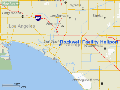
Rockwell Facility Heliport |
|
|
Location
& QuickFacts
|
FAA
Information Effective: |
2006-09-28 |
|
Airport
Identifier: |
CL98 |
|
Longitude/Latitude: |
118-05-05.2290W/33-45-28.0610N
-118.084786/33.757795 (Estimated) |
|
Elevation: |
12 ft / 3.66 m (Estimated) |
|
Land: |
0 acres |
|
From
nearest city: |
1 nautical miles NE of Seal Beach, CA |
|
Location: |
Orange County, CA |
|
Magnetic Variation: |
14E (1985) |
Owner
& Manager
|
Ownership: |
Privately owned |
|
Owner: |
Rockwell Int'l. Corp. |
|
Address: |
2230 E. Imperial Highway
El Segundo, CA 90245 |
|
Phone
number: |
213-647-5327 |
|
Manager: |
N. M. Thomas, Dir., Flt Ops |
|
Address: |
2230 E. Imperial Highway
El Segundo, CA 90245 |
|
Phone number: |
213-647-5327 |
Airport
Operations and Facilities
|
Airport
Use: |
Private |
|
Wind
indicator: |
Yes |
|
Segmented
Circle: |
No |
|
Control
Tower: |
No |
|
Attendance
Schedule: |
ALL/MON-FRI/0700-2100 |
|
Lighting
Schedule: |
PHONE REQ
FOR PERIMETER LGTS CALL 213-647-5327. |
|
Sectional
chart: |
Los Angeles |
|
Region: |
AWP - Western-Pacific |
|
Boundary
ARTCC: |
ZLA - Los Angeles |
|
Tie-in
FSS: |
HHR - Hawthorne |
|
FSS
Phone: |
310-970-0102 |
|
FSS
Toll Free: |
1-800-WX-BRIEF |
|
Runway Information
Helipad H1
|
Dimension: |
60 x 60 ft / 18.3 x 18.3 m |
|
Surface: |
CONC-TURF, |
|
|
Runway H1 |
Runway |
|
Traffic
Pattern: |
Left |
Left |
|
Radio Navigation
Aids
|
ID |
Type |
Name |
Ch |
Freq |
Var |
Dist |
|
CPM |
NDB |
Compton |
|
378.00 |
15E |
11.3 nm |
|
EMT |
NDB |
El Monte |
|
359.00 |
15E |
20.0 nm |
|
PAI |
NDB |
Pacoima |
|
370.00 |
15E |
34.3 nm |
|
SB |
NDB |
Petis |
|
397.00 |
14E |
40.1 nm |
|
RIV |
TACAN |
March |
077X |
|
14E |
41.4 nm |
|
NFG |
TACAN |
Camp Pendleton |
055X |
|
13E |
45.5 nm |
|
RAL |
VOR |
Riverside |
|
112.40 |
15E |
33.8 nm |
|
HDF |
VOR |
Homeland |
|
113.40 |
14E |
45.0 nm |
|
ELB |
VOR/DME |
El Toro |
119X |
117.20 |
14E |
18.4 nm |
|
SMO |
VOR/DME |
Santa Monica |
045X |
110.80 |
15E |
24.0 nm |
|
VNY |
VOR/DME |
Van Nuys |
078X |
113.10 |
15E |
34.6 nm |
|
SLI |
VORTAC |
Seal Beach |
104X |
115.70 |
15E |
2.1 nm |
|
LAX |
VORTAC |
Los Angeles |
083X |
113.60 |
15E |
20.3 nm |
|
POM |
VORTAC |
Pomona |
041X |
110.40 |
15E |
24.3 nm |
|
SXC |
VORTAC |
Santa Catalina |
051X |
111.40 |
15E |
28.5 nm |
|
PDZ |
VORTAC |
Paradise |
059X |
112.20 |
15E |
29.3 nm |
|
OCN |
VORTAC |
Oceanside |
100X |
115.30 |
15E |
45.7 nm |
|
SNA |
VOT |
Santa Ana |
|
110.00 |
|
11.8 nm |
|
LAX |
VOT |
San Pedro Hill |
|
113.90 |
|
12.6 nm |
Remarks
- PRVDD
PVT USE/VFR ONLY; LGTG BE INSTALLED PER AC 150/5390-1B IF NGT OPERS
ARE DESIRED; & HELI PLTS MUST CTC LOS ALAMITOS ATCT DUR OPER HRS
ON 123.85/347.5 PRIOR TO ENT/DEP ARPT TFC AREA.
Rockwell Facility Heliport
Address:
Orange County, CA
Tel:
213-647-5327
Images
and information placed above are from
http://www.airport-data.com/airport/CL98/
We
thank them for the data!
| General
Info |
| Country |
United
States |
| State |
CALIFORNIA
|
| FAA ID |
CL98
|
| Latitude |
33-45-28.061N
|
| Longitude |
118-05-05.229W
|
| Elevation |
12 feet
|
| Near City |
SEAL BEACH
|
We don't guarantee the information is fresh and accurate. The data may
be wrong or outdated.
For more up-to-date information please refer to other sources.
|
|


