 |
|
| Roberts Army Heliport |
| IATA: SYL – ICAO: KSYL – FAA LID: SYL |
| Summary |
| Airport type |
Military |
| Owner |
United States Army |
| Location |
Camp Roberts / San Miguel, California |
| Elevation AMSL |
630 ft / 192 m |
| Coordinates |
35°48′54″N 120°44′38″W / 35.815°N 120.74389°W / 35.815; -120.74389 |
| Helipads |
| Number |
Length |
Surface |
| ft |
m |
| H1 |
2,740 |
835 |
Asphalt |
| Source: Federal Aviation Administration |
Roberts Army Heliport (IATA: SYL, ICAO: KSYL, FAA LID: SYL) is a U.S. Army heliport at Camp Roberts in extreme southern Monterey County, California, United States. It is located just off U.S. Route 101, four nautical miles (7 km) northwest of the central business district of San Miguel, about halfway between it and the tiny community of Bradley in southern Monterey County. Roberts AHP has one helipad designated H1 with a 2,740 x 100 ft (835 x 30 m) asphalt surface.
The above content comes from Wikipedia and is published under free licenses – click here to read more.
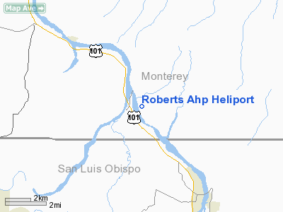
Location
& QuickFacts
|
FAA
Information Effective: |
2006-09-28 |
|
Airport
Identifier: |
SYL |
|
Longitude/Latitude: |
120-44-37.6250W/35-48-53.8790N
-120.743785/35.814966 (Estimated) |
|
Elevation: |
630 ft / 192.02 m (Estimated) |
|
Land: |
0 acres |
|
From
nearest city: |
4 nautical miles NW of Camp Roberts/san Miguel,
CA |
|
Location: |
San Luis Obispo County, CA |
|
Magnetic Variation: |
15E (1985) |
Owner
& Manager
|
Ownership: |
Army owned |
|
Owner: |
U S Army, Atca-aso |
|
Address: |
Cameron Station
Alexandria, VA 22314 |
|
Address: |
|
|
Phone number: |
805-238-3100 |
Airport
Operations and Facilities
|
Airport
Use: |
Private |
|
Segmented
Circle: |
No |
|
Control
Tower: |
No |
|
Lighting
Schedule: |
PHONE REQ
ACTVT HELIPAD PERIMETER LGTS - CTAF. |
|
Sectional chart: |
Los Angeles |
|
Region: |
AWP - Western-Pacific |
|
Boundary ARTCC: |
ZOA - Oakland |
|
Tie-in FSS: |
HHR - Hawthorne |
|
FSS on Airport: |
No |
|
FSS Phone: |
310-970-0102 |
|
FSS Toll Free: |
1-800-WX-BRIEF |
Airport
Communications
|
Runway Information
Helipad H1
|
Dimension: |
2740 x 100 ft / 835.2 x 30.5 m |
|
Surface: |
ASPH, |
|
|
Runway H1 |
Runway |
|
Traffic
Pattern: |
Left |
Left |
|
Radio Navigation
Aids
|
ID |
Type |
Name |
Ch |
Freq |
Var |
Dist |
|
HGT |
NDB |
Hunter Liggett |
|
209.00 |
15E |
23.4 nm |
|
NLC |
TACAN |
Lemoore |
080X |
|
16E |
49.4 nm |
|
ROM |
VOR |
Priest |
|
110.00 |
16E |
19.9 nm |
|
PRB |
VORTAC |
Paso Robles |
090X |
114.30 |
16E |
10.3 nm |
|
MQO |
VORTAC |
Morro Bay |
071X |
112.40 |
16E |
33.8 nm |
|
AVE |
VORTAC |
Avenal |
118X |
117.10 |
16E |
38.7 nm |
|
BSR |
VORTAC |
Big Sur |
087X |
114.00 |
16E |
48.9 nm |
Remarks
- LIGHTED
MED EVAC HELIPAD LCTD 1.2NM SW OF FLD, OPERS 1500-0300Z MON-FRI.
- AFLD
CLSD TO F/W ACFT.
- TFC
PAT - R/W W 1100 FT.
- PPR
FOR ALL OPNS WITHIN ROBERTS MIL RESERVATION; FOR PPR WHEN AFLD OPER
V949-8181 OR C805-238-8181 OT V949-8269 OR C805-238-8269.
Roberts Ahp Heliport
Address:
San Luis Obispo County, CA
Tel:
805-238-3100
Images
and information placed above are from
http://www.airport-data.com/airport/SYL/
We
thank them for the data!
| General
Info |
| Country |
United
States |
| State |
CALIFORNIA
|
| FAA ID |
SYL
|
| Latitude |
35-48-53.879N
|
| Longitude |
120-44-37.625W
|
| Elevation |
630 feet
|
| Near City |
CAMP ROBERTS/SAN
MIGUEL |
We don't guarantee the information is fresh and accurate. The data may
be wrong or outdated.
For more up-to-date information please refer to other sources.
|
|


