 |
|
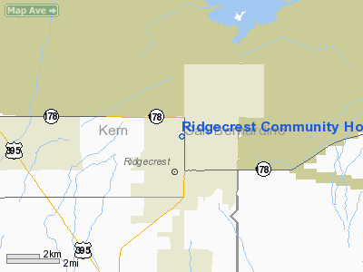
Ridgecrest Community Hospital Heliport |
|
|
Location
& QuickFacts
|
FAA
Information Effective: |
2006-09-28 |
|
Airport
Identifier: |
CA77 |
|
Longitude/Latitude: |
117-40-17.2300W/35-38-27.8400N
-117.671453/35.641067 (Estimated) |
|
Elevation: |
2290 ft / 697.99 m (Estimated) |
|
Land: |
0 acres |
|
From
nearest city: |
1 nautical miles N of Ridgecrest, CA |
|
Location: |
Kern County, CA |
|
Magnetic Variation: |
14E (1985) |
Owner
& Manager
|
Ownership: |
Privately owned |
|
Owner: |
Ridgecrest Community Hosp |
|
Address: |
1081 N China Lake Blvd
Ridgecrest, CA 93555 |
|
Phone
number: |
619-446-3551 |
|
Manager: |
David Mechtenberg
ADMINISTRATOR |
|
Address: |
1081 N China Lake Blvd
Ridgecrest, CA 93555 |
|
Phone number: |
619-446-3551 |
Airport
Operations and Facilities
|
Airport Use: |
Private
MEDICAL. |
|
Wind indicator: |
Yes |
|
Segmented Circle: |
No |
|
Control Tower: |
No |
|
Attendance Schedule: |
IREG |
|
Landing fee charge: |
No |
|
Sectional chart: |
Los Angeles |
|
Region: |
AWP - Western-Pacific |
|
Boundary ARTCC: |
ZLA - Los Angeles |
|
Tie-in FSS: |
RAL - Riverside |
|
FSS on Airport: |
No |
|
FSS Phone: |
951-351-3020 |
|
FSS Toll Free: |
1-800-WX-BRIEF |
Airport
Services
|
Airframe
Repair: |
NONE |
|
Power
Plant Repair: |
NONE |
|
Runway Information
Helipad H1
|
Dimension: |
50 x 50 ft / 15.2 x 15.2 m |
|
Surface: |
CONC, |
|
|
Runway H1 |
Runway |
|
Traffic
Pattern: |
Right |
Left |
|
Radio Navigation
Aids
|
ID |
Type |
Name |
Ch |
Freq |
Var |
Dist |
|
NID |
TACAN |
China Lake |
053X |
|
16E |
3.0 nm |
|
EDW |
VORTAC |
Edwards |
111X |
116.40 |
15E |
39.7 nm |
Remarks
Ridgecrest Community Hospital Heliport
Address:
Kern County, CA
Tel:
619-446-3551
Images
and information placed above are from
http://www.airport-data.com/airport/CA77/
We
thank them for the data!
| General
Info |
| Country |
United
States |
| State |
CALIFORNIA
|
| FAA ID |
CA77
|
| Latitude |
35-38-27.840N
|
| Longitude |
117-40-17.230W
|
| Elevation |
2290 feet
|
| Near City |
RIDGECREST
|
We don't guarantee the information is fresh and accurate. The data may
be wrong or outdated.
For more up-to-date information please refer to other sources.
|
|


