|
|
Reid-hillview Of Santa Clara County Airport |
| Reid-Hillview Airport of Santa Clara County |
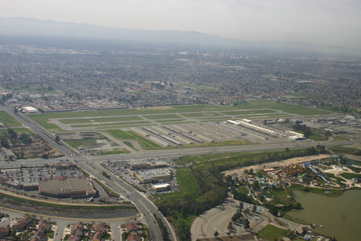 |
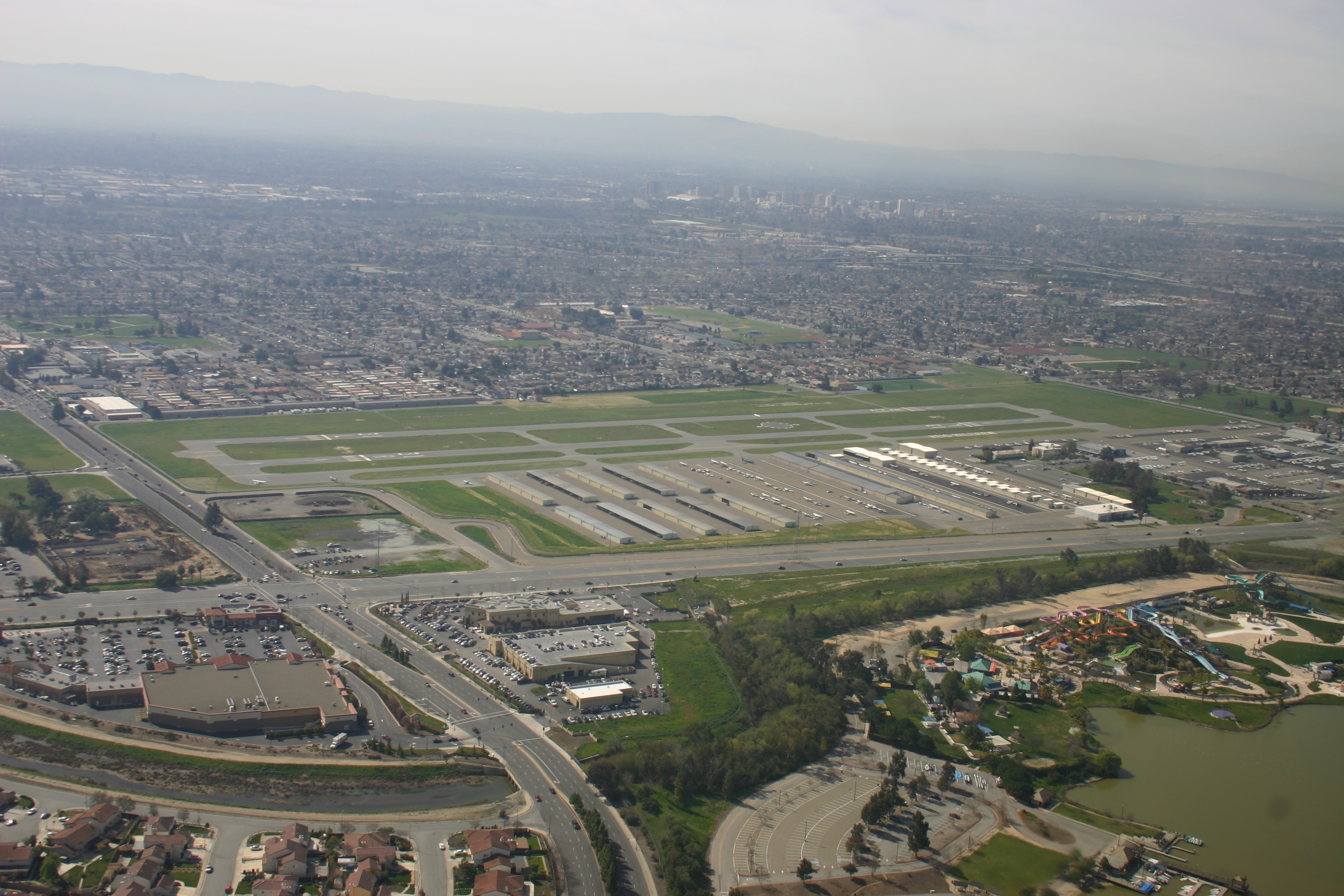
| Aerial view of airport from the east |
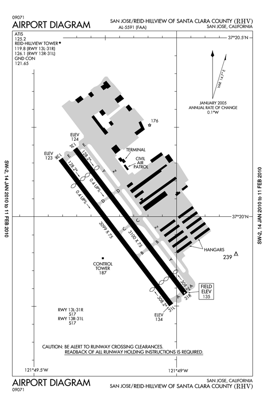 |
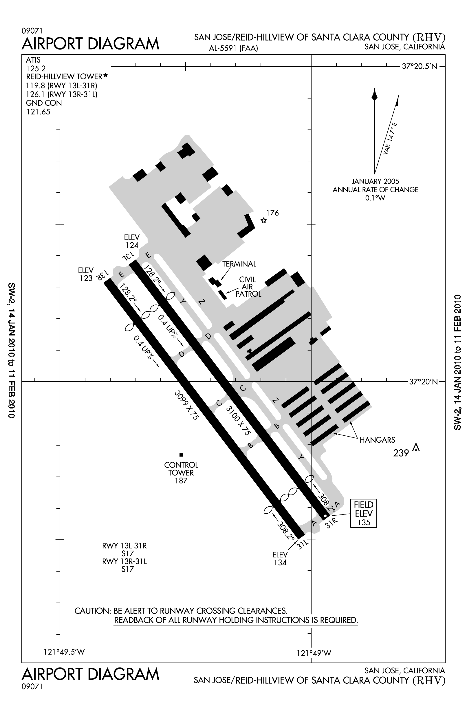
| Reid-Hillview Airport diagram |
| IATA: RHV – ICAO: KRHV – FAA LID: RHV |
| Summary |
| Airport type |
Public |
| Owner |
Santa Clara County, California |
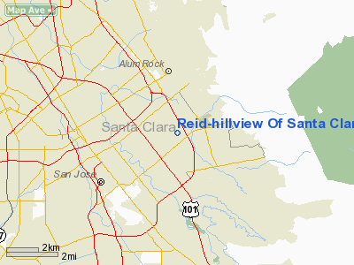
| Location |
San Jose, California |
| Elevation AMSL |
133 ft / 40.5 m |
| Coordinates |
37°19′58″N 121°49′11″W / 37.33278°N 121.81972°W / 37.33278; -121.81972Coordinates: 37°19′58″N 121°49′11″W / 37.33278°N 121.81972°W / 37.33278; -121.81972 |
| Runways |
| Direction |
Length |
Surface |
| ft |
m |
| 13L/31R |
3100 |
945 |
Asphalt |
| 13R/31L |
3099 |
945 |
Asphalt |
Reid-Hillview Airport of Santa Clara County (IATA: RHV, ICAO: KRHV, FAA LID: RHV) is located in the eastern part of San Jose, south of San Francisco Bay, in Santa Clara County, California, USA. The airport is owned by Santa Clara County.
Reid-Hillview is a general aviation airport; there is no scheduled airline service. However, as with most general aviation airports air charter operations are available. The airport has a control tower that operates 7 a.m. to 10 p.m. local time. The FAA classifies Reid-Hillview as a reliever airport for San Jose International Airport, providing public access via general aviation to the San Jose area while separating the faster and slower traffic to different airports. History
Groundbreaking for Reid-Hillview airport came in 1937. Bob and Cecil Reid first built the Garden City Airport in 1935, which was quickly closed to make room for U.S. Route 101. Their second site was northwest of the Hillview golf course, hence the name. Until 1946, the single runway at the airport was unpaved.
Reid-Hillview was a single runway airport until 1965, when a second runway was added. The control tower was added in October 1967.
The airport became the origin for an emergency supply airlift to the Watsonville Municipal Airport following the 1989 Loma Prieta earthquake, after mountain and coastal roads were blocked, cutting off Santa Cruz and Watsonville from relief efforts by ground. The Watsonville Airport estimates that it received 100 tons of supplies via the airlift during the week following the quake. John McAvoy and Bill Dunn of the Reid-Hillview Airport Association received the 1990 Grand Award from the Bay Area's Metropolitan Transportation Commission for organizing the airlift.
In 2010, San Jose State University's Aviation program relocated to Reid-Hillview. The University operates out of the Swift Building, where it holds classes during the academic year.
Fixed base operators
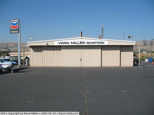
At Reid-Hillview, fixed base operators (FBOs) compete for fuel sales, aircraft rentals and/or flight training.
- Air Accord
- AeroDynamic Aviation, formerly Amelia Reid Aviation
- Nice Air Aviation
- Squadron 2 Flying Club
- Trade Winds Aviation
Ground transportation
Capitol Expressway (County Route G21) is at the entrance to the airport at Cunningham Ave.
Car/taxi
Taxis are not located on-field. They may be dispatched by phone to the terminal building.
Rental cars (Enterprise) are located in the same building with the Airport Shoppe at the airport entrance.
Bus
The Santa Clara Valley Transportation Authority (VTA) has its Eastridge Transit Center across Tully Road at Eastridge Mall, about 1/2 mile walk southbound along Capitol Expressway. For transit options, see a Google Transit search starting from Reid-Hillview Airport.
VTA has future plans for a bus rapid transit line from the Diridon train station in downtown San Jose to the Eastridge Transit Center. Further distant future plans with less certain funding include a light rail extension from the Alum Rock station to Eastridge. In both cases, the segment along Capitol Expressway would serve Reid-Hillview.
The above content comes from Wikipedia and is published under free licenses – click here to read more.
|
 |
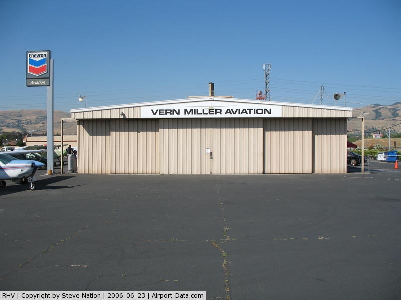
(Click on the photo to enlarge) |
|
 |
(Click on the photo to enlarge) |
|
 |
(Click on the photo to enlarge) |
Location
& QuickFacts
|
FAA
Information Effective: |
2006-09-28 |
|
Airport
Identifier: |
RHV |
|
Longitude/Latitude: |
121-49-11.3000W/37-19-58.3000N
-121.819806/37.332861 (Estimated) |
|
Elevation: |
135 ft / 41.15 m (Surveyed) |
|
Land: |
179 acres |
|
From
nearest city: |
4 nautical miles SE of San Jose, CA |
|
Location: |
Santa Clara County, CA |
|
Magnetic Variation: |
16E (1985) |
Owner
& Manager
|
Ownership: |
Publicly owned |
|
Owner: |
County Of Santa Clara |
|
Address: |
2500 Cunningham Ave
San Jose, CA 95148 |
|
Phone
number: |
408-929-1060
DIRECTOR OF AIRPORTS, CARL HONAKER. |
|
Manager: |
Chris Nucci |
|
Address: |
2500 Cunningham Ave.
San Jose, CA 95148 |
|
Phone number: |
408-929-2256 |
Airport
Operations and Facilities
|
Airport
Use: |
Open to public |
|
Wind
indicator: |
Yes |
|
Segmented
Circle: |
Yes |
|
Control
Tower: |
Yes |
|
Attendance
Schedule: |
ALL/ALL/0700-2200 |
|
Lighting
Schedule: |
DUSK-DAWN |
|
Beacon
Color: |
Clear-Green (lighted land airport) |
|
Landing
fee charge: |
No |
|
Sectional
chart: |
San Francisco |
|
Region: |
AWP - Western-Pacific |
|
Traffic
Pattern Alt: |
1000 ft |
|
Boundary
ARTCC: |
ZOA - Oakland |
|
Tie-in
FSS: |
OAK - Oakland |
|
FSS
on Airport: |
No |
|
FSS
Phone: |
510-273-6111 |
|
FSS
Toll Free: |
1-800-WX-BRIEF |
|
NOTAMs
Facility: |
RHV (NOTAM-d service avaliable) |
|
Federal Agreements: |
NGY |
Airport
Communications
|
CTAF: |
119.800 |
|
Unicom: |
122.950 |
Airport
Services
|
Fuel
available: |
100LLA
SELF-FUELING AVIALABLE 24/7. |
|
Airframe
Repair: |
MAJOR |
|
Power
Plant Repair: |
MAJOR |
|
Bottled
Oxygen: |
LOW |
|
Bulk
Oxygen: |
LOW |
|
Runway Information
Runway 13L/31R
|
Dimension: |
3100 x 75 ft / 944.9 x 22.9 m |
|
Surface: |
ASPH, Good Condition |
|
Weight
Limit: |
Single wheel: 17000 lbs. |
|
Edge
Lights: |
Medium |
|
|
Runway 13L |
Runway 31R |
|
Longitude: |
121-49-21.3662W |
121-48-58.2046W |
|
Latitude: |
37-20-11.4493N |
37-19-47.0107N |
|
Elevation: |
124.00 ft |
135.00 ft |
|
Alignment: |
127 |
127 |
|
Traffic
Pattern: |
Left |
Right |
|
Markings: |
Basic, Good Condition |
Basic, Good Condition |
|
Crossing
Height: |
25.00 ft |
17.00
ft |
|
Displaced
threshold: |
499.00 ft |
410.00 ft |
|
VASI: |
2-box on left side |
2-box on left side |
|
Visual
Glide Angle: |
4.00� |
4.00� |
|
Runway
End Identifier: |
Yes |
Yes |
|
Centerline
Lights: |
No |
No |
|
Touchdown
Lights: |
No |
No |
|
Obstruction: |
31 ft trees, 830.0 ft from runway, 37 ft left
of centerline, 20:1 slope to clear
APCH RATIO TO DSPLCD THR 42:1. |
16 ft road, 200.0 ft from runway
RWY 31R APCH RATION TO DSPLCD THR 10:1 OVER 60' TREES 150'
RIGHT OF CNTRL AND 650' FM DSPLCD THR.
& 31L +6 FT FENCE 150 FT FROM THR; RY 31R & 31L ROAD
EDGE 155 FT FROM THR. |
|
Runway 13R/31L
|
Dimension: |
3099 x 75 ft / 944.6 x 22.9 m |
|
Surface: |
ASPH, Good Condition |
|
Weight
Limit: |
Single wheel: 17000 lbs. |
|
|
Runway 13R |
Runway 31L |
|
Longitude: |
121-49-24.3301W |
121-49-01.1735W |
|
Latitude: |
37-20-09.6541N |
37-19-45.2266N |
|
Elevation: |
123.00 ft |
134.00 ft |
|
Alignment: |
127 |
127 |
|
Traffic
Pattern: |
Right |
Left |
|
Markings: |
Basic, Good Condition |
Basic, Good Condition |
|
Crossing
Height: |
0.00
ft |
17.00
ft |
|
Displaced
threshold: |
499.00 ft |
409.00 ft |
|
VASI: |
|
2-box on left side |
|
Visual
Glide Angle: |
0.00� |
4.00� |
|
Runway
End Identifier: |
No |
No |
|
Centerline
Lights: |
No |
No |
|
Touchdown
Lights: |
No |
No |
|
Obstruction: |
35 ft trees, 900.0 ft from runway, 170 ft right
of centerline, 20:1 slope to clear
APCH RATIO TO DSPLCD THR 39:1. |
18 ft road, 200.0 ft from runway
APCH RATIO TO DSPLCD THR 33:1 |
|
Radio Navigation
Aids
|
ID |
Type |
Name |
Ch |
Freq |
Var |
Dist |
|
LV |
NDB |
Reiga |
|
374.00 |
16E |
22.5 nm |
|
PDG |
NDB |
Pajar |
|
327.00 |
17E |
25.2 nm |
|
TCY |
NDB |
Tracy |
|
203.00 |
15E |
28.1 nm |
|
NUQ |
TACAN |
Moffett |
123X |
|
17E |
12.8 nm |
|
SJC |
VOR/DME |
San Jose |
088X |
114.10 |
16E |
6.5 nm |
|
SFO |
VOR/DME |
San Francisco |
105X |
115.80 |
17E |
31.6 nm |
|
CCR |
VOR/DME |
Concord |
117X |
117.00 |
17E |
44.1 nm |
|
MOD |
VOR/DME |
Modesto |
093X |
114.60 |
17E |
44.8 nm |
|
OSI |
VORTAC |
Woodside |
086X |
113.90 |
17E |
22.3 nm |
|
OAK |
VORTAC |
Oakland |
115X |
116.80 |
17E |
30.5 nm |
|
SNS |
VORTAC |
Salinas |
120X |
117.30 |
17E |
41.5 nm |
|
ECA |
VORTAC |
Manteca |
107X |
116.00 |
17E |
43.1 nm |
|
SAU |
VORTAC |
Sausalito |
109X |
116.20 |
17E |
45.9 nm |
|
SFO |
VOT |
San Francisco Intl |
|
111.00 |
|
31.6 nm |
Remarks
- RY
31R CALM WIND RY WHEN ATCT CLSD.
-
< NOISE
36 FAR MEETING THOSE EXCEPT ACFT MIL SURPLUS NO AND JET PURE>
- NO
TURNS BLO 500' WHEN LEAVING PATTERN EXCEPT RWY 31R DEPARTURES - AS SOON
AS PRACTICABLE AFTER DEPARTURE MAKE A SLIGHT RIGHT TURN TO AVOID SCHOOL
ONE HALF MILE OFF DEPARTURE END.
- NO
TOUCH & GO LNDGS BTN 2100-0700.
- NO
SIMULATED EMERGENCIES IN ARPT TFC AREA.
- BIRDS
ON AND INVOF ARPT.
Based Aircraft
|
Aircraft
based on field: |
697 |
|
Single
Engine Airplanes: |
616 |
|
Multi
Engine Airplanes: |
74 |
|
Helicopters: |
7 |
Operational Statistics
|
Aircraft
Operations: |
631/Day |
|
General
Aviation Local: |
60.2% |
|
General
Aviation Itinerant: |
39.8% |
Reid-hillview Of Santa Clara County Airport
Address:
Santa Clara County, CA
Tel:
408-929-1060, 408-929-2256
Images
and information placed above are from
http://www.airport-data.com/airport/RHV/
We
thank them for the data!
| General
Info |
| Country |
United
States |
| State |
CALIFORNIA
|
| FAA ID |
RHV
|
| Latitude |
37-19-58.343N
|
| Longitude |
121-49-11.261W
|
| Elevation |
133 feet
|
| Near City |
SAN JOSE
|
We don't guarantee the information is fresh and accurate. The data may
be wrong or outdated.
For more up-to-date information please refer to other sources.
|
|