 |
|
|
|
Location
& QuickFacts
|
FAA
Information Effective: |
2006-09-28 |
|
Airport
Identifier: |
49CN |
|
Longitude/Latitude: |
122-23-23.9910W/40-00-57.5570N
-122.389997/40.015988 (Estimated) |
|
Elevation: |
550 ft / 167.64 m (Estimated) |
|
Land: |
36 acres |
|
From
nearest city: |
10 nautical miles SW of Red Bluff, CA |
|
Location: |
Tehama County, CA |
|
Magnetic Variation: |
17E (1985) |
Owner
& Manager
|
Ownership: |
Privately owned |
|
Owner: |
Rancho Tehama Association |
|
Address: |
Rtr Box 5111
Corning, CA 96021 |
|
Phone number: |
530-585-2444 |
|
Manager: |
Larry Korodi |
|
Address: |
Rtr Box 5111
Corning, CA 96021 |
|
Phone number: |
530-585-2444 |
Airport
Operations and Facilities
|
Airport Use: |
Private |
|
Wind indicator: |
Yes |
|
Segmented Circle: |
No |
|
Control Tower: |
No |
|
Attendance Schedule: |
UNATNDD |
|
Landing fee charge: |
No |
|
Sectional chart: |
Klamath Falls |
|
Region: |
AWP - Western-Pacific |
|
Boundary ARTCC: |
ZOA - Oakland |
|
Tie-in FSS: |
RIU - Rancho Murieta |
|
FSS on Airport: |
No |
|
FSS Phone: |
916-354-0161 |
|
FSS Toll Free: |
1-800-WX-BRIEF |
Airport
Services
|
Airframe
Repair: |
NONE |
|
Power
Plant Repair: |
NONE |
|
Runway Information
Runway 09/27
|
Dimension: |
3750 x 40 ft / 1143.0 x 12.2 m |
|
Surface: |
OIL&CHIP-T, Good Condition |
|
|
Runway 09 |
Runway 27 |
|
Traffic
Pattern: |
Left |
Right |
|
Radio Navigation
Aids
|
ID |
Type |
Name |
Ch |
Freq |
Var |
Dist |
|
PBT |
NDB |
Proberta |
|
338.00 |
16E |
9.2 nm |
|
OVE |
NDB |
Oroville |
|
212.00 |
16E |
47.3 nm |
|
CIC |
VOR/DME |
Chico |
035X |
109.80 |
16E |
28.5 nm |
|
RDD |
VOR/DME |
Redding |
021X |
108.40 |
18E |
29.7 nm |
|
RBL |
VORTAC |
Red Bluff |
104X |
115.70 |
18E |
8.6 nm |
|
MXW |
VORTAC |
Maxwell |
037X |
110.00 |
18E |
42.7 nm |
Based Aircraft
|
Aircraft
based on field: |
9 |
|
Single
Engine Airplanes: |
8 |
|
Ultralights: |
1 |
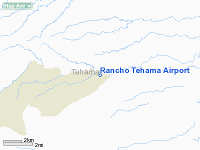
Rancho Tehama Airport
Address:
Tehama County, CA
Tel:
530-585-2444
Images
and information placed above are from
http://www.airport-data.com/airport/49CN/
We
thank them for the data!
| General
Info |
| Country |
United
States |
| State |
CALIFORNIA
|
| FAA ID |
49CN
|
| Latitude |
40-00-57.557N
|
| Longitude |
122-23-23.991W
|
| Elevation |
550 feet
|
| Near City |
RED BLUFF
|
We don't guarantee the information is fresh and accurate. The data may
be wrong or outdated.
For more up-to-date information please refer to other sources.
|
|


