 |
|
Location
& QuickFacts
|
FAA
Information Effective: |
2006-09-28 |
|
Airport
Identifier: |
4CL4 |
|
Longitude/Latitude: |
117-01-35.0000W/34-27-16.0000N
-117.026389/34.454444 (Estimated) |
|
Elevation: |
2942 ft / 896.72 m (Estimated) |
|
Land: |
160 acres |
|
From
nearest city: |
3 nautical miles NW of Lucerne, CA |
|
Location: |
San Bernardino County, CA |
|
Magnetic Variation: |
14E (1990) |
Owner
& Manager
|
Ownership: |
Privately owned |
|
Owner: |
Edward Bilewitch |
|
Address: |
7100 Santa Fe Ave E
Hesperia, CA 92345 |
|
Phone number: |
619-948-3111 |
|
Address: |
|
Airport
Operations and Facilities
|
Airport
Use: |
Private |
|
Wind
indicator: |
Yes |
|
Segmented
Circle: |
Yes |
|
Control
Tower: |
No |
|
Attendance
Schedule: |
UNATNDD |
|
Sectional
chart: |
Los Angeles |
|
Region: |
AWP - Western-Pacific |
|
Boundary
ARTCC: |
ZLA - Los Angeles |
|
Tie-in
FSS: |
RAL - Riverside |
|
FSS
on Airport: |
No |
|
FSS
Phone: |
951-351-3020 |
|
FSS
Toll Free: |
1-800-WX-BRIEF |
|
Runway Information
Runway 08/26
|
Dimension: |
3530 x 100 ft / 1075.9 x 30.5 m |
|
Surface: |
DIRT,
1500 FT USABLE WHEN WET. |
|
|
Runway 08 |
Runway 26 |
|
Traffic
Pattern: |
Right |
Left |
|
Obstruction: |
15 ft road, 200.0 ft from runway |
|
|
Runway 14/32
|
Dimension: |
2200 x 100 ft / 670.6 x 30.5 m |
|
Surface: |
DIRT,
1500 FT USABLE WHEN WET. |
|
|
Runway 14 |
Runway 32 |
|
Traffic
Pattern: |
Right |
Left |
|
Obstruction: |
|
17 ft road, 350.0 ft from runway |
|
Radio Navigation
Aids
|
ID |
Type |
Name |
Ch |
Freq |
Var |
Dist |
|
SB |
NDB |
Petis |
|
397.00 |
14E |
29.3 nm |
|
SJY |
NDB |
San Jacinto |
|
227.00 |
14E |
39.7 nm |
|
RIV |
TACAN |
March |
077X |
|
14E |
35.2 nm |
|
NXP |
TACAN |
Coyote |
063X |
|
14E |
44.1 nm |
|
RAL |
VOR |
Riverside |
|
112.40 |
15E |
36.8 nm |
|
HDF |
VOR |
Homeland |
|
113.40 |
14E |
41.5 nm |
|
VCV |
VOR/DME |
Victorville |
031X |
109.40 |
14E |
19.9 nm |
|
HEC |
VORTAC |
Hector |
074X |
112.70 |
15E |
34.7 nm |
|
DAG |
VORTAC |
Daggett |
079X |
113.20 |
15E |
37.7 nm |
|
PDZ |
VORTAC |
Paradise |
059X |
112.20 |
15E |
40.8 nm |
|
POM |
VORTAC |
Pomona |
041X |
110.40 |
15E |
44.0 nm |
|
PSP |
VORTAC |
Palm Springs |
102X |
115.50 |
13E |
46.0 nm |
|
EDW |
VORTAC |
Edwards |
111X |
116.40 |
15E |
47.2 nm |
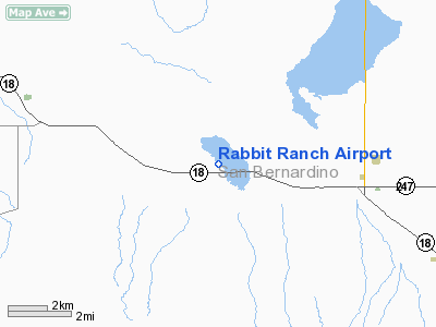
Rabbit Ranch Airport
Address:
San Bernardino County, CA
Tel:
619-948-3111
Images
and information placed above are from
http://www.airport-data.com/airport/4CL4/
We
thank them for the data!
| General
Info |
| Country |
United
States |
| State |
CALIFORNIA
|
| FAA ID |
4CL4
|
| Latitude |
34-27-16.000N
|
| Longitude |
117-01-35.000W
|
| Elevation |
2942 feet
|
| Near City |
LUCERNE
|
We don't guarantee the information is fresh and accurate. The data may
be wrong or outdated.
For more up-to-date information please refer to other sources.
|
|


