 |
|
Poso Airport
Poso-Kern County Airport |
| IATA: none – ICAO: none – FAA LID: L73 |
| Summary |
| Airport type |
Public |
| Owner |
County of Kern Dept. of Airports |
| Serves |
Famoso, California |
| Elevation AMSL |
635 ft / 194 m |
| Coordinates |
35°35′47″N 119°07′42″W / 35.59639°N 119.12833°W / 35.59639; -119.12833 |
| Runways |
| Direction |
Length |
Surface |
| ft |
m |
| 16/34 |
3,000 |
914 |
Asphalt |
| Statistics (2010) |
| Aircraft operations |
1,000 |
| Source: Federal Aviation Administration |
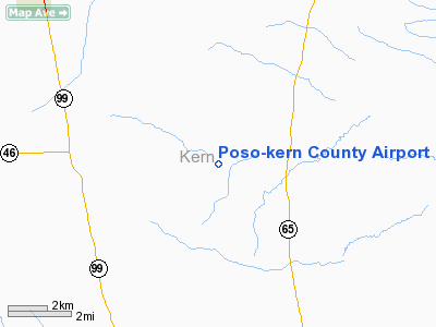
Poso Airport (FAA LID: L73), also known as Poso-Kern County Airport, is a county-owned public-use airport located four nautical miles (7 km) east of the central business district of Famoso, in Kern County, California, United States. The airport is mostly used for general aviation.
Facilities and aircraft
Poso-Kern County Airport covers an area of 400 acres (162 ha) at an elevation of 635 feet (194 m) above mean sea level. It has one runway designated 16/34 with an asphalt surface measuring 3,000 by 60 feet (914 x 18 m). For the 12-month period ending March 17, 2010, the airport had 1,000 general aviation aircraft operations, an average of 83 per month.
The above content comes from Wikipedia and is published under free licenses – click here to read more.
Location
& QuickFacts
|
FAA
Information Effective: |
2006-09-28 |
|
Airport
Identifier: |
L73 |
|
Longitude/Latitude: |
119-07-39.3750W/35-35-47.8390N
-119.127604/35.596622 (Estimated) |
|
Elevation: |
635 ft / 193.55 m (Estimated) |
|
Land: |
400 acres |
|
From
nearest city: |
4 nautical miles E of Famoso, CA |
|
Location: |
Kern County, CA |
|
Magnetic Variation: |
15E (1985) |
Owner
& Manager
|
Ownership: |
Publicly owned |
|
Owner: |
County Of Kern Dept Of Airports |
|
Address: |
3701 Wings Way, Suite 300
Bakersfield, CA 93308-7026 |
|
Phone
number: |
661-391-1800 |
|
Manager: |
Jack Gotcher
CONTACT JACK GOTCHER, DEPUTY DIRECTOR |
|
Address: |
3701 Wings Way, Suite 300
Bakersfield, CA 93308-7026 |
|
Phone
number: |
661-391-1800
CELL PHONE: (661) 747-4055 24 HRS: (661) 393-3868 FAX: (661)
391-1801 EMAIL: BFLSECURITY@CO.KERN.CA.US |
Airport
Operations and Facilities
|
Airport
Use: |
Open to public |
|
Wind
indicator: |
Yes |
|
Segmented
Circle: |
No |
|
Control
Tower: |
No |
|
Attendance
Schedule: |
UNATNDD |
|
Landing
fee charge: |
No |
|
Sectional
chart: |
Los Angeles |
|
Region: |
AWP - Western-Pacific |
|
Traffic
Pattern Alt: |
800 ft |
|
Boundary
ARTCC: |
ZLA - Los Angeles |
|
Tie-in
FSS: |
RIU - Rancho Murieta |
|
FSS
on Airport: |
No |
|
FSS
Phone: |
916-354-0161 |
|
FSS
Toll Free: |
1-800-WX-BRIEF |
|
NOTAMs
Facility: |
RIU (NOTAM-d service avaliable) |
|
Federal Agreements: |
R |
Airport
Communications
Airport
Services
|
Airframe
Repair: |
NONE |
|
Power
Plant Repair: |
NONE |
|
Bottled
Oxygen: |
NONE |
|
Bulk
Oxygen: |
NONE |
|
Runway Information
Runway 16/34
|
Dimension: |
3000 x 60 ft / 914.4 x 18.3 m |
|
Surface: |
ASPH, Fair Condition |
|
Weight
Limit: |
Single wheel: 6000 lbs. |
|
|
Runway 16 |
Runway 34 |
|
Elevation: |
635.00 ft |
0.00
ft |
|
Traffic
Pattern: |
Left |
Left |
|
Markings: |
Basic, Fair Condition |
Basic, Fair Condition |
|
Displaced
threshold: |
210.00 ft |
0.00
ft |
|
Runway
End Identifier: |
No |
No |
|
Centerline
Lights: |
No |
No |
|
Touchdown
Lights: |
No |
No |
|
Obstruction: |
20 ft trees, 525.0 ft from runway, 16:1 slope
to clear
APCH RATIO 36:1 TO DSPLCD THR. |
, 50:1 slope to clear |
|
Radio Navigation
Aids
|
ID |
Type |
Name |
Ch |
Freq |
Var |
Dist |
|
COR |
NDB |
Salyer Farms |
|
205.00 |
16E |
34.6 nm |
|
TTE |
VOR/DME |
Tule |
029X |
109.20 |
16E |
19.7 nm |
|
VIS |
VOR/DME |
Visalia |
031X |
109.40 |
16E |
49.4 nm |
|
EHF |
VORTAC |
Shafter |
101X |
115.40 |
14E |
6.9 nm |
|
AVE |
VORTAC |
Avenal |
118X |
117.10 |
16E |
41.7 nm |
|
FLW |
VORTAC |
Fellows |
122X |
117.50 |
16E |
47.2 nm |
|
GMN |
VORTAC |
Gorman |
108X |
116.10 |
16E |
49.4 nm |
|
BFL |
VOT |
Bakersfield |
|
111.20 |
|
11.1 nm |
Remarks
- AREAS
OF OPEN APRON ROUGH AND DETERIORATING.
- POSO
PAINTED ON RWY.
- CROP
DUSTING OPNS PROHIBITED EXCP BY PPR AMGR 661-393-7990.
- ARPT
CLSD TO NIGHT OPNS.
- RDO-CTL
MODEL ACFT BLO 800 FT AGL INVOF ARPT.
- ESTABD
PRIOR TO 5/1/59.
Operational Statistics
|
Aircraft
Operations: |
20/Week |
|
General
Aviation Itinerant: |
100.0% |
Poso-kern County Airport
Address:
Kern County, CA
Tel:
661-391-1800
FAX:
(661) 391-1801
EMAIL:
BFLSECURITY@CO.KERN.CA.US
Images
and information placed above are from
http://www.airport-data.com/airport/L73/
We
thank them for the data!
| General
Info |
| Country |
United
States |
| State |
CALIFORNIA
|
| FAA ID |
L73
|
| Latitude |
35-35-47.839N
|
| Longitude |
119-07-39.375W
|
| Elevation |
635 feet
|
| Near City |
FAMOSO
|
We don't guarantee the information is fresh and accurate. The data may
be wrong or outdated.
For more up-to-date information please refer to other sources.
|
|


