 |
|
Location
& QuickFacts
|
FAA
Information Effective: |
2006-09-28 |
|
Airport
Identifier: |
CA52 |
|
Longitude/Latitude: |
118-16-33.7550W/33-43-55.5670N
-118.276043/33.732102 (Estimated) |
|
Elevation: |
2 ft / 0.61 m (Estimated) |
|
Land: |
0 acres |
|
From
nearest city: |
0 nautical miles E of San Pedro, CA |
|
Location: |
Los Angeles County, CA |
|
Magnetic Variation: |
14E (1985) |
Owner
& Manager
|
Ownership: |
Privately owned |
|
Owner: |
Ports O'call Restaurant Corp |
|
Address: |
Berth 77
San Pedro, CA 90731 |
|
Phone number: |
213-831-0287 |
|
Address: |
|
Airport
Operations and Facilities
|
Airport
Use: |
Private |
|
Segmented
Circle: |
No |
|
Control
Tower: |
No |
|
Attendance
Schedule: |
UNATNDD |
|
Sectional
chart: |
Los Angeles |
|
Region: |
AWP - Western-Pacific |
|
Boundary
ARTCC: |
ZLA - Los Angeles |
|
Tie-in
FSS: |
HHR - Hawthorne |
|
FSS
Phone: |
310-970-0102 |
|
FSS
Toll Free: |
1-800-WX-BRIEF |
|
Runway Information
Helipad H1
|
Dimension: |
20
x 20 ft / 6.1 x 6.1 m |
|
Surface: |
WOOD, |
|
|
Runway H1 |
Runway |
|
Traffic
Pattern: |
Left |
Left |
|
Radio Navigation
Aids
|
ID |
Type |
Name |
Ch |
Freq |
Var |
Dist |
|
CPM |
NDB |
Compton |
|
378.00 |
15E |
9.5 nm |
|
EMT |
NDB |
El Monte |
|
359.00 |
15E |
24.6 nm |
|
PAI |
NDB |
Pacoima |
|
370.00 |
15E |
32.4 nm |
|
NUC |
NDB |
San Clemente |
|
350.00 |
15E |
44.9 nm |
|
SB |
NDB |
Petis |
|
397.00 |
14E |
49.4 nm |
|
NUC |
TACAN |
San Clemente |
123X |
|
15E |
45.0 nm |
|
NTD |
TACAN |
Point Mugu |
043X |
|
15E |
48.3 nm |
|
RAL |
VOR |
Riverside |
|
112.40 |
15E |
43.3 nm |
|
SMO |
VOR/DME |
Santa Monica |
045X |
110.80 |
15E |
19.0 nm |
|
ELB |
VOR/DME |
El Toro |
119X |
117.20 |
14E |
27.5 nm |
|
VNY |
VOR/DME |
Van Nuys |
078X |
113.10 |
15E |
31.4 nm |
|
VTU |
VOR/DME |
Ventura |
019X |
108.20 |
15E |
44.9 nm |
|
CMA |
VOR/DME |
Camarillo |
105X |
115.80 |
15E |
50.0 nm |
|
SLI |
VORTAC |
Seal Beach |
104X |
115.70 |
15E |
11.5 nm |
|
LAX |
VORTAC |
Los Angeles |
083X |
113.60 |
15E |
14.4 nm |
|
SXC |
VORTAC |
Santa Catalina |
051X |
111.40 |
15E |
22.6 nm |
|
POM |
VORTAC |
Pomona |
041X |
110.40 |
15E |
32.1 nm |
|
PDZ |
VORTAC |
Paradise |
059X |
112.20 |
15E |
38.9 nm |
|
FIM |
VORTAC |
Fillmore |
072X |
112.50 |
15E |
48.1 nm |
|
LAX |
VOT |
San Pedro Hill |
|
113.90 |
|
3.1 nm |
|
SNA |
VOT |
Santa Ana |
|
110.00 |
|
20.6 nm |
Remarks
- PRVDD
PVT USE/VFR COND ONLY; INSTALL LIGHTING BEFORE CONDUCTING NGT OPERS.
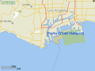
Ports O'call Heliport
Address:
Los Angeles County, CA
Tel:
213-831-0287
Images
and information placed above are from
http://www.airport-data.com/airport/CA52/
We
thank them for the data!
| General
Info |
| Country |
United
States |
| State |
CALIFORNIA
|
| FAA ID |
CA52
|
| Latitude |
33-43-55.567N
|
| Longitude |
118-16-33.755W
|
| Elevation |
2 feet
|
| Near City |
SAN PEDRO
|
We don't guarantee the information is fresh and accurate. The data may
be wrong or outdated.
For more up-to-date information please refer to other sources.
|
|


