 |
|
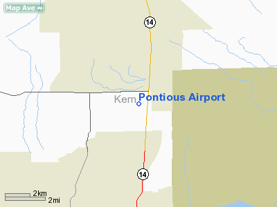
Location
& QuickFacts
|
FAA
Information Effective: |
2006-09-28 |
|
Airport
Identifier: |
1CL2 |
|
Longitude/Latitude: |
118-10-11.2700W/34-56-32.9080N
-118.169797/34.942474 (Estimated) |
|
Elevation: |
2610 ft / 795.53 m (Estimated) |
|
Land: |
40 acres |
|
From
nearest city: |
7 nautical miles S of Mojave, CA |
|
Location: |
Kern County, CA |
|
Magnetic Variation: |
14E (1985) |
Owner
& Manager
|
Ownership: |
Privately owned
ALFRED L PONTIOUS & HOWARD H GINN, CO-OWNERS. |
|
Owner: |
Donald E Murray |
|
Address: |
Star Rt 1 Box 61 S
Mojave, CA 93501 |
|
Phone number: |
805-256-2314 |
|
Address: |
|
Airport
Operations and Facilities
|
Airport
Use: |
Private |
|
Wind
indicator: |
Yes |
|
Segmented
Circle: |
No |
|
Control
Tower: |
No |
|
Attendance
Schedule: |
UNATNDD |
|
Sectional
chart: |
Los Angeles |
|
Region: |
AWP - Western-Pacific |
|
Boundary
ARTCC: |
ZLA - Los Angeles |
|
Tie-in
FSS: |
RAL - Riverside |
|
FSS
Phone: |
951-351-3020 |
|
FSS
Toll Free: |
1-800-WX-BRIEF |
|
Runway Information
Runway 03/21
|
Dimension: |
1900 x 50 ft / 579.1 x 15.2 m |
|
Surface: |
DIRT, |
|
|
Runway 03 |
Runway 21 |
|
Traffic
Pattern: |
Left |
Left |
|
Runway 07/25
|
Dimension: |
1300 x 50 ft / 396.2 x 15.2 m |
|
Surface: |
DIRT, |
|
|
Runway 07 |
Runway 25 |
|
Traffic
Pattern: |
Left |
Left |
|
Radio Navigation
Aids
|
ID |
Type |
Name |
Ch |
Freq |
Var |
Dist |
|
GWF |
NDB |
Gen William J Fox |
|
282.00 |
15E |
12.5 nm |
|
PAI |
NDB |
Pacoima |
|
370.00 |
15E |
42.8 nm |
|
VCV |
VOR/DME |
Victorville |
031X |
109.40 |
14E |
43.8 nm |
|
VNY |
VOR/DME |
Van Nuys |
078X |
113.10 |
15E |
46.1 nm |
|
PMD |
VORTAC |
Palmdale |
092X |
114.50 |
15E |
19.4 nm |
|
EDW |
VORTAC |
Edwards |
111X |
116.40 |
15E |
21.7 nm |
|
LHS |
VORTAC |
Lake Hughes |
021X |
108.40 |
15E |
25.4 nm |
|
GMN |
VORTAC |
Gorman |
108X |
116.10 |
16E |
35.1 nm |
|
FIM |
VORTAC |
Fillmore |
072X |
112.50 |
15E |
49.8 nm |
Remarks
- OWNER
DESIRES ARPT NOT BE CHARTED
- PRVD
ARPT USED DURING VFR CONDITIONS ONLY; & USERS ARE CAUTIONED ABOUT
HIGH SPEED LOW ALT JET OPS ROUTE IR 256 WHICH IS W OF ARPT & RUNS
ALONG A LINE WESTWARD TO SOUTHEAST.
Based Aircraft
|
Aircraft
based on field: |
6 |
|
Single
Engine Airplanes: |
6 |
Pontious Airport
Address:
Kern County, CA
Tel:
805-256-2314
Images
and information placed above are from
http://www.airport-data.com/airport/1CL2/
We
thank them for the data!
| General
Info |
| Country |
United
States |
| State |
CALIFORNIA
|
| FAA ID |
1CL2
|
| Latitude |
34-56-32.908N
|
| Longitude |
118-10-11.270W
|
| Elevation |
2610 feet
|
| Near City |
MOJAVE
|
We don't guarantee the information is fresh and accurate. The data may
be wrong or outdated.
For more up-to-date information please refer to other sources.
|
|


