 |
|
Ponderosa Sky Ranch Airport |
|
|
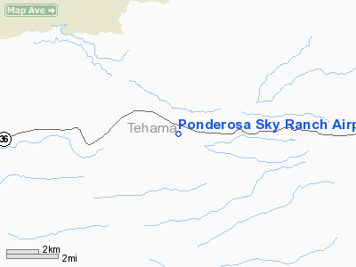
Location
& QuickFacts
|
FAA
Information Effective: |
2006-09-28 |
|
Airport
Identifier: |
52CN |
|
Longitude/Latitude: |
121-46-28.9470W/40-20-39.5690N
-121.774707/40.344325 (Estimated) |
|
Elevation: |
3454 ft / 1052.78 m (Surveyed) |
|
Land: |
0 acres |
|
From
nearest city: |
6 nautical miles E of Paynes Creek, CA |
|
Location: |
Tehama County, CA |
|
Magnetic Variation: |
17E (1985) |
Owner
& Manager
|
Ownership: |
Privately owned |
|
Owner: |
O K Improvement Corp |
|
Address: |
Ponderosa Sky Ranch
Paynes Creek, CA 96075 |
|
Phone
number: |
916-597-2441 |
|
Manager: |
O A Figgs |
|
Address: |
Box 101, Route 5
Paynes Creek, CA 96075 |
|
Phone number: |
916-597-2441 |
Airport
Operations and Facilities
|
Airport Use: |
Private |
|
Wind indicator: |
Yes |
|
Segmented Circle: |
No |
|
Control Tower: |
No |
|
Attendance Schedule: |
UNATNDD |
|
Landing fee charge: |
No |
|
Sectional chart: |
Klamath Falls |
|
Region: |
AWP - Western-Pacific |
|
Boundary ARTCC: |
ZOA - Oakland |
|
Tie-in FSS: |
RIU - Rancho Murieta |
|
FSS on Airport: |
No |
|
FSS Phone: |
916-354-0161 |
|
FSS Toll Free: |
1-800-WX-BRIEF |
Airport
Services
|
Airframe
Repair: |
MINOR |
|
Power
Plant Repair: |
MINOR |
|
Runway Information
Runway 09/27
|
Dimension: |
2000 x 100 ft / 609.6 x 30.5 m |
|
Surface: |
DIRT, |
|
|
Runway 09 |
Runway 27 |
|
Traffic
Pattern: |
Left |
Left |
|
Radio Navigation
Aids
|
ID |
Type |
Name |
Ch |
Freq |
Var |
Dist |
|
PBT |
NDB |
Proberta |
|
338.00 |
16E |
25.3 nm |
|
RDD |
VOR/DME |
Redding |
021X |
108.40 |
18E |
25.5 nm |
|
CIC |
VOR/DME |
Chico |
035X |
109.80 |
16E |
33.5 nm |
|
RBL |
VORTAC |
Red Bluff |
104X |
115.70 |
18E |
25.8 nm |
Remarks
- PRIOR
NOTICE NOT RQRD. FIRST REPORTED 1/18/60. ARPT IS 25 NM NW OF RED BLUFF
MARPT.
Based Aircraft
|
Aircraft
based on field: |
2 |
|
Single
Engine Airplanes: |
2 |
Ponderosa Sky Ranch Airport
Address:
Tehama County, CA
Tel:
916-597-2441
Images
and information placed above are from
http://www.airport-data.com/airport/52CN/
We
thank them for the data!
| General
Info |
| Country |
United
States |
| State |
CALIFORNIA
|
| FAA ID |
52CN
|
| Latitude |
40-20-39.569N
|
| Longitude |
121-46-28.947W
|
| Elevation |
3454 feet
|
| Near City |
PAYNES
CREEK |
We don't guarantee the information is fresh and accurate. The data may
be wrong or outdated.
For more up-to-date information please refer to other sources.
|
|


