 |
|
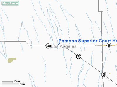
Pomona Superior Court Heliport |
|
|
Location
& QuickFacts
|
FAA
Information Effective: |
2006-09-28 |
|
Airport
Identifier: |
99L |
|
Longitude/Latitude: |
117-44-57.2180W/34-30-08.9840N
-117.749227/34.502496 (Estimated) |
|
Elevation: |
1000 ft / 304.80 m (Estimated) |
|
Land: |
0 acres |
|
From
nearest city: |
0 nautical miles N of Pomona, CA |
|
Location: |
Los Angeles County, CA |
|
Magnetic Variation: |
14E (1985) |
Owner
& Manager
|
Ownership: |
Publicly owned |
|
Owner: |
County Of Los Angeles |
|
Address: |
4700 Ramona Blvd
Monterey Park, CA 91754-2169 |
|
Manager: |
James Digiovanna |
|
Address: |
4324 Donald Douglas Dr
Long Beach, CA 90808 |
|
Phone number: |
310-421-2701 |
Airport
Operations and Facilities
|
Airport
Use: |
Private |
|
Wind
indicator: |
Yes |
|
Segmented
Circle: |
Yes |
|
Control
Tower: |
No |
|
Attendance
Schedule: |
UNATNDD |
|
Lighting
Schedule: |
PHONE REQ
FOR PERIMETER LGTS CALL 213-421-2701. |
|
Landing
fee charge: |
No |
|
Sectional
chart: |
Los Angeles |
|
Region: |
AWP - Western-Pacific |
|
Boundary
ARTCC: |
ZLA - Los Angeles |
|
Tie-in
FSS: |
RAL - Riverside |
|
FSS on Airport: |
No |
|
FSS Phone: |
951-351-3020 |
|
FSS Toll Free: |
1-800-WX-BRIEF |
Airport
Services
|
Airframe
Repair: |
NONE |
|
Power
Plant Repair: |
NONE |
|
Runway Information
Helipad H1
|
Dimension: |
65 x 65 ft / 19.8 x 19.8 m |
|
Surface: |
CONC, |
|
|
Runway H1 |
Runway |
|
Traffic
Pattern: |
Left |
Left |
|
Radio Navigation
Aids
|
ID |
Type |
Name |
Ch |
Freq |
Var |
Dist |
|
GWF |
NDB |
Gen William J Fox |
|
282.00 |
15E |
27.1 nm |
|
EMT |
NDB |
El Monte |
|
359.00 |
15E |
28.6 nm |
|
SB |
NDB |
Petis |
|
397.00 |
14E |
32.9 nm |
|
PAI |
NDB |
Pacoima |
|
370.00 |
15E |
36.0 nm |
|
CPM |
NDB |
Compton |
|
378.00 |
15E |
44.4 nm |
|
RIV |
TACAN |
March |
077X |
|
14E |
42.9 nm |
|
RAL |
VOR |
Riverside |
|
112.40 |
15E |
36.3 nm |
|
VCV |
VOR/DME |
Victorville |
031X |
109.40 |
14E |
18.6 nm |
|
VNY |
VOR/DME |
Van Nuys |
078X |
113.10 |
15E |
40.5 nm |
|
SMO |
VOR/DME |
Santa Monica |
045X |
110.80 |
15E |
45.9 nm |
|
ELB |
VOR/DME |
El Toro |
119X |
117.20 |
14E |
49.7 nm |
|
PMD |
VORTAC |
Palmdale |
092X |
114.50 |
15E |
17.4 nm |
|
POM |
VORTAC |
Pomona |
041X |
110.40 |
15E |
25.6 nm |
|
EDW |
VORTAC |
Edwards |
111X |
116.40 |
15E |
28.9 nm |
|
PDZ |
VORTAC |
Paradise |
059X |
112.20 |
15E |
36.8 nm |
|
LHS |
VORTAC |
Lake Hughes |
021X |
108.40 |
15E |
42.4 nm |
|
SLI |
VORTAC |
Seal Beach |
104X |
115.70 |
15E |
45.8 nm |
|
LAX |
VORTAC |
Los Angeles |
083X |
113.60 |
15E |
48.2 nm |
Pomona Superior Court Heliport
Address:
Los Angeles County, CA
Tel:
310-421-2701
Images
and information placed above are from
http://www.airport-data.com/airport/99L/
We
thank them for the data!
| General
Info |
| Country |
United
States |
| State |
CALIFORNIA
|
| FAA ID |
99L
|
| Latitude |
34-30-08.984N
|
| Longitude |
117-44-57.218W
|
| Elevation |
1000 feet
|
| Near City |
POMONA
|
We don't guarantee the information is fresh and accurate. The data may
be wrong or outdated.
For more up-to-date information please refer to other sources.
|
|


